Unlock a world of possibilities! Login now and discover the exclusive benefits awaiting you.
- Qlik Community
- :
- Forums
- :
- Analytics
- :
- New to Qlik Analytics
- :
- Re: Map - KML - US County
- Subscribe to RSS Feed
- Mark Topic as New
- Mark Topic as Read
- Float this Topic for Current User
- Bookmark
- Subscribe
- Mute
- Printer Friendly Page
- Mark as New
- Bookmark
- Subscribe
- Mute
- Subscribe to RSS Feed
- Permalink
- Report Inappropriate Content
Map - KML - US County
New to Qlik Sense (downloaded the free desktop version this past weekend), but the Map feature is just what we've been looking for. What I've been trying to accomplish over the past 4 days is figuring out how to import a KML file, for US Counties, that automatically brings in the "name" as :
Two digit state - county name - For example, it would bring in name = "NY-Erie"
Trying to avoid the common issue where you have the same county name all over the country. Cannot figure out how to come up with a KML file that I can link to with the key of state-county ( NY-Erie ). Each time I play around with a US Census KML file, it ALWAYS imports area.name = county name
.
I am posting this discussion in hopes that someone can point me to a good link/suggestion that will explain how I can "modify" an existing KML file so Qlik Sense will bring in the "name" field as state-county, so I can then link my real estate data to the KML and generate the mapping visuals we've been looking for.
I hope this question isn't redundant, but I have been at this for several days and keep coming up empty.
Thank you in advance.
Joe
- Tags:
- kml
- « Previous Replies
-
- 1
- 2
- Next Replies »
- Mark as New
- Bookmark
- Subscribe
- Mute
- Subscribe to RSS Feed
- Permalink
- Report Inappropriate Content
original image didn't come through ... 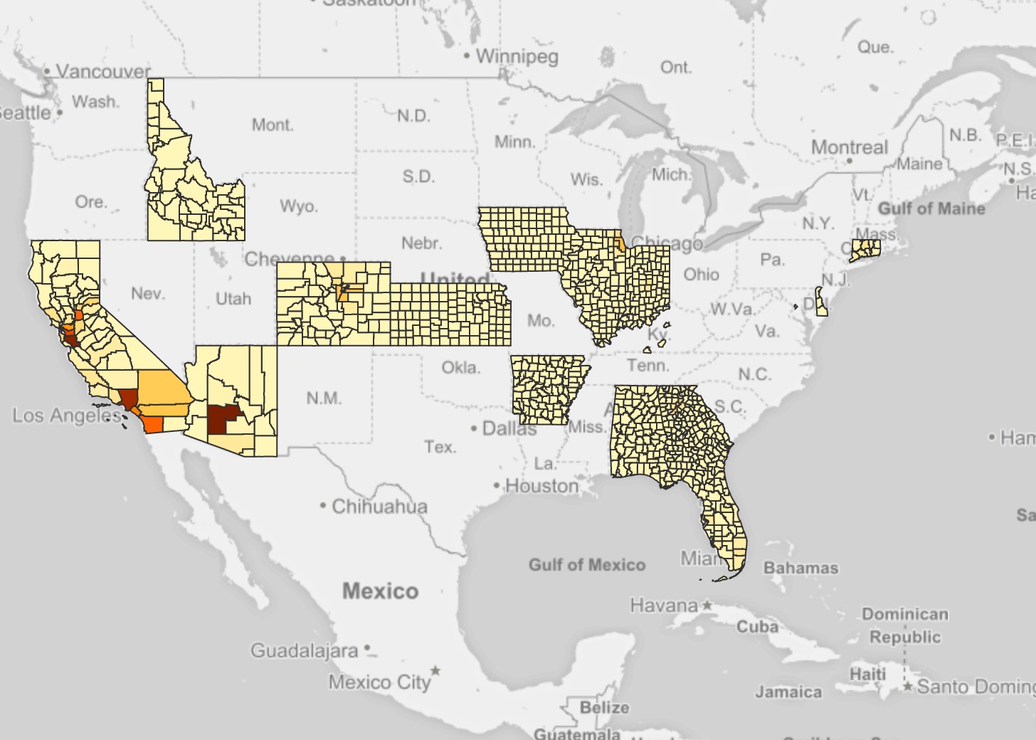
- Mark as New
- Bookmark
- Subscribe
- Mute
- Subscribe to RSS Feed
- Permalink
- Report Inappropriate Content
Looks to me that you have an issue with some states?
- Mark as New
- Bookmark
- Subscribe
- Mute
- Subscribe to RSS Feed
- Permalink
- Report Inappropriate Content
For sure! Looking at it now, it looks like they've been loaded in order of the FIPS code ending at KS; KY would be the next one and is the first one that drops. Potentially an issue there in the KML... I'll see what's up at that location and post results of the KML needs modified.
- Mark as New
- Bookmark
- Subscribe
- Mute
- Subscribe to RSS Feed
- Permalink
- Report Inappropriate Content
Appears that Qlik Sense has a limitation to only allow 1000 unique area identifiers. Will have to work with support to try to change that.
- Mark as New
- Bookmark
- Subscribe
- Mute
- Subscribe to RSS Feed
- Permalink
- Report Inappropriate Content
You could question if over 1000 areas in one overview is still useful (or even over a 100).
Might be worth it to go up a level and turn it into a drill-down dimension.
- Mark as New
- Bookmark
- Subscribe
- Mute
- Subscribe to RSS Feed
- Permalink
- Report Inappropriate Content
So, added a drilldown, and now it's showing all of the counties. Not really sure how the interpolation of the information for viewing the polygon data from the KML is related to a drilldown dimension, but hey, it worked. (but did find the KML is missing two counties: one in Wyoming and one in Nebraska)
- « Previous Replies
-
- 1
- 2
- Next Replies »