Unlock a world of possibilities! Login now and discover the exclusive benefits awaiting you.
- Qlik Community
- :
- Forums
- :
- Analytics
- :
- New to Qlik Analytics
- :
- Re: Automatic GeoInfo problem with UK
- Subscribe to RSS Feed
- Mark Topic as New
- Mark Topic as Read
- Float this Topic for Current User
- Bookmark
- Subscribe
- Mute
- Printer Friendly Page
- Mark as New
- Bookmark
- Subscribe
- Mute
- Subscribe to RSS Feed
- Permalink
- Report Inappropriate Content
Automatic GeoInfo problem with UK
Hi,
As per title, your automatic geoInfo generation from country codes behaves in a weird way when it comes to UK area mapping.
The country codes in my company DB are stored as 2ISO, and the common one is -in fact- UK.
I suspect that in your reference for the automatic geoInfo generation on data load has that mapped to GB.
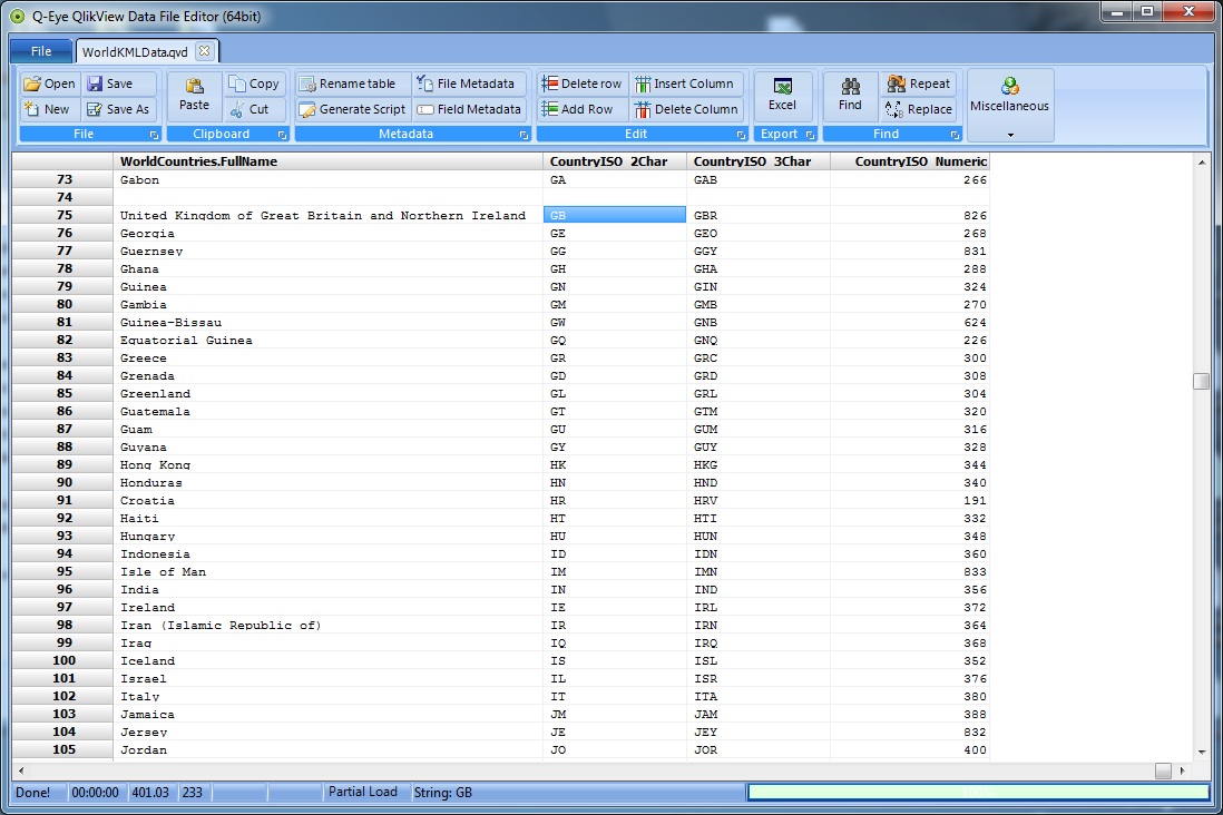
What I did is getting this file >> World Mapping File For Qlik Sense Maps (KML Shape and Point)
Then check it with a QVD editor and added a line under the default United Kingdom, which is still United Kingdom but with the correct 2ISO, so to have both entries.
Then loading it into the app.
The problem now is that the association between the KML table and the other table with the country codes makes ALL countries show if none is selected in the Map Chart, since the automatic JOIN seems a FULL OUTER (all rows in, even those with null values on either table) and there is no GUI way (apparently) to change the type of JOIN.
Before resorting to manually editing the whole loading script, I was wondering if anyone had a solution for this.
Thank you in advance for your answers!
Andrea
- Mark as New
- Bookmark
- Subscribe
- Mute
- Subscribe to RSS Feed
- Permalink
- Report Inappropriate Content
Can you take a screen shot of your KML file, UI and your data having ISO codes?
Correct me if I'm wrong. You are trying to load only shapes for UK or GB but the file you've is shape for world?
- Mark as New
- Bookmark
- Subscribe
- Mute
- Subscribe to RSS Feed
- Permalink
- Report Inappropriate Content
Hi. Thanks for the answer.
I am setting up an environment and I need to load data geolocated all over the world. At the moment I am working with 4 countries: New Zealand, Australia, Thailand and the United Kingdom.
For some reason (maybe a caching issue?) the problem with all the countries showing on the map due to the KML file is now gone upon user logoff.
Anyway, the UK was not recognized at all by your automation in the first place. I had to go through quite much trouble to show it on the map due to this GB/UK dilemma.
You find the screen of the KML file that I have then corrected manually.
For the other tables, I can't really upload anything but it is simple to explain: I joined the KML Country 2ISO column on our own 2ISO column. Everything worked for the other 3 (NZ, AU and TH), but not for UK, neither through QlikSense automated geolocation service (drag and drop) nor through that KML table. I hence modified the latter to UK and now it seems to be working.