Unlock a world of possibilities! Login now and discover the exclusive benefits awaiting you.
- Qlik Community
- :
- Forums
- :
- Analytics
- :
- New to Qlik Analytics
- :
- Re: Large parts of KML map missing
- Subscribe to RSS Feed
- Mark Topic as New
- Mark Topic as Read
- Float this Topic for Current User
- Bookmark
- Subscribe
- Mute
- Printer Friendly Page
- Mark as New
- Bookmark
- Subscribe
- Mute
- Subscribe to RSS Feed
- Permalink
- Report Inappropriate Content
Large parts of KML map missing
I've loaded a boundary map of England and Wales in KML format into Qlik Sense, however only a small section of the map is visible? Are there any restrictions around the number of polygon elements?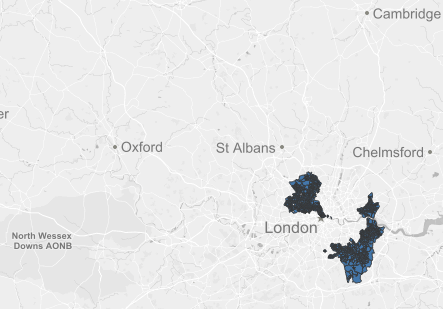
Attached is the KML file if anyone wants to give it a go.
- Mark as New
- Bookmark
- Subscribe
- Mute
- Subscribe to RSS Feed
- Permalink
- Report Inappropriate Content
Hi,
I tried your file in IdevioMaps (http://bi.idevio.com). There it can be displayed but it is not really practically useful. The sense map has a limit of 1000 objects I think. The main problem is that there are too many (more than 7000) detailed areas to be displayed at the same time. The usual solution in these cases is to do a drill down hierarchy with IdevioMaps. You then would need to have some more information that you can group your areas with, such as county. Then you could make a drill-down hierarchy and first display all counties. When one county is selected you would display only the areas in that.
Regards
Johan
- Mark as New
- Bookmark
- Subscribe
- Mute
- Subscribe to RSS Feed
- Permalink
- Report Inappropriate Content
I am using Sense desktop 3.1. By loading the kml file that you have attached, it shows 3333 polygons.
If using the old version of Sense can only load 1000 polygons, that means the new version has improved a little...