Unlock a world of possibilities! Login now and discover the exclusive benefits awaiting you.
- Qlik Community
- :
- Forums
- :
- Analytics
- :
- New to Qlik Analytics
- :
- Re: OpenSeaMap and Qlik Cloud
- Subscribe to RSS Feed
- Mark Topic as New
- Mark Topic as Read
- Float this Topic for Current User
- Bookmark
- Subscribe
- Mute
- Printer Friendly Page
- Mark as New
- Bookmark
- Subscribe
- Mute
- Subscribe to RSS Feed
- Permalink
- Report Inappropriate Content
OpenSeaMap and Qlik Cloud
Dear All,
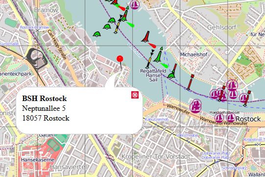
I want to use OpenSeaMap as my background map, I need to look some points over nautical charts.
I have been trying to use it as a Slippy-Map, however I don't know what to fill in the URL and atribution string.
There is a tutorial about how to embed OpenSeaMap as Slippy-Map: OpenSeaMap in Website – OpenSeaMap-dev
Thank you all!
- Mark as New
- Bookmark
- Subscribe
- Mute
- Subscribe to RSS Feed
- Permalink
- Report Inappropriate Content
Nobody?
- Mark as New
- Bookmark
- Subscribe
- Mute
- Subscribe to RSS Feed
- Permalink
- Report Inappropriate Content
Never worked on OpenSeaMap
But if you'd like to embed objects then maybe the below link will be helpful?
- Mark as New
- Bookmark
- Subscribe
- Mute
- Subscribe to RSS Feed
- Permalink
- Report Inappropriate Content
Thanks but what I want is to use OpenSeaMap as the background of a map item in Qlikview Cloud.
Not related with others websites or anything like that.
- Mark as New
- Bookmark
- Subscribe
- Mute
- Subscribe to RSS Feed
- Permalink
- Report Inappropriate Content
I understand you want to build your own custom map background.
You need to have the .PNG image for Openseamap available for you to show as background.
Ex:
http://wiki.openseamap.org/images/6/61/Marker_in_URL.jpg
I got the above image from Datei:Marker in URL.jpg – OpenSeaMap-dev and the link you've provided.
The above link you can use in Qlik Sense custom Map link
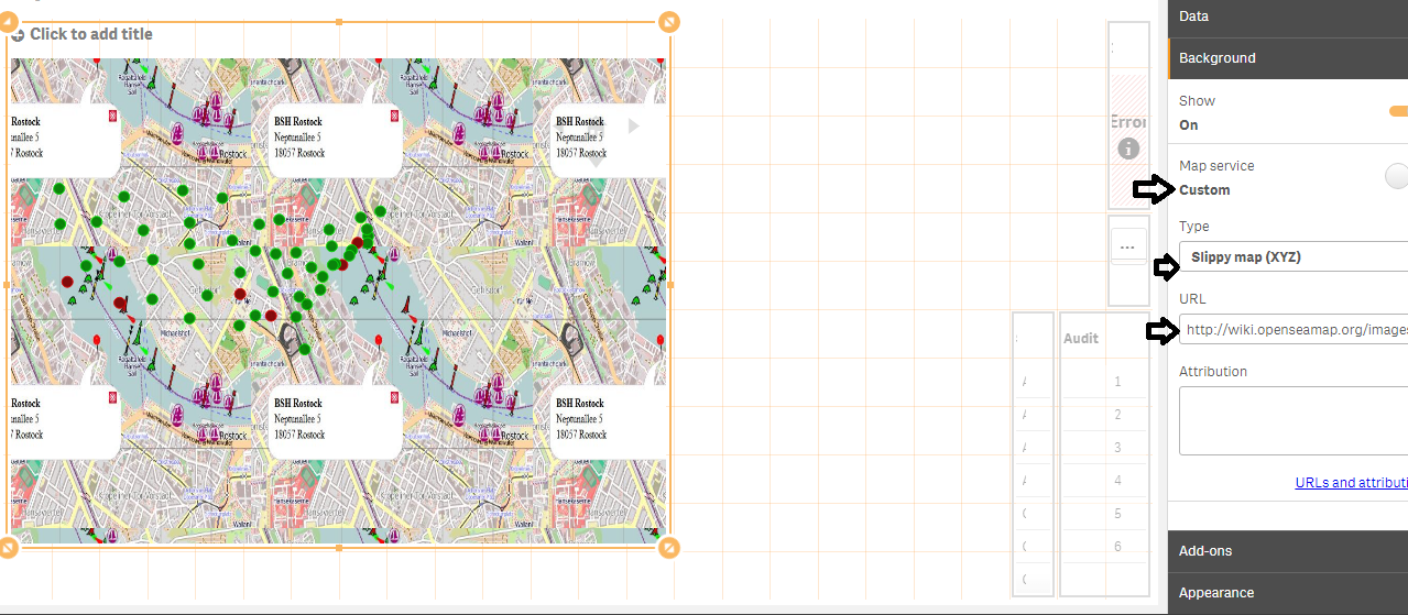
But you need to find your type of back ground which fits the data points you want to show. But it will be Dynamic, you'll only have bubbles on map which will show you distance as you want. The background will be only an image with the http......png link
- Mark as New
- Bookmark
- Subscribe
- Mute
- Subscribe to RSS Feed
- Permalink
- Report Inappropriate Content
I want it working dynamically, so I would be able to navigate over it.
- Mark as New
- Bookmark
- Subscribe
- Mute
- Subscribe to RSS Feed
- Permalink
- Report Inappropriate Content
I do not know how to make it dynamic...
https://help.qlik.com/en-US/sense/3.1/Subsystems/Hub/Content/Visualizations/Map/create-map.htm
The different customized base maps you can use.
- Mark as New
- Bookmark
- Subscribe
- Mute
- Subscribe to RSS Feed
- Permalink
- Report Inappropriate Content
Dear Arvin,
Do you know if is possible to set the minimum and maximum values of the axis?
So I would set the image as the background and when I plot the coordinates the bubbles would be corretly positioned.
Thanks
- Mark as New
- Bookmark
- Subscribe
- Mute
- Subscribe to RSS Feed
- Permalink
- Report Inappropriate Content
Hi,
I don't think so you've that option in default Qlik Sense Map. You can just have navigation button on map.