Unlock a world of possibilities! Login now and discover the exclusive benefits awaiting you.
- Qlik Community
- :
- All Forums
- :
- GeoAnalytics
- :
- Re: WMS map visible in 'edit' mode, but disappears...
- Subscribe to RSS Feed
- Mark Topic as New
- Mark Topic as Read
- Float this Topic for Current User
- Bookmark
- Subscribe
- Mute
- Printer Friendly Page
- Mark as New
- Bookmark
- Subscribe
- Mute
- Subscribe to RSS Feed
- Permalink
- Report Inappropriate Content
WMS map visible in 'edit' mode, but disappears in normal mode
Hi,
Please look at attached example. On sheet 'Zoom level check' I added a WMS Geo Data Layer (Reference Systems). In edit mode the layer works perfect. Blue lines following picture:

When I click on done, the blue lines disappear. What am I doing wrong? 🙂

Thanks,
Frank
- Mark as New
- Bookmark
- Subscribe
- Mute
- Subscribe to RSS Feed
- Permalink
- Report Inappropriate Content
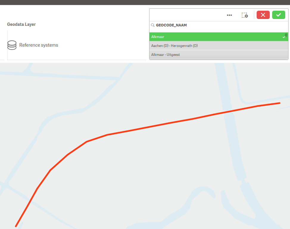
I changed buffer from 100 to 0, now it shows the 'Reference system layer'. But when I make a selection in field 'GEOCODE_NAAM', (for example 'Alkmaar') the map zooms in, but it stop showing the 'Reference system layer':
This is the result:
When I click on a zoom button (+ or -) the layer pops up again:(the purple and blue lines)

- Mark as New
- Bookmark
- Subscribe
- Mute
- Subscribe to RSS Feed
- Permalink
- Report Inappropriate Content
Hi Frank, thanks for reporting, we are looking into the issue.
Thanks,
Patric Nordström
Qlik
- Mark as New
- Bookmark
- Subscribe
- Mute
- Subscribe to RSS Feed
- Permalink
- Report Inappropriate Content
Hi Frank,
Ok, we found the problem, it's the wms service at prorail.nl that complains that the wms image is to big.
If you make the map window smaller it works, that's why the "margin" parameter had some effect.
To spot the error, opne up the dev console ctrl shift right mouse click -> "Show dev tools" and check network tab for the image that fails. Open the image url in a browser:
<ServiceExceptionReport xmlns="http://www.opengis.net/ogc" xmlns:xsi="http://www.w3.org/2001/XMLSchema-instance" version="1.3.0" xsi:schemaLocation="http://www.opengis.net/ogc http://schemas.opengis.net/wms/1.3.0/exceptions_1_3_0.xsd">
</ServiceExceptionReport>
Thanks,
Patric Nordström
Qlik