Unlock a world of possibilities! Login now and discover the exclusive benefits awaiting you.
- Qlik Community
- :
- Forums
- :
- Analytics
- :
- New to Qlik Analytics
- :
- How to display a map of the Netherlands on a dashb...
- Subscribe to RSS Feed
- Mark Topic as New
- Mark Topic as Read
- Float this Topic for Current User
- Bookmark
- Subscribe
- Mute
- Printer Friendly Page
- Mark as New
- Bookmark
- Subscribe
- Mute
- Subscribe to RSS Feed
- Permalink
- Report Inappropriate Content
How to display a map of the Netherlands on a dashboard?
Hi there,
I'm trying to create a map of the Netherlands on neighbourhood level. Something that looks similar to the image below: 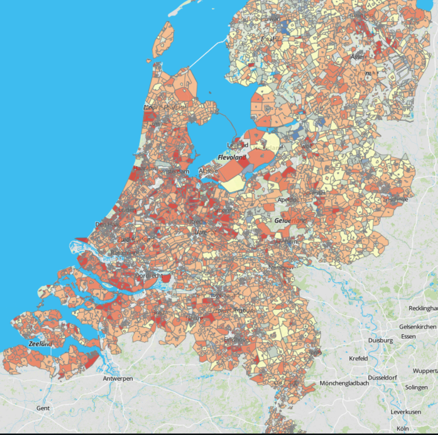
I tried to download KML files from several websites but the coördinates never seemed to line up properly on the map. For instance a place that's a few kilometers from my house ended up in the Indian Ocean.
What I tried:
1. Downloaded a KML file
2. Created a new app in Qlik Sense
3. Prepared and loaded the KML file
4. Added a map element on the dashboard
5. Added the dimension: latitude, longitude
Any help would be greatly appreciated. If I didn't explain the steps I took in enough detail please let me know. I'm rather new to Qlik Sense.
With kind regards,
Sven
Accepted Solutions
- Mark as New
- Bookmark
- Subscribe
- Mute
- Subscribe to RSS Feed
- Permalink
- Report Inappropriate Content
Hi Sven,
In attached files three KML files of different levels of detail and two implementation examples for the first and second levels. I hope this will help you.
Regards,
Andrey
- Mark as New
- Bookmark
- Subscribe
- Mute
- Subscribe to RSS Feed
- Permalink
- Report Inappropriate Content
One of the things you will run into is that a standard Qlik Sense map cannot show more than 3333 polygons. Since there are more than 12.000 neighbourhoods you won't get a map that shows them all. I think you'll need a mapping extension like GeoQlik or Qlik GeoAnalytics
Also a lattitude, longitude dimension doesn't sound right for a KML file. I'd expect a geometry field instead of one lat./long. coordinate.
talk is cheap, supply exceeds demand
- Mark as New
- Bookmark
- Subscribe
- Mute
- Subscribe to RSS Feed
- Permalink
- Report Inappropriate Content
I've added a KML file with 389 unique areas including what I think are geometry fields: Gemeenten 2017 onbeveiligd.xlsx - Google Drive
When I add a map element to the dashboard however, this time it doesn't seem to show any of the dimensions I created (GM_CODE, GM_NAAM, KML).
I've also tried to arrange a trial version of GeoQlik and GeoAnalytics. Because we're a group of students we'll only use the extension for a singular project. Unfortunately none of the people we contacted seemed to have an trail account/code we can use for a week.
- Mark as New
- Bookmark
- Subscribe
- Mute
- Subscribe to RSS Feed
- Permalink
- Report Inappropriate Content
If you like you can try free version of SVG Maps.
For that you'd need 2 digit ISO codes for the areas you trying to load. SVG does have a preloaded Netherlands map but it is not on street or district level.
You have to find a .svg map for the areas on google.
Download SVG extension and try it for your self....
Or as Gysbert suggested, you'd have to get paid versions of GeoQlik or Qlik Maps.
I guess GeoQlik has free version as well... check their website
- Mark as New
- Bookmark
- Subscribe
- Mute
- Subscribe to RSS Feed
- Permalink
- Report Inappropriate Content
Hi Sven,
In attached files three KML files of different levels of detail and two implementation examples for the first and second levels. I hope this will help you.
Regards,
Andrey
- Mark as New
- Bookmark
- Subscribe
- Mute
- Subscribe to RSS Feed
- Permalink
- Report Inappropriate Content
Thanks so much! That's exactly what I was looking for.
With kind regards,
Sven