Unlock a world of possibilities! Login now and discover the exclusive benefits awaiting you.
- Qlik Community
- :
- All Forums
- :
- GeoAnalytics
- :
- Re: Prob Regarding Qliksense Map
- Subscribe to RSS Feed
- Mark Topic as New
- Mark Topic as Read
- Float this Topic for Current User
- Bookmark
- Subscribe
- Mute
- Printer Friendly Page
- Mark as New
- Bookmark
- Subscribe
- Mute
- Subscribe to RSS Feed
- Permalink
- Report Inappropriate Content
Prob Regarding Qliksense Map
Hello All,
I am working on maps in qliksense and stuck in an issue. I have used "Show and Hide container" extension in QlikSense.
In this extension, i have used 2 maps:
1: State Level Sales
2: City level Sales
When we click any state, it will show data as per cities connected to that state(kind of drill down functionality)
Problem is: There are multiple cities which are not in the maps but present in my database. I cannt figure out the reason why some cities can not be shown. For example, in the attached QVF file, if you select "Garbeta" as Sales Territory, you cannt see it's location in the map. Can anyone help me in this why it's location is not shown?
Thanks
Accepted Solutions
- Mark as New
- Bookmark
- Subscribe
- Mute
- Subscribe to RSS Feed
- Permalink
- Report Inappropriate Content
I apologize, as you originally posted the question in the Qlik GeoAnalytics discussion, I assumed you already had the GeoAnalytics Extension. You cannot use the GeoAnalytics Extension without a GeoAnalytics License.
- Mark as New
- Bookmark
- Subscribe
- Mute
- Subscribe to RSS Feed
- Permalink
- Report Inappropriate Content
I don't know why Garbeta is not showing up but you are using the standard map in Qlik Sense not GeoAnalytics - if you use the GeoAnalytics map and add a bubble layer for your Sales Territory Name you will find that that Garbeta shows up.
Also if you use GeoAnalytics you would be able to create a drill down from State to City on the same map so you would not need to use the Show and Hide Container
- Mark as New
- Bookmark
- Subscribe
- Mute
- Subscribe to RSS Feed
- Permalink
- Report Inappropriate Content
Thanks David for the valuable information. Can you pls also attach a sample application with GeoAnalytics that shows 'Garbeta'? It can really help me out.
- Mark as New
- Bookmark
- Subscribe
- Mute
- Subscribe to RSS Feed
- Permalink
- Report Inappropriate Content
Here you go - This app shows the standard map and the GeoAnalytics map - select Garbets and you will se it shows up in the GeoAnalytics map but not in the standard map.
- Mark as New
- Bookmark
- Subscribe
- Mute
- Subscribe to RSS Feed
- Permalink
- Report Inappropriate Content
Thanks David. I imported the app but it is showing me invalid visualisation. Do i need to have GeoAnalytics License or do i need to add Idevio map extension? Pls find attached snapshot. Also can you add a snapshot showing "Garbeta" ?
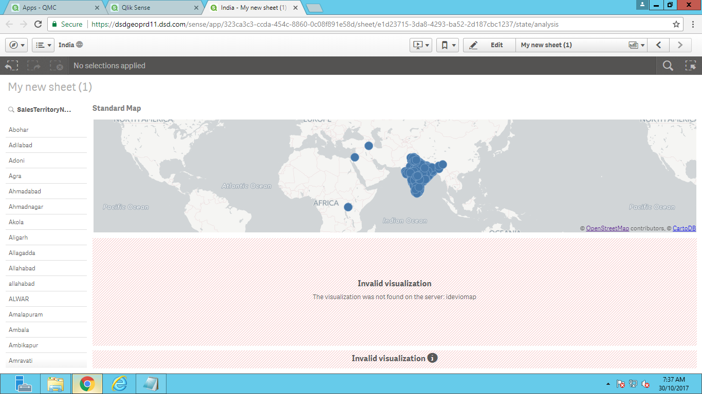
- Mark as New
- Bookmark
- Subscribe
- Mute
- Subscribe to RSS Feed
- Permalink
- Report Inappropriate Content
I apologize, as you originally posted the question in the Qlik GeoAnalytics discussion, I assumed you already had the GeoAnalytics Extension. You cannot use the GeoAnalytics Extension without a GeoAnalytics License.
- Mark as New
- Bookmark
- Subscribe
- Mute
- Subscribe to RSS Feed
- Permalink
- Report Inappropriate Content
Hey David,
Will take license as well but meanwhile can you attach the snapshot showing
Garbeta?
- Mark as New
- Bookmark
- Subscribe
- Mute
- Subscribe to RSS Feed
- Permalink
- Report Inappropriate Content
Sure, here you go
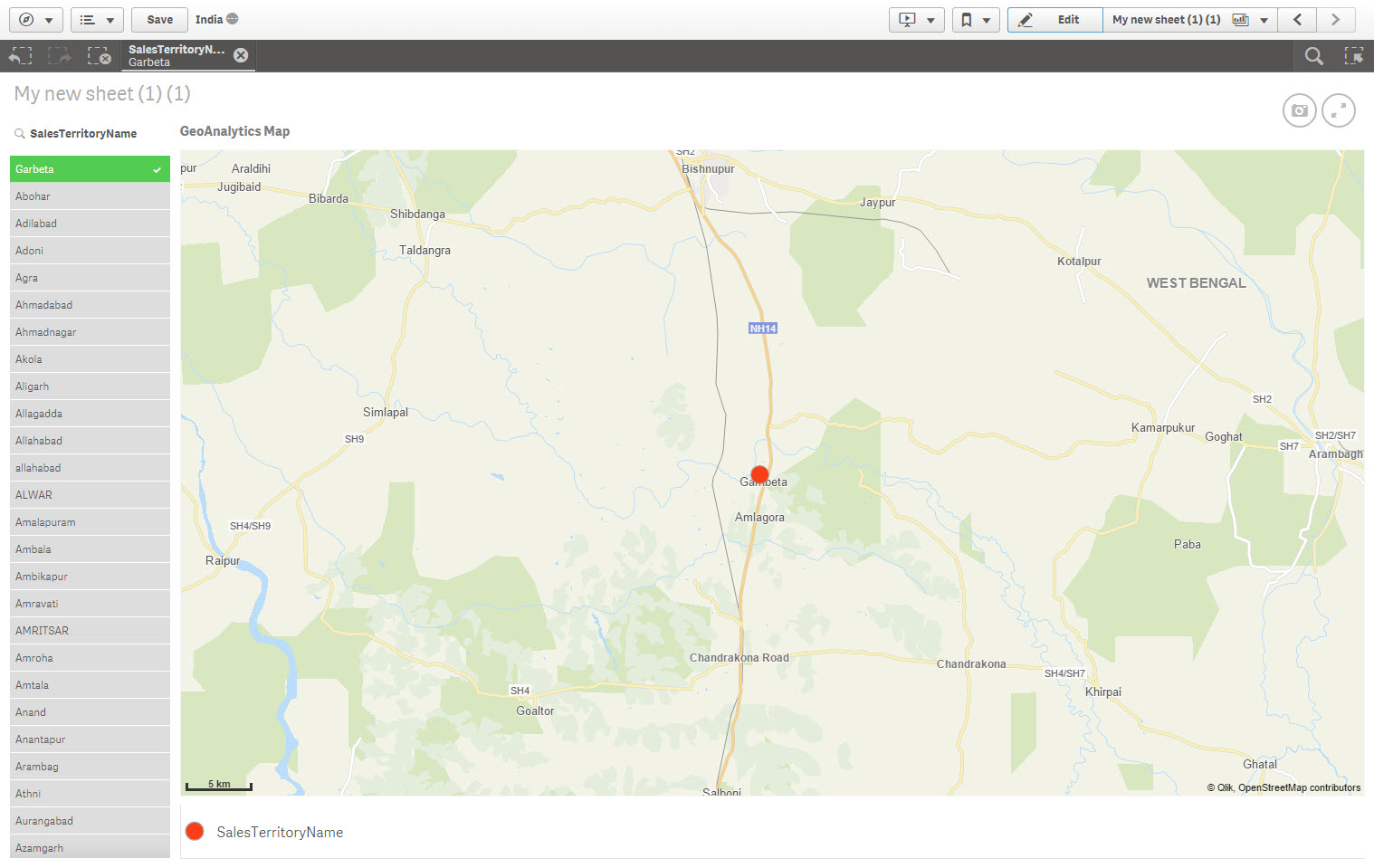
- Mark as New
- Bookmark
- Subscribe
- Mute
- Subscribe to RSS Feed
- Permalink
- Report Inappropriate Content
Thanks a ton David 