Unlock a world of possibilities! Login now and discover the exclusive benefits awaiting you.
- Qlik Community
- :
- Forums
- :
- Analytics
- :
- New to Qlik Analytics
- :
- Re: Map Chart
- Subscribe to RSS Feed
- Mark Topic as New
- Mark Topic as Read
- Float this Topic for Current User
- Bookmark
- Subscribe
- Mute
- Printer Friendly Page
- Mark as New
- Bookmark
- Subscribe
- Mute
- Subscribe to RSS Feed
- Permalink
- Report Inappropriate Content
Map Chart
Hi guys,
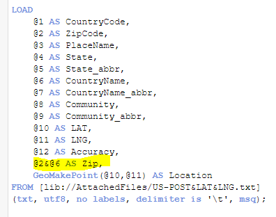
I got US-POST&LAT&LNG.txt online (GeoNames, US.zip), with zip code, latitude and longitude information. My script in data load editor is like:

But the map shows like this:
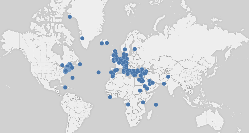
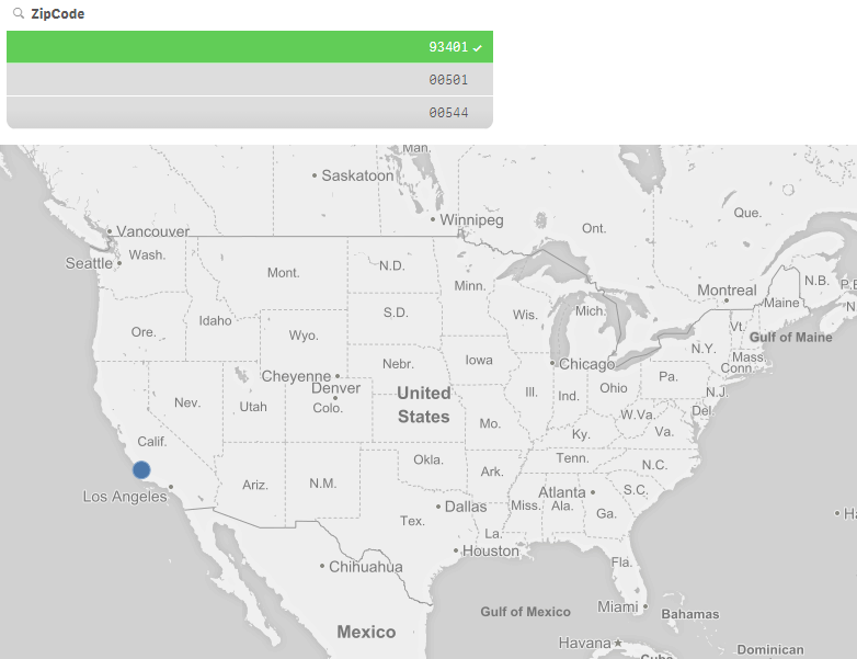
Which is confusing, many dots in the US are not showing. Like this dot in CA, which is only shown with the filter:
Any ideas?
Thanks in advance!
- Mark as New
- Bookmark
- Subscribe
- Mute
- Subscribe to RSS Feed
- Permalink
- Report Inappropriate Content
I would suggest using the ZipCode &'-'& CountryName as your dimension to allow Qlik to differentiate Zipcodes among different countries
- Mark as New
- Bookmark
- Subscribe
- Mute
- Subscribe to RSS Feed
- Permalink
- Report Inappropriate Content
Hi Rupam,
Thanks for help!
I modified my script with the highlighted line:
Then I used Zip field as my point layer, the map shows like this:
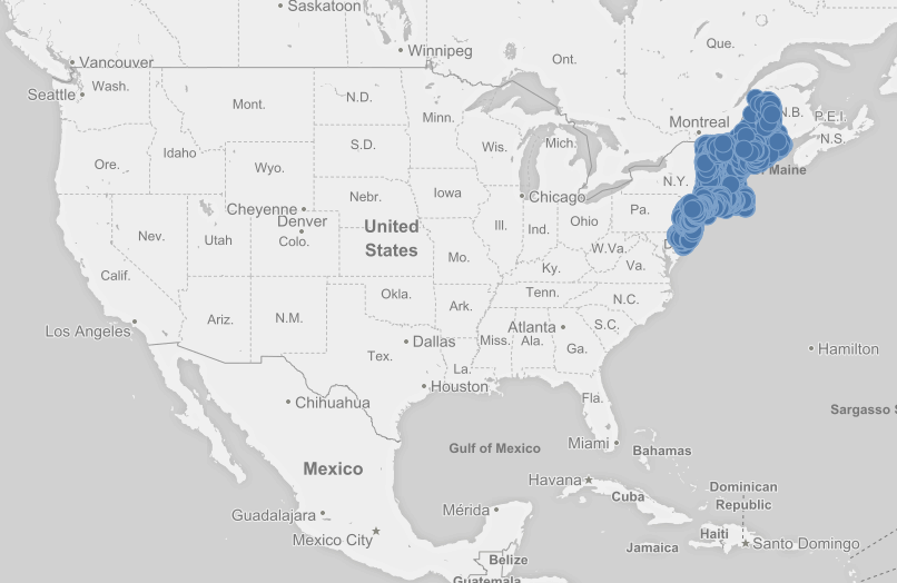
Any ideas?
- Mark as New
- Bookmark
- Subscribe
- Mute
- Subscribe to RSS Feed
- Permalink
- Report Inappropriate Content
@2&','@6 as ZIP, this should help you. Also put sorting as 'None'.
This thread would you.
Re: Is there a way to pre-scrub location information for correctness?