Unlock a world of possibilities! Login now and discover the exclusive benefits awaiting you.
- Qlik Community
- :
- All Forums
- :
- QlikView Integrations
- :
- Re: QlikView and Google Maps
- Subscribe to RSS Feed
- Mark Topic as New
- Mark Topic as Read
- Float this Topic for Current User
- Bookmark
- Subscribe
- Mute
- Printer Friendly Page
- Mark as New
- Bookmark
- Subscribe
- Mute
- Subscribe to RSS Feed
- Permalink
- Report Inappropriate Content
QlikView and Google Maps
Hey, I'm working on my final project in QV
and got some problems with definning the maps.
I managed to add the google maps,
but can't actually connect it with my data...
i have a bunch of restaurants and would like to see them on the google map,
please help me, i might have gotten stuck with the script.
that it shows the places but when i press a place on the table
it doesn't show which one it is on the maps,
and shows no information on the map also.
another question is, how do i make a window that shows the site
i have a list of all the sites and still can't manage to open a windon
on the dashboard that shows it.
thanx a lot'
Yotam ziv
this is my google maps script:
var r=Math.floor(Math.random()*10001);
var divName = "div" + r;
//Houston - We have lift off.
loadLibs();
// Initilize Marker API - When ready call Google API
// Initilize Google Maps API - When ready get ready to do some voodoo magic!
function loadLibs() {
Qva.LoadScript('http://google-maps-utility-library-v3.googlecode.com/svn/tags/markerclustererplus/2.0.1/src/markercl...', function () {
Qva.LoadScript('https://maps.google.com/maps/api/js?sensor=false&callback=Map_Done')
});
};
//Do magic.
function Map_Done() {
Qva.AddExtension("Map",
function() {
//Check for existing map canvas.
if (this.Element.children.length == 0) {
var ui = document.createElement("div");
ui.setAttribute("id",divName);
ui.setAttribute("style","width: 100%; height: 100%");
this.Element.appendChild(ui);
}
//Define Map center
var center = new google.maps.LatLng(32.727136, 35.139817);
//Draw map - Change options to suit your needs.
var map = new google.maps.Map(document.getElementById(divName), {
zoom: 8,
center: center,
mapTypeId: google.maps.MapTypeId.ROADMAP
});
//Create marker array and cycle through your rows.
var markers = [];
for (var i = 0; i < this.Data.Rows.length; i++) {
var row = this.Data.Rows ;
var latLng = new google.maps.LatLng(row[0].text,row[1].text);
//Example title for pins, adjust to suit your need.
//var mTitle = 'No. Employees: ' + row[3].text + ' Average Monthly Pay: ' + row[2].text;
var marker = new google.maps.Marker({
position: latLng,
//title: mTitle
});
//Push row into array
markers.push(marker);
}
//Apply markercluster to map - Might want to segment this if you are plotting a huge number of markers.
//Add options to fine-tune performence
var mcOptions = {gridSize: 30, maxZoom: 15};
var markerCluster = new MarkerClusterer(map, markers, mcOptions);
});
//Not used right now - Used to calculate a different number on the marker
function count(markers) {
var total = 0;
for (var i = 0;i < markers.length; i++) {
total = markers.value;
}
var value = total;
// different index for different icons showed on cluster maker.
var index = parseInt(value / 30, 10) + 1;
return {
text: value,
index: index
};
};
};
- Tags:
- qlikview_extensions
- Mark as New
- Bookmark
- Subscribe
- Mute
- Subscribe to RSS Feed
- Permalink
- Report Inappropriate Content
That looks like the extension I wrote a while back.
When looking your screenshot it looks like you only have one restaurant selected?
The data exposed to the extension works in the same way as qlikview works so most likely you have more then one set of coordinates related to your restaurant.
Easiest way to try this is to pull out listboxes for restaurant, latitude, longitude. Select a restaurant and you should only get one coordinate set back.
You could probably also remove the marker cluster lib completly, I only had it in there becuse I needed to plot a pretty huge number of markers and wanted to improve performance.
- Mark as New
- Bookmark
- Subscribe
- Mute
- Subscribe to RSS Feed
- Permalink
- Report Inappropriate Content
Alexander, thank you so much,
i managed to connect between the coordinates and the Restaurant Name,
so it shows only one Place every time i chose 1.
You startd talking about removing the cluster lib,
unfortunately i don't know much about JAVA,
i'm a little better in C# so i tried something but it didn't work,
would be deliteful if you remove the cluster lib for me
and the map will keep showing...
One last thing for now is,
i tried openning a web page on the screen
but it won't let me,
everytime i chose a place, it asks me to save some file.
the web pages that i want to show are all in a table on the screen( bottom right where the mouse is ),
don't know what to enter in the URL column so the data in this table will be shown on the web page,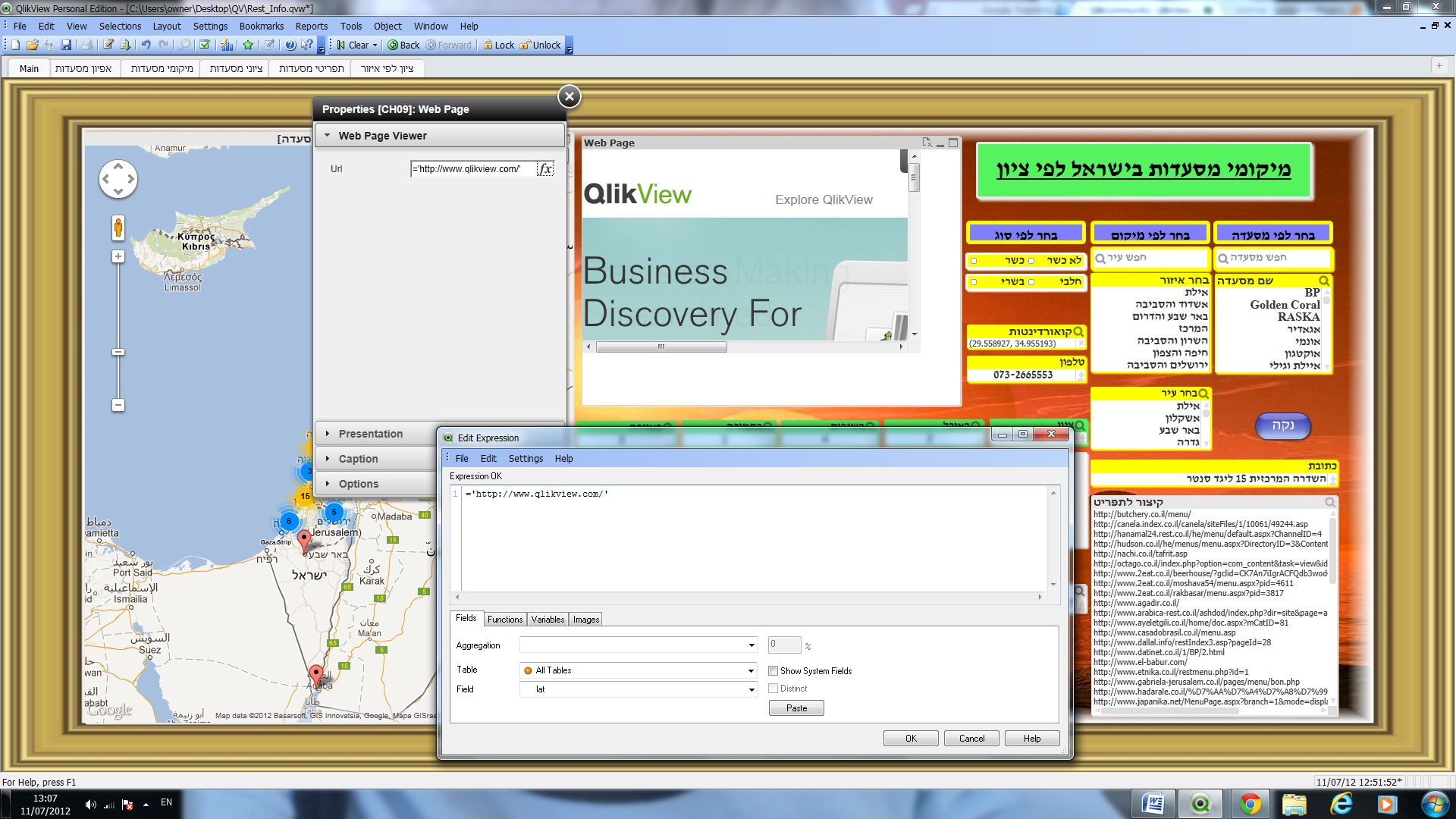
i added a photo to show you the situation.
again, thank you so much for being so helpful,
i'll notice it in the project...
Yotam Ziv