Unlock a world of possibilities! Login now and discover the exclusive benefits awaiting you.
- Qlik Community
- :
- All Forums
- :
- QlikView Administration
- :
- Heat Map API
- Subscribe to RSS Feed
- Mark Topic as New
- Mark Topic as Read
- Float this Topic for Current User
- Bookmark
- Subscribe
- Mute
- Printer Friendly Page
- Mark as New
- Bookmark
- Subscribe
- Mute
- Subscribe to RSS Feed
- Permalink
- Report Inappropriate Content
Heat Map API
Hi frnds,
I m facing a problem of how to use the Heat Map API in the Qlikview..We know the Qlikview 9 has a in built Google Map API but if we have to use the Heat Map API then how to use it???
To implement it we have to use the JAVASCRIPT and for further any study about the Heat Map API go to the website of
http://www.heatmapapi.com/Default.aspx
Help me!!!!!
Thnks & Regards,
Nitin Jain
- Mark as New
- Bookmark
- Subscribe
- Mute
- Subscribe to RSS Feed
- Permalink
- Report Inappropriate Content
Hi,
I do have the same question. Can someone give some ideas on it?
- Mark as New
- Bookmark
- Subscribe
- Mute
- Subscribe to RSS Feed
- Permalink
- Report Inappropriate Content
Hi,
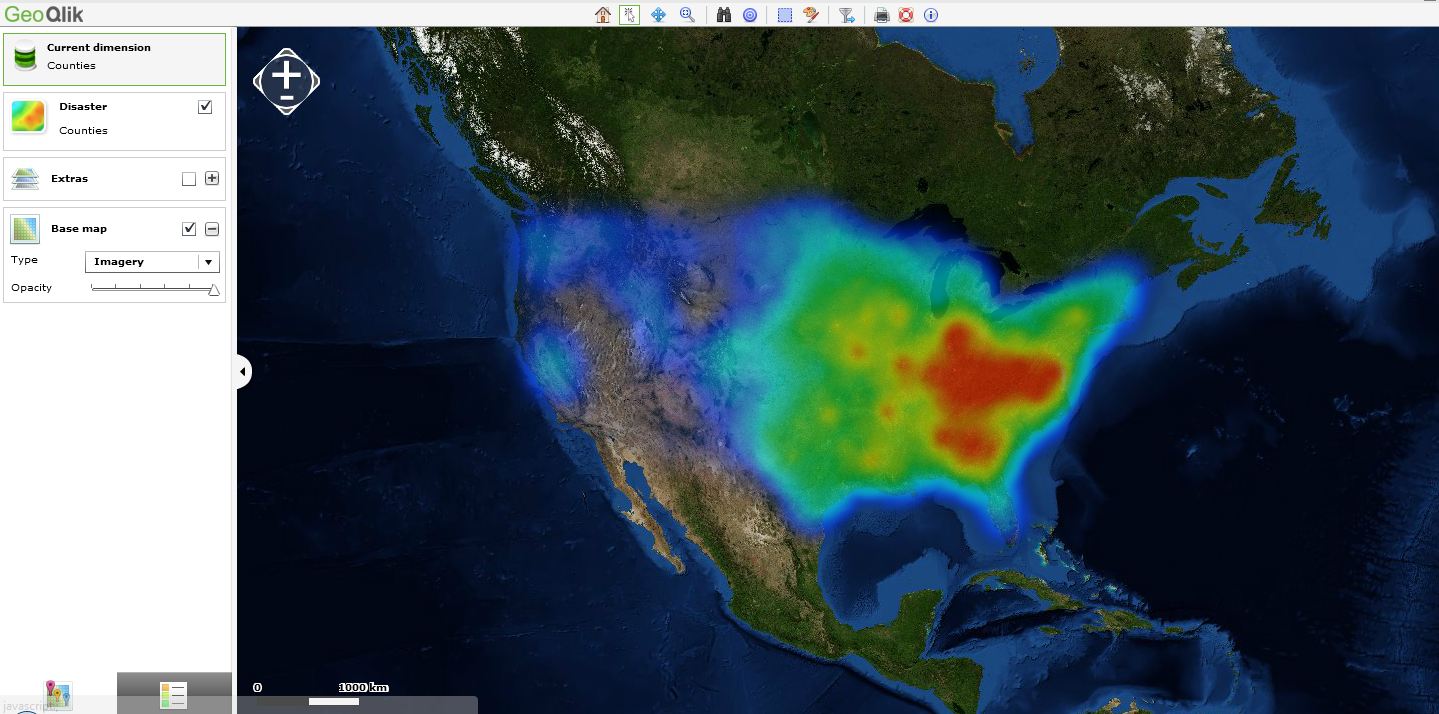
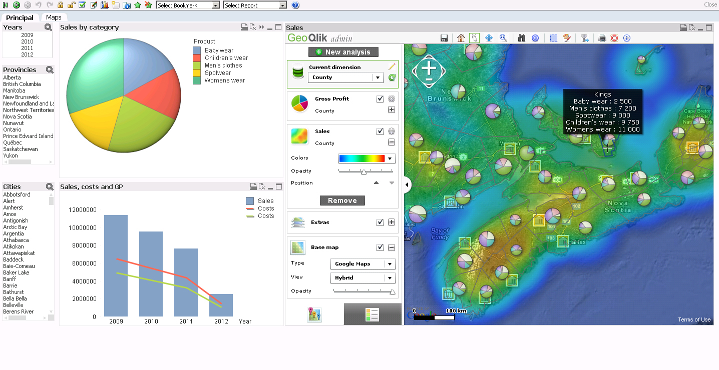
GIS/Maps Analytics in QlikView is a very interesting topic and "Heat Maps" are one of the ways to display QlikVIew KPI indicators and to represent a density on a Geografic map (ex: population, deliveries, etc.)
QlikView customers and channel parners are interested in displaying their QlikView KPI indicators on Geographic maps but also sometimes on a building plan (ex: logistic warehouse, supermarket, hospital, etc).
Business Geografic has developed a mapping extension for QlikView (V9, V10, V11) namely "GeoQlik" and we have been a Technology Partner of QlikTech since 2006 starting with QlikView 8!
I hereby suggest you to have a look at our new mapping extension for QlikView 11 "SR1": GeoQlik v11.6:
http://www.geoqlik.com/en/geoqlik-for-qlikview/geoqlik-v11.html
Please find hereafter a few "Heat Maps" screenshots of GeoQlik V11.6 using WMS/TMS services to display QlikView KPIs:
Thanks and best regards,
David
@ Business Geografic