Unlock a world of possibilities! Login now and discover the exclusive benefits awaiting you.
- Qlik Community
- :
- All Forums
- :
- Deployment & Management
- :
- Re: Qlik Sense Map with more than 1 dimension
- Subscribe to RSS Feed
- Mark Topic as New
- Mark Topic as Read
- Float this Topic for Current User
- Bookmark
- Subscribe
- Mute
- Printer Friendly Page
- Mark as New
- Bookmark
- Subscribe
- Mute
- Subscribe to RSS Feed
- Permalink
- Report Inappropriate Content
Qlik Sense Map with more than 1 dimension
Hi to all,
has anyone tried to implement a Map in Sense with more than 1 dimension?
Is it possible? I've not found any good solution until now.
Many thanks for your contributes
- « Previous Replies
-
- 1
- 2
- Next Replies »
- Mark as New
- Bookmark
- Subscribe
- Mute
- Subscribe to RSS Feed
- Permalink
- Report Inappropriate Content
Hello Alessandro,
I've used the extensión called SVGReader (there are several, maybe you took another one) and I can add dimensions:
If you'd like, I could send you the dimension I'm using
- Mark as New
- Bookmark
- Subscribe
- Mute
- Subscribe to RSS Feed
- Permalink
- Report Inappropriate Content
Hi Ainhoa,
Sorry for my late reply.
I have been trying too build an world map based on an kml file, which points to the countries in my DB based on the ISO code. It works fine on the Qlik Desktop but has performance issues on the server side.
Do you think this would work with the SVG extension you mentioned, and also does the SVG need any licensing?
Thanks
Best Regards
Sai.
- Mark as New
- Bookmark
- Subscribe
- Mute
- Subscribe to RSS Feed
- Permalink
- Report Inappropriate Content
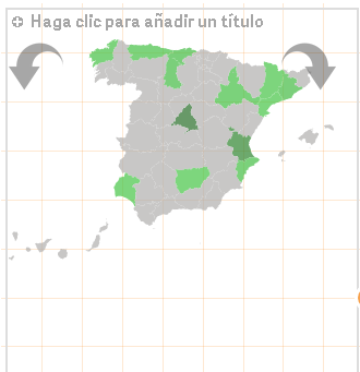
Hi Alessandro,
Is this what you'd like to do?
- Mark as New
- Bookmark
- Subscribe
- Mute
- Subscribe to RSS Feed
- Permalink
- Report Inappropriate Content
Hi Ainhoa,
I need a Geopoint Map (not an area map), but it's interesting anyway if you really have used MORE THAN 1 DIMENSION !
How do you add the geopoint locations? via Script? I need to use the data inside my model: Shops and Customers, and I need 2 Geopoint Locations in my data model...
- Mark as New
- Bookmark
- Subscribe
- Mute
- Subscribe to RSS Feed
- Permalink
- Report Inappropriate Content
Hello!
I do not think it needs any licensing Sometimes creators share for free their extensions, other times they only give Access to it as a demo, and you need to ask the developer for further information. For that reason, I have asked its creator just to take our doubts out 
- Mark as New
- Bookmark
- Subscribe
- Mute
- Subscribe to RSS Feed
- Permalink
- Report Inappropriate Content
Hi Alessandro,
I'm sorry but with the current extension I am working the maps with I think it is not possible to add geopoint locations neither via script nor edition mode.I will have a look at it and in case I could get it I let you know.
I remember there were some demo versions to download in Qlik Branch to work with maps and set up some geopoint locations but they were demos.
There is a program for Sense and View which allows you to do so (I dont know if I have ever told you);
GeoQlik, the only true mapping component for QlikView and Qlik Sense
In the link I have written, there is a trial version in case you want to try it. It has very good options but it might be a bit expensive.
- Mark as New
- Bookmark
- Subscribe
- Mute
- Subscribe to RSS Feed
- Permalink
- Report Inappropriate Content
Hi Alessandro,
You could take a look at IdevioMaps (http://bi.idevio.com), it has excellent support for multiple layers on the map, i.e. multiple dimensions. Actually each layer is a separate component which you drag into the sheet and it displays the data at a map component that you also drag there. There are several types of layers like Bubble Layer, Area Layer, Line Layer, Heatmap Layer etc.
Send an email to info@idevio.com if you would like to try it out. To quickly see how it works, take a look at the video at New video: add a map in a minute « bi.idevio.com.
Regards
Johan
- Mark as New
- Bookmark
- Subscribe
- Mute
- Subscribe to RSS Feed
- Permalink
- Report Inappropriate Content
Unfortunately Qlik Support has just confirmed me that Sense allow the use of only 1 dimension in maps (1 Geopoint Location).
I know GeoQlik but it's too expensive.
- « Previous Replies
-
- 1
- 2
- Next Replies »