Unlock a world of possibilities! Login now and discover the exclusive benefits awaiting you.
- Qlik Community
- :
- Forums
- :
- Analytics
- :
- New to Qlik Analytics
- :
- Creating polygon maps - linking tables
- Subscribe to RSS Feed
- Mark Topic as New
- Mark Topic as Read
- Float this Topic for Current User
- Bookmark
- Subscribe
- Mute
- Printer Friendly Page
- Mark as New
- Bookmark
- Subscribe
- Mute
- Subscribe to RSS Feed
- Permalink
- Report Inappropriate Content
Creating polygon maps - linking tables
Hi all,
I am a new user of QlikSense and I am currently going through the tutorial video on creating polygon maps - Creating a Polygon (choropleth) Map
I performed the following steps:
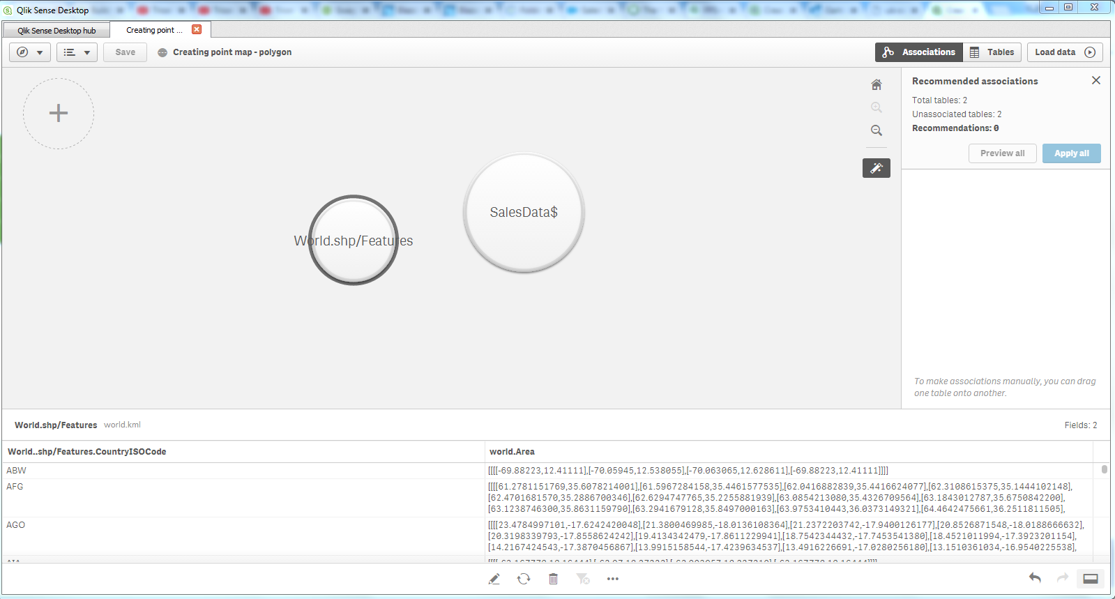
1. load data from gettingstarteddata.xls
2. load data from world.kml
3. change the column name of world.name to CountryISOCode
However, I was not able to associate the two tables via the CountryISOCode column by dragging and dropping either of the tables on each other. And also, the column name of CountryISOCode of the world.kml is changed to world.shp/features.CountryISOCode instead.
Could someone please advise or point out what did I do wrongly?
Thanks in advance
Regards,
Griffin
- Mark as New
- Bookmark
- Subscribe
- Mute
- Subscribe to RSS Feed
- Permalink
- Report Inappropriate Content
Hi,
I think you just need to load the data source (in your case sales data). You need to ensure having one single column in the data source with the ISO2 or ISO3 code.
After loading the data open the data manager and edit the data source. Make sure that for the appropriate colum the field type is set to geo data and the format is set to ISO2 or ISO3.
Do the reload again. You then can drag the country field onto the map together with the KPI field.
The world map visualisation is done automatically.
Regards,
Thomas
Please mark helpful / correct if applicable
- Mark as New
- Bookmark
- Subscribe
- Mute
- Subscribe to RSS Feed
- Permalink
- Report Inappropriate Content
Hi Thomas,
Thanks for your reply.
I tried out your suggested solutions but it still did not work for me.
I think the problem lies with the fact that the column name of 'World.Name' of the world.kml file cannot be changed to 'CountryISOCode' without an error message showing, which says 'the field name must be unique. the field already exists in table: salesdata$'
Regards,
Griffin
- Mark as New
- Bookmark
- Subscribe
- Mute
- Subscribe to RSS Feed
- Permalink
- Report Inappropriate Content
Hi, maybe I didn´t explain myself enough.
I meant just to load the sales data file. The world map is loaded automatically when you assign the country field as a geo field with ISO2 or ISO3 code. You don´t need to load a separate world.kml file.
Regards,
Thomas
PS: Yes, it´s right. The data manager doesn´t allow to rename a field to the same fieldname of an another source. For me this is a missing feature, because exactly by having same field name you can achive the match between data sources.
If you really need to load your own world.kml file you have to go to the data load editor, unlock the autogenerated code and then to rename the field automatically in the script. Unfortunately this will cause that the data load manager cannot be used for the existing loads (only for new loads).