Unlock a world of possibilities! Login now and discover the exclusive benefits awaiting you.
- Qlik Community
- :
- Forums
- :
- Analytics
- :
- New to Qlik Analytics
- :
- Re: Help with Plotting Coordinates as Map
- Subscribe to RSS Feed
- Mark Topic as New
- Mark Topic as Read
- Float this Topic for Current User
- Bookmark
- Subscribe
- Mute
- Printer Friendly Page
- Mark as New
- Bookmark
- Subscribe
- Mute
- Subscribe to RSS Feed
- Permalink
- Report Inappropriate Content
Help with Plotting Coordinates as Map
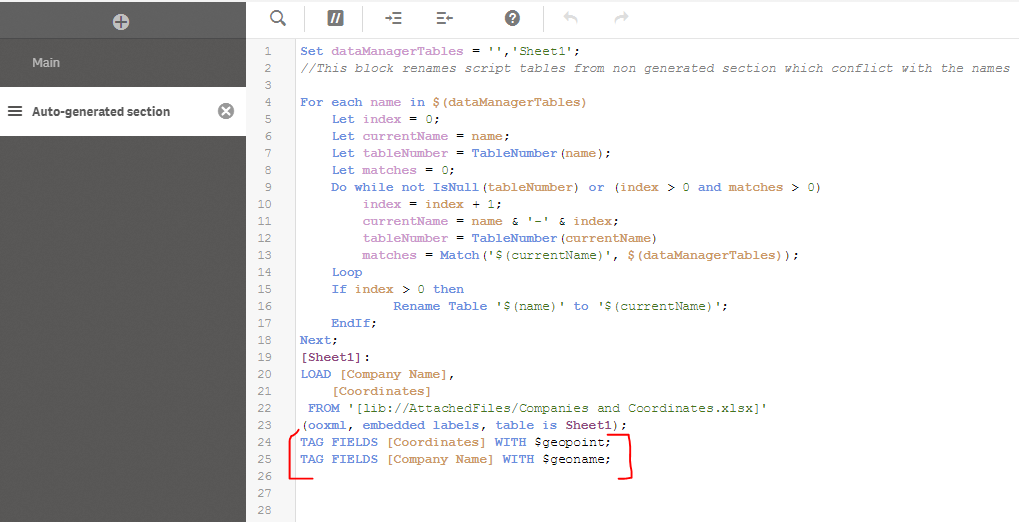
I have converted many full addresses into coordinates of the formula [x, y] via a different tutorial and I know thy are correct. I can copy paste and single one of them into google and it comes up with the correct location. Following a different tutorial, I ended up with the following script (the stuff I added bracketed in red):
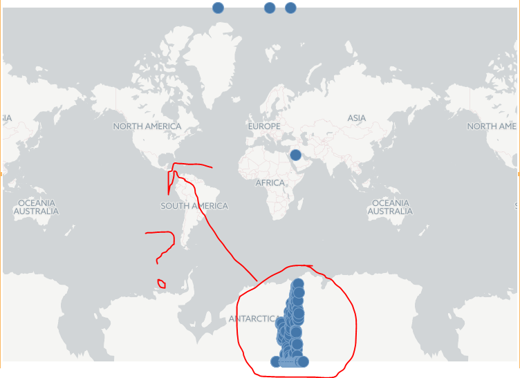
From here, I went into my sheet and opened a map and added coordinates (with no little black earth next to the name) as a dimension. For some reason, nearly all of my coordinates are popping up in Antarctica. What am I doing wrong here? I've attached a simplified version of my document. I really appreciate any help I can get on this. Bad map also shown below:
Accepted Solutions
- Mark as New
- Bookmark
- Subscribe
- Mute
- Subscribe to RSS Feed
- Permalink
- Report Inappropriate Content
That's cus you pre-created coordinates.
Your Coordinates are wrong....
It should be like below
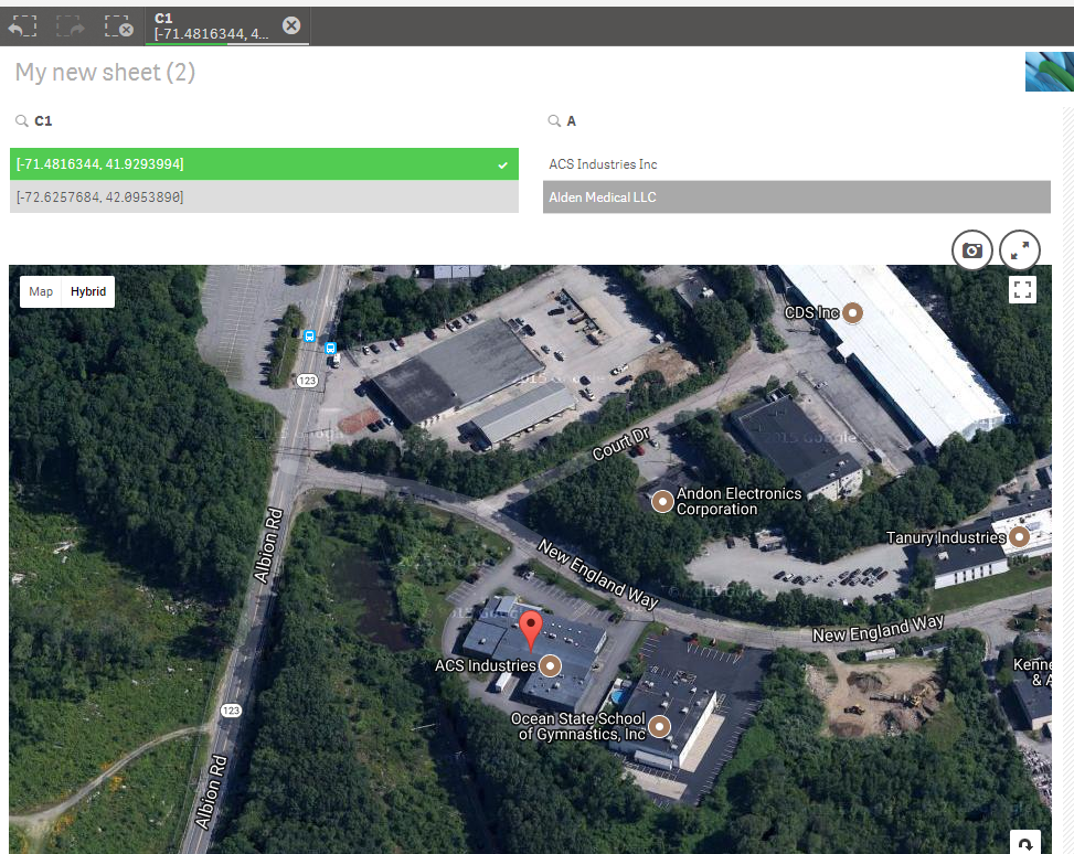
| Test | Geo | |||
| ACS Industries Inc | [-71.4816344, 41.9293994] | |||
| Alden Medical LLC | [-72.6257684, 42.0953890] | |||
First you should have Longitude and then Latitude
FYI, I'm using Google Map extension and not the Qlik default map.
To use google map you'd need your own API key as a developer but in your case you can use default Qlik Maps
Better Use Latitude and Longitude as separate fields then make a Geopoint out of it to create Coordinates.
Something like below in your script if you have below 2 fields
GeoMakePoint( Lattitude, Longitude) as GeoLocation
And use GeoLocation as a Layer in Map
- Mark as New
- Bookmark
- Subscribe
- Mute
- Subscribe to RSS Feed
- Permalink
- Report Inappropriate Content
That's cus you pre-created coordinates.
Your Coordinates are wrong....
It should be like below
| Test | Geo | |||
| ACS Industries Inc | [-71.4816344, 41.9293994] | |||
| Alden Medical LLC | [-72.6257684, 42.0953890] | |||
First you should have Longitude and then Latitude
FYI, I'm using Google Map extension and not the Qlik default map.
To use google map you'd need your own API key as a developer but in your case you can use default Qlik Maps
Better Use Latitude and Longitude as separate fields then make a Geopoint out of it to create Coordinates.
Something like below in your script if you have below 2 fields
GeoMakePoint( Lattitude, Longitude) as GeoLocation
And use GeoLocation as a Layer in Map
- Mark as New
- Bookmark
- Subscribe
- Mute
- Subscribe to RSS Feed
- Permalink
- Report Inappropriate Content
When you're right you're right! Separating the coordinates into 2 separate fields resolved the problem and allow qlik to piece them together separately on it's own. Didn't even have to do any script editing. Thanks.