Unlock a world of possibilities! Login now and discover the exclusive benefits awaiting you.
- Qlik Community
- :
- Forums
- :
- Analytics
- :
- New to Qlik Analytics
- :
- Re: How to connect Google maps with Qlik map
- Subscribe to RSS Feed
- Mark Topic as New
- Mark Topic as Read
- Float this Topic for Current User
- Bookmark
- Subscribe
- Mute
- Printer Friendly Page
- Mark as New
- Bookmark
- Subscribe
- Mute
- Subscribe to RSS Feed
- Permalink
- Report Inappropriate Content
How to connect Google maps with Qlik map
Hello Qlik Community,
I am working on data regarding Fault occurrences in multiple cities trying to insert them on geographic map. I have the city available in separate column using which I have mapped the cities and the darkness of color shows the count of faults occurring. Now I want to take it to next level and map the areas in a particular city with respect to fault occurrences. The address is searchable in Google maps and provides a pinpoint location. Kindly guide me how can I use this address field and mark the points on map using addresses.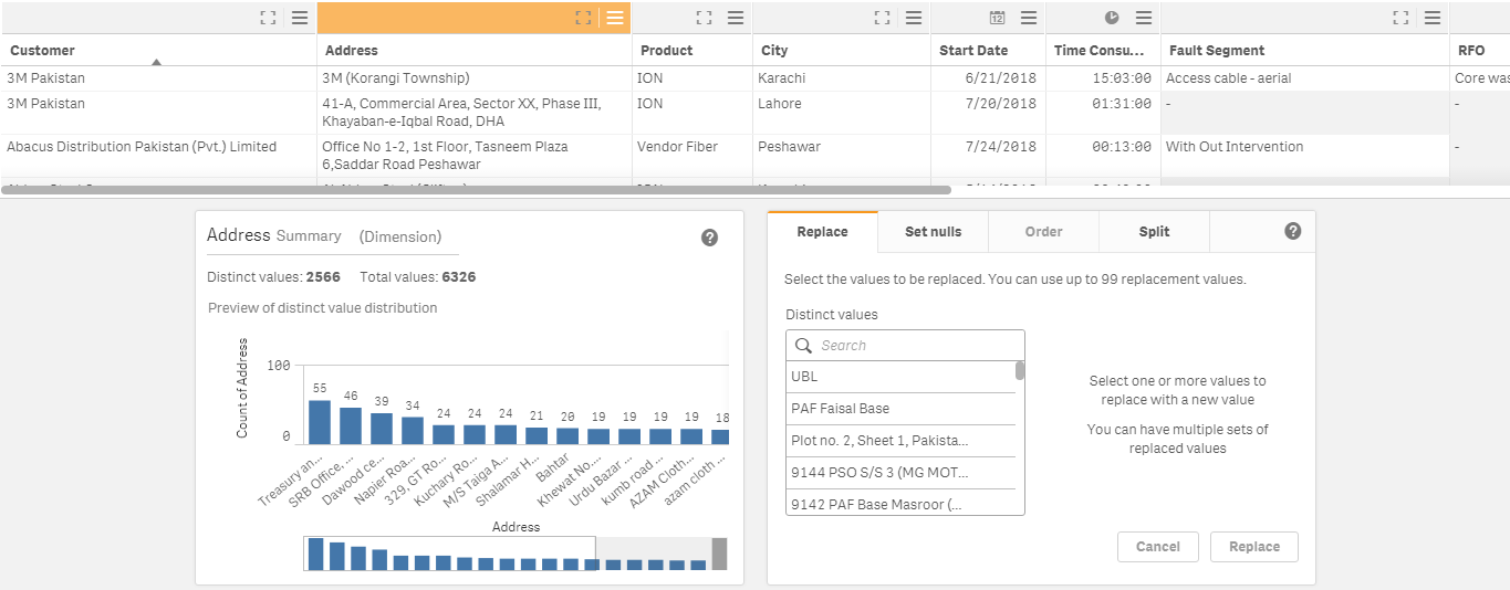
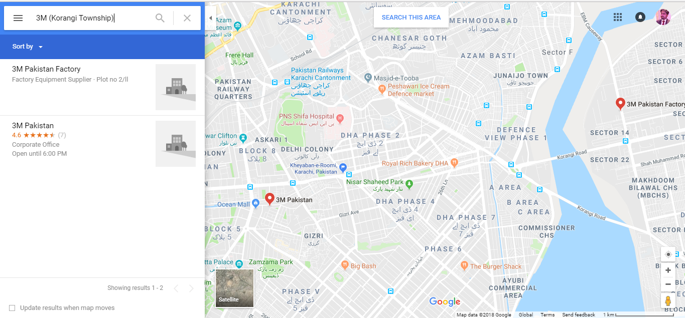
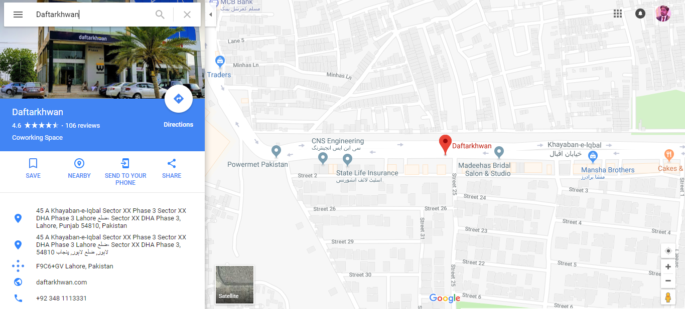
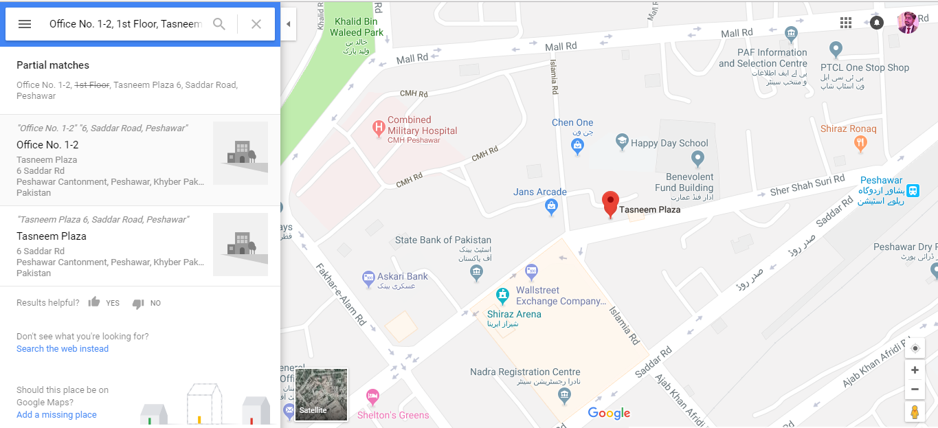
Following are the results from Google maps first 3 addresses visible in the above data.
My map on Qlik is shown below with cities and I want to create Area layer using above process of identifying the addresses just like Google map.
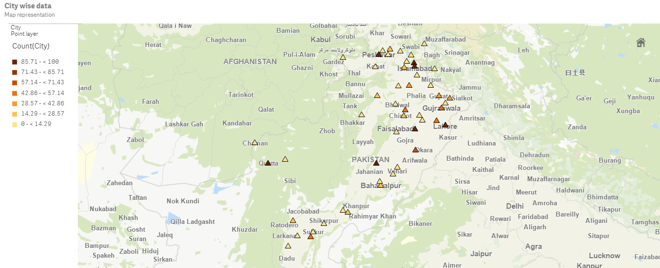
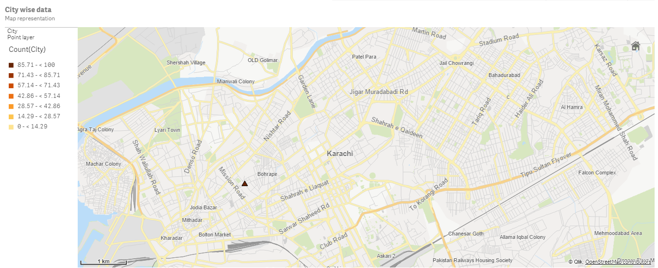
The below map shows the areas of one of the cities with Maximum counts which I need to work on
- Mark as New
- Bookmark
- Subscribe
- Mute
- Subscribe to RSS Feed
- Permalink
- Report Inappropriate Content
Maybe this extension on Qlik Branch is something you could use:
GoogleMapsAPIv3Toolkit-QS: Qlik Branch
- Mark as New
- Bookmark
- Subscribe
- Mute
- Subscribe to RSS Feed
- Permalink
- Report Inappropriate Content
Hello Petter,
Thanks. Let me check this.
- Mark as New
- Bookmark
- Subscribe
- Mute
- Subscribe to RSS Feed
- Permalink
- Report Inappropriate Content
Qlik GeoAnalytics should support geocoding (converting addresses into geographic coordinates). With Qlik Sense you would need to get the Longitude and Latitude of the locations and load them to your existing set of data. You can use any tool for batch geocoding, e.g. https://geocode.localfocus.nl/