Unlock a world of possibilities! Login now and discover the exclusive benefits awaiting you.
- Qlik Community
- :
- Forums
- :
- Analytics
- :
- New to Qlik Analytics
- :
- Re: Map Object Display City Issue
- Subscribe to RSS Feed
- Mark Topic as New
- Mark Topic as Read
- Float this Topic for Current User
- Bookmark
- Subscribe
- Mute
- Printer Friendly Page
- Mark as New
- Bookmark
- Subscribe
- Mute
- Subscribe to RSS Feed
- Permalink
- Report Inappropriate Content
Map Object Display City Issue
I have name of the cities and geo coordinates in my data (longitude and latitude) and I want to display organizations by cities on the map.
I created a GeoMakePoint() from longitude and latitude and the data field seems ok and corresponds to a city correctly (see the table object from the picture below). But when I try to plot the coordinates on the map object all my points are distributed chaotically and mostly in Antarctica  . I don't think Qlik sees the coordinates correctly somehow.
I checked the coordinates for the cities with an external source and they are correct.
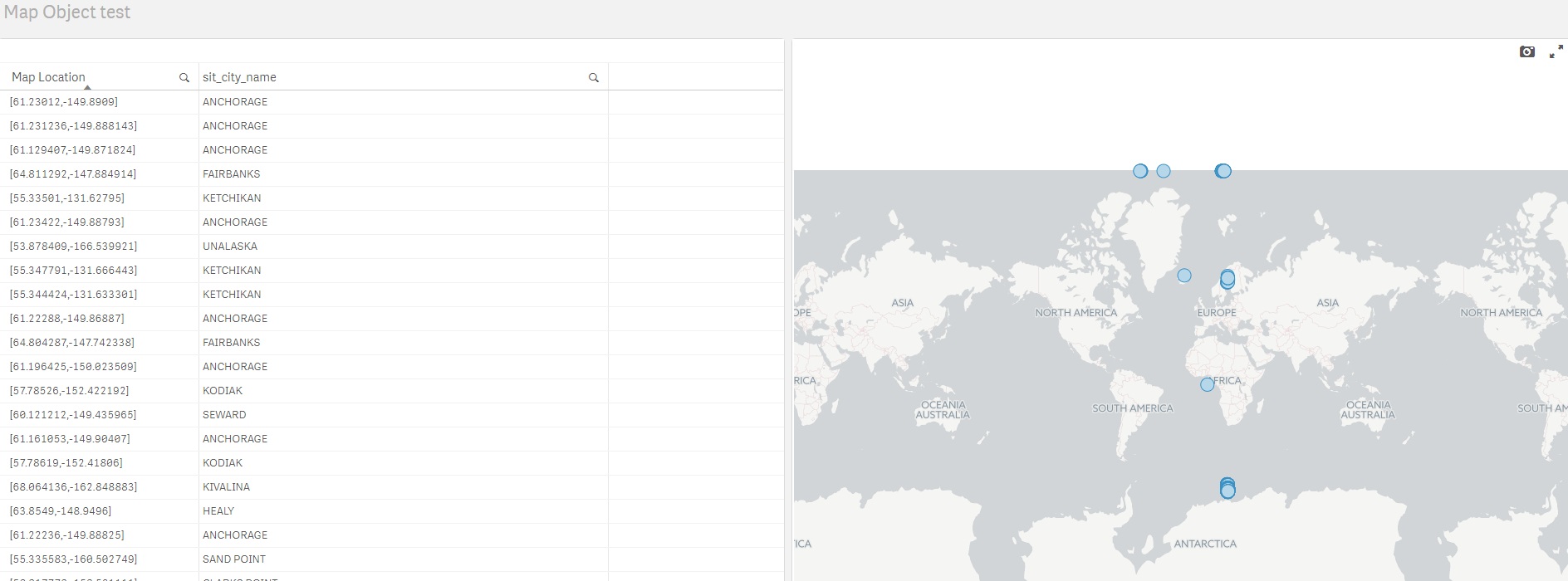
Any ideas what is the issue with my map?
Thanks,
- Tags:
- map city
- map object
Accepted Solutions
- Mark as New
- Bookmark
- Subscribe
- Mute
- Subscribe to RSS Feed
- Permalink
- Report Inappropriate Content
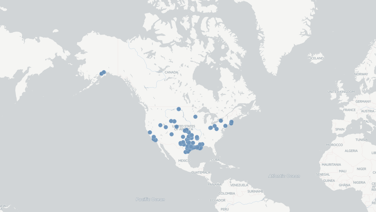
With your Data I'm getting the points on USA.
And below is the script
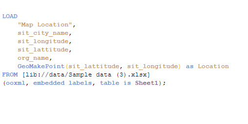
I guess in your script you used
GeoMakePoint(sit_longitude, sit_lattitude) as Location
But you should first use Latitude and then longitude like above field Location.
- Mark as New
- Bookmark
- Subscribe
- Mute
- Subscribe to RSS Feed
- Permalink
- Report Inappropriate Content
Can you please upload the sample file for your Lat & Long to test?
- Mark as New
- Bookmark
- Subscribe
- Mute
- Subscribe to RSS Feed
- Permalink
- Report Inappropriate Content
maybe you have to replace dot with comma symbol for lat and long data.
- Mark as New
- Bookmark
- Subscribe
- Mute
- Subscribe to RSS Feed
- Permalink
- Report Inappropriate Content
Try To create the GeoMakePoint() as a Master Item and use it.
Load the appropriate Map Background.
if possible share the sample data.
- Mark as New
- Bookmark
- Subscribe
- Mute
- Subscribe to RSS Feed
- Permalink
- Report Inappropriate Content
Hi Aehman, I attached the sample data and I added the raw columns longitude and latitude and the GeoMakePoint(Map Location) that I created with longitude and latitude. Thanks,
- Mark as New
- Bookmark
- Subscribe
- Mute
- Subscribe to RSS Feed
- Permalink
- Report Inappropriate Content
Hi Ramesh,
I attached the sample data and I tried the GetMakePoint() aprroach. I have the raw columns longitude and latitude and the column Map location is the result of GetMakePoint(longitude, latitude). Thanks,
- Mark as New
- Bookmark
- Subscribe
- Mute
- Subscribe to RSS Feed
- Permalink
- Report Inappropriate Content
I will try this. Thanks,
- Mark as New
- Bookmark
- Subscribe
- Mute
- Subscribe to RSS Feed
- Permalink
- Report Inappropriate Content
With your Data I'm getting the points on USA.
And below is the script
I guess in your script you used
GeoMakePoint(sit_longitude, sit_lattitude) as Location
But you should first use Latitude and then longitude like above field Location.
- Mark as New
- Bookmark
- Subscribe
- Mute
- Subscribe to RSS Feed
- Permalink
- Report Inappropriate Content
You are right  . I did used longitude and latitude when making the points. Problem solved. Thanks,