Unlock a world of possibilities! Login now and discover the exclusive benefits awaiting you.
- Qlik Community
- :
- Forums
- :
- Analytics
- :
- New to Qlik Analytics
- :
- Re: Need help in creating maps in Qliksense
- Subscribe to RSS Feed
- Mark Topic as New
- Mark Topic as Read
- Float this Topic for Current User
- Bookmark
- Subscribe
- Mute
- Printer Friendly Page
- Mark as New
- Bookmark
- Subscribe
- Mute
- Subscribe to RSS Feed
- Permalink
- Report Inappropriate Content
Need help in creating maps in Qliksense
Hi,
I have found three ways of implementing maps in Qliksense. Please let me know which is the best approach
- https://www.geoqlik.com/en/geoqlik-for-qlik-sense.html
- http://www.qlikmaps.com/
- https://community.qlik.com/docs/DOC-17940
Apart from these three options please let me know if there is any other way to implement drill down @maps in qliksense. (free of cost)
- « Previous Replies
- Next Replies »
- Mark as New
- Bookmark
- Subscribe
- Mute
- Subscribe to RSS Feed
- Permalink
- Report Inappropriate Content
I used Qlik Maps and i liked it.
you can also request a trial version.
- Mark as New
- Bookmark
- Subscribe
- Mute
- Subscribe to RSS Feed
- Permalink
- Report Inappropriate Content
Hi,
all you have listed here are advanced and paid features.
if you are looking for the free Geo features which is already excellents, you should read this:
basically you can make two types of maps: Points (latitude, longitude) maps and Areas Maps (KML file).
if you need more assistance, don't hesitate
- Mark as New
- Bookmark
- Subscribe
- Mute
- Subscribe to RSS Feed
- Permalink
- Report Inappropriate Content
Hi Youssef,
Thanks for your reply. I am facing one issue in creating map in Qlik sense. I have Region, division and territory all in one column called Level name and its data in another column called Position Name . Hence i am writing if condition to get them as three different fields.
[Sheet1$]:
LOAD [LEVEL_NAME],
[PARENT_POSITION_NAME],
[PARENT_POSITION_NBR],
[POSITION_NAME],
if([LEVEL_NAME]='REGION',[POSITION_NAME]) as Region,
if([LEVEL_NAME]='DIVISION',[POSITION_NAME]) as Division,
if([LEVEL_NAME]='TERRITORY',[POSITION_NAME]) as Territory,
[POSITION_NBR]
FROM [lib://Map/Geo Data.xls]
(biff, embedded labels, table is Sheet1$);
But i am not getting any association between these fields. Please find the snap shot below. I have attached qvf and data file as well. 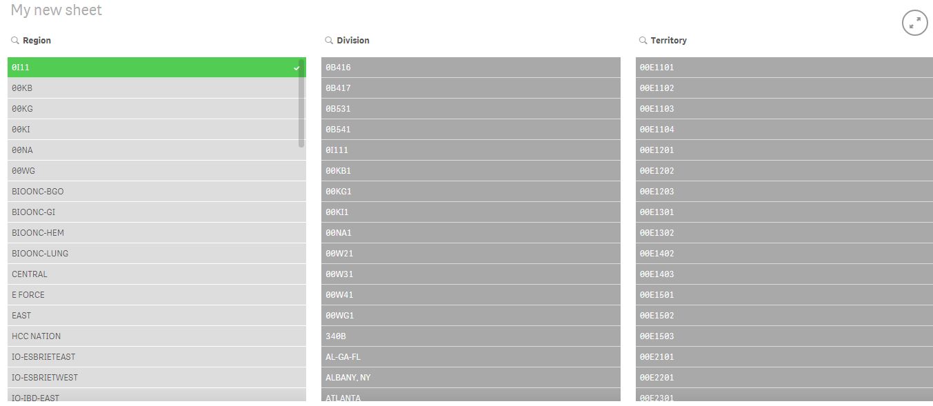
Please help me to get association between the above three fields.
- Mark as New
- Bookmark
- Subscribe
- Mute
- Subscribe to RSS Feed
- Permalink
- Report Inappropriate Content
If I'm not wrong, with this informations you have on your file (regardless of the association), you are not able to make maps works.
I'm I right ?
because i don't see latitude, longitude or areas..
- Mark as New
- Bookmark
- Subscribe
- Mute
- Subscribe to RSS Feed
- Permalink
- Report Inappropriate Content
Yes Youssef,
I have KML files for maps and please find the attachement.
- Mark as New
- Bookmark
- Subscribe
- Mute
- Subscribe to RSS Feed
- Permalink
- Report Inappropriate Content
To help you more i should test it at home because here i don't have Qliksense..
I hope someone else read this and give you the answer, otherwise I'll let you know tonight 
- Mark as New
- Bookmark
- Subscribe
- Mute
- Subscribe to RSS Feed
- Permalink
- Report Inappropriate Content
No Problem Youssef.
- Mark as New
- Bookmark
- Subscribe
- Mute
- Subscribe to RSS Feed
- Permalink
- Report Inappropriate Content
But take a look at the community at the same time, because I already build multi layer maps on qliksense (with drill down and without extensions), but i really forgot it was with points or with areas..
But I'm sure we can make it work
- Mark as New
- Bookmark
- Subscribe
- Mute
- Subscribe to RSS Feed
- Permalink
- Report Inappropriate Content
I have gone through many threads on community but i didnt get any solution May be due to the association problem. It would be great if you could help me on the association 
- « Previous Replies
- Next Replies »