Unlock a world of possibilities! Login now and discover the exclusive benefits awaiting you.
- Qlik Community
- :
- Forums
- :
- Analytics
- :
- New to Qlik Analytics
- :
- Re: Polygon Heat Map for Brazil - Hypercube result...
- Subscribe to RSS Feed
- Mark Topic as New
- Mark Topic as Read
- Float this Topic for Current User
- Bookmark
- Subscribe
- Mute
- Printer Friendly Page
- Mark as New
- Bookmark
- Subscribe
- Mute
- Subscribe to RSS Feed
- Permalink
- Report Inappropriate Content
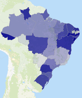
Polygon Heat Map for Brazil - Hypercube results too large
Hi guys,
Hope I could get some help. I am trying to build a polygon heat map for Brazil.
I downloaded the Brazil map by state from the link below before importing it to Qliksense:
Global Administrative Areas | Boundaries without limits
However, when I was editing my sheet and building the map, I received the error: Hypercube results are too large
Is there a solution to this, or do you know of a source that I could download another kml file for Brazil by states.
Thank you!!
- Mark as New
- Bookmark
- Subscribe
- Mute
- Subscribe to RSS Feed
- Permalink
- Report Inappropriate Content
Hello Chen,
This is most likely due to the fact that Qlik Sense has a limit on data points or polygons. The limit in the latest version of Qlik Sense has been lifted to 3333, so if your Hybercube has more data points than this then it will thrown this error or only plot the first amount of points until the limit is reached.
I hope this helps.
Please mark my answer as helpful and answered if so.
- Mark as New
- Bookmark
- Subscribe
- Mute
- Subscribe to RSS Feed
- Permalink
- Report Inappropriate Content
Hi James,
Thank you for your answer.
Is there a way to circumvent this problem or do you know of a source where I can download a kml file for Brazil with less data points? Thanks.
-Chen
- Mark as New
- Bookmark
- Subscribe
- Mute
- Subscribe to RSS Feed
- Permalink
- Report Inappropriate Content
I would check Google, otherwise you could also search Google for a KML reduction tool.
There are several posts:
google maps - How to simplify (reduce number of points) in KML? - Stack Overflow
ksoft - KMLReduce - Optimize KML file size, Reduce Polygons, Coordinates, Download
I personally have used the second one before and would recommend looking at that.
Please mark this response as helpful and mark the question as answered if this helps
- Mark as New
- Bookmark
- Subscribe
- Mute
- Subscribe to RSS Feed
- Permalink
- Report Inappropriate Content
Hi,
You could also try IdevioMaps (http://bi.idevio.com). It includes first level areas of Brazil and center points of the second level.
Also see the video Add IdevioMaps to Qlik Sense - YouTube for a quick demo. Send an email to info@idevio.com if you would like to try it.
Regards
Johan
- Mark as New
- Bookmark
- Subscribe
- Mute
- Subscribe to RSS Feed
- Permalink
- Report Inappropriate Content
Great ideas. Also, if you don't manage to externally edit the KML, there is a series of geo aggregation functions that are valid in the script to amalgamate different polygons into the larger polygon. So you can use this to amalgamate US based zip codes into a county. Or amalgamate counties into a State. That kind of thing.
- Mark as New
- Bookmark
- Subscribe
- Mute
- Subscribe to RSS Feed
- Permalink
- Report Inappropriate Content
Try to use smaller kml files
Polígonos de Estados e Municípios Brasileiros - IBGE - Gmapas