Unlock a world of possibilities! Login now and discover the exclusive benefits awaiting you.
- Qlik Community
- :
- Forums
- :
- Analytics
- :
- New to Qlik Analytics
- :
- Re: how to define the location information in dril...
- Subscribe to RSS Feed
- Mark Topic as New
- Mark Topic as Read
- Float this Topic for Current User
- Bookmark
- Subscribe
- Mute
- Printer Friendly Page
- Mark as New
- Bookmark
- Subscribe
- Mute
- Subscribe to RSS Feed
- Permalink
- Report Inappropriate Content
how to define the location information in drill-down map
Hi there, I would like to ask how we can define the location information in drill-down map in qlik sense? I uploaded two files, one is like a shape file. there are geo information and ID. The other are ID and name. I linked these two with ID. when i am creating the drill-down dimension, which field i should use? I tried with the name but it looks like it didn't show the correct location information on the map. So how can i make it? If i use the geo field in the shape file, then it will display the location name...Also i uploaded the output layer. but on the map, it said it only shows a limited of data sets. anyone knows why??
Thanks so much!
- « Previous Replies
-
- 1
- 2
- Next Replies »
- Mark as New
- Bookmark
- Subscribe
- Mute
- Subscribe to RSS Feed
- Permalink
- Report Inappropriate Content
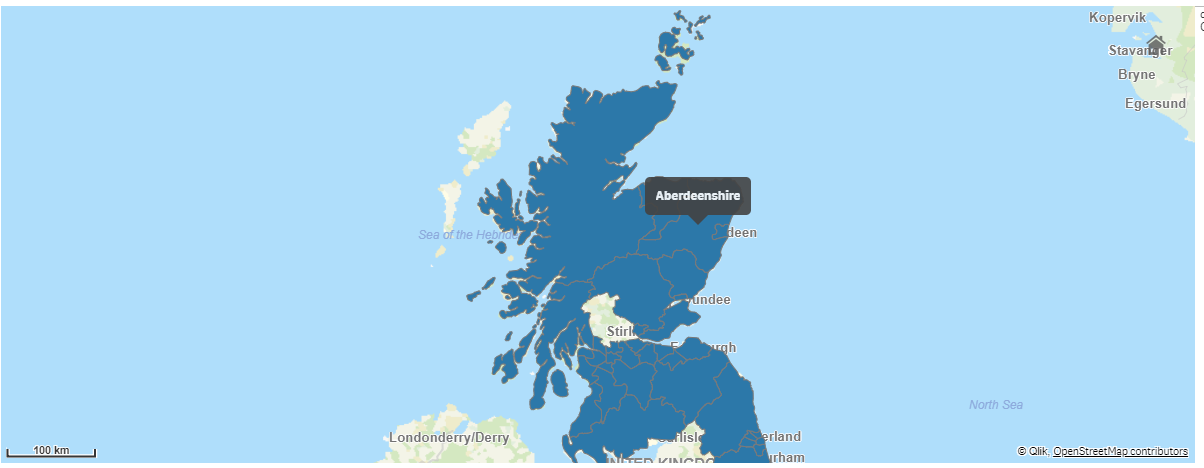
do you mean this ?
- Mark as New
- Bookmark
- Subscribe
- Mute
- Subscribe to RSS Feed
- Permalink
- Report Inappropriate Content
yes! this is the correct map. I want to make a drill-down map from country to local authority. I am not sure how to create the drill-down dimension since if i just use the name, it will give me the correct location. Do you know how to do it?
- Mark as New
- Bookmark
- Subscribe
- Mute
- Subscribe to RSS Feed
- Permalink
- Report Inappropriate Content
to do this you need a joining key between Country table and Authority district table.. how do you want to join these tables ?
- Mark as New
- Bookmark
- Subscribe
- Mute
- Subscribe to RSS Feed
- Permalink
- Report Inappropriate Content
Hi youssef, i figured it out. Yeah i added the joining key to match these two and i also changed the location info. Now my last question is that is it possible to change the title name of each layer?
- Mark as New
- Bookmark
- Subscribe
- Mute
- Subscribe to RSS Feed
- Permalink
- Report Inappropriate Content
DATA => Dimension => Label, on the map properties..
the layer concept is new so maybe you mean something else
- « Previous Replies
-
- 1
- 2
- Next Replies »