Unlock a world of possibilities! Login now and discover the exclusive benefits awaiting you.
- Qlik Community
- :
- All Forums
- :
- GeoAnalytics
- :
- Re: GeoAnalytics using Within Function
- Subscribe to RSS Feed
- Mark Topic as New
- Mark Topic as Read
- Float this Topic for Current User
- Bookmark
- Subscribe
- Mute
- Printer Friendly Page
- Mark as New
- Bookmark
- Subscribe
- Mute
- Subscribe to RSS Feed
- Permalink
- Report Inappropriate Content
GeoAnalytics using Within Function
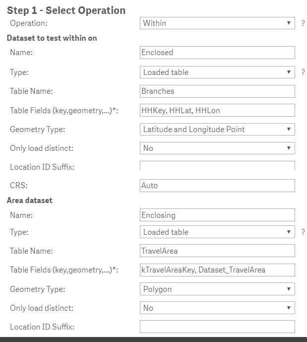
I have two associated datasets for households and bank branches. I have created travel areas around each bank branch and a point map of the households using Lat, Lon. I need the travel area (polygon) selectable to select the households (points) within that travel area.
When I load a small sample (10) of the housholds the data loads, creates 3 synthetic keys, a circular reference and the engine fails.
When I load a larger sample (100) of the households the load fails with a null error (though no nulls exist).
i am finding very very little documentation on using within and the within example is using a point within a standard area rather than a loaded table polygon and I am unable to use it to make my app work.
Is there anyone out there that has successfully done this that would be able to help me out?
Thanks
My data model and settings for the within are as follows.
- « Previous Replies
-
- 1
- 2
- Next Replies »
- Mark as New
- Bookmark
- Subscribe
- Mute
- Subscribe to RSS Feed
- Permalink
- Report Inappropriate Content
Hi Larry,
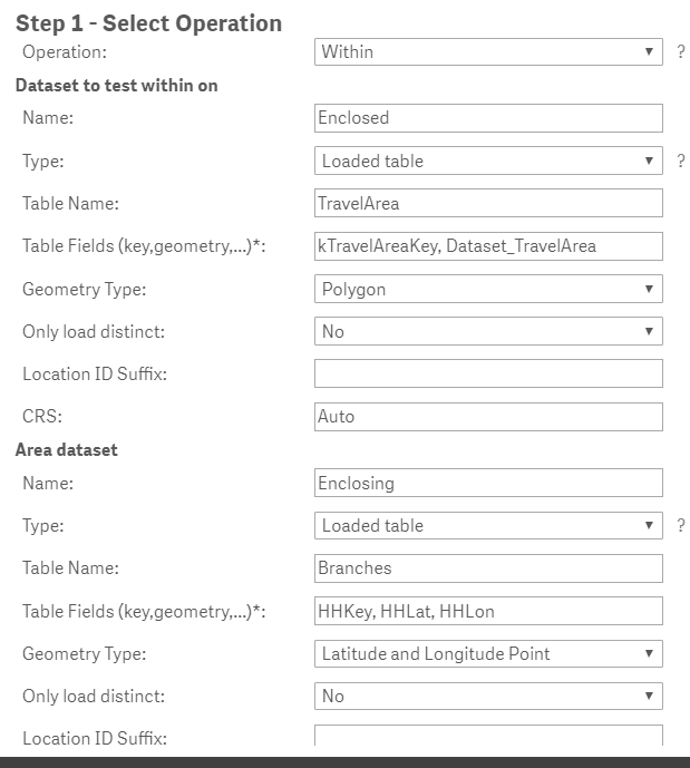
Switch the order of the indata, the first dataset should be the points you want to test with and the second dataset is the areas (in your case TravelAreas.)
Check out the example for "Within"
http://bi.idevio.com/geoanalytics/geoanalytics-connector-examples
Thanks,
Patric
- Mark as New
- Bookmark
- Subscribe
- Mute
- Subscribe to RSS Feed
- Permalink
- Report Inappropriate Content
I get the same result either way. It doesn't populate the withinassociations table with either load order.
- Mark as New
- Bookmark
- Subscribe
- Mute
- Subscribe to RSS Feed
- Permalink
- Report Inappropriate Content
Hi Larry,
I would plot the branches and the travelareas on a map first to get a visual check of which branches that falls into which area. Sorry for being unclear, I meant fill in the parameters like this:
Thanks,
Patric
- Mark as New
- Bookmark
- Subscribe
- Mute
- Subscribe to RSS Feed
- Permalink
- Report Inappropriate Content
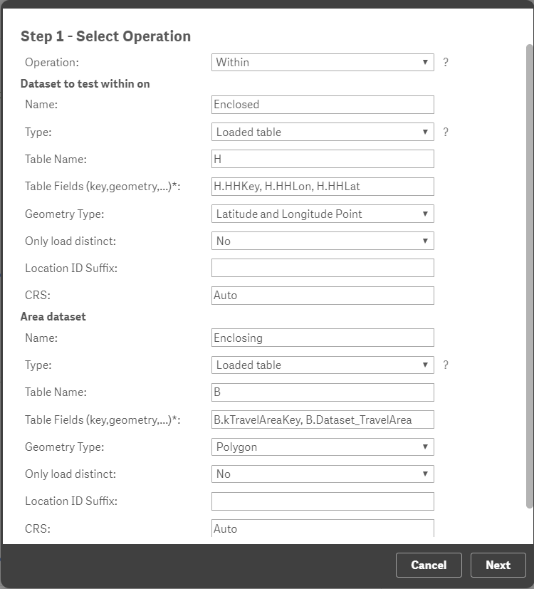
I have tried both and I get the same result.
here is a setup with your suggestion and i get the same result. 0 records found in the withinassociations table.
- Mark as New
- Bookmark
- Subscribe
- Mute
- Subscribe to RSS Feed
- Permalink
- Report Inappropriate Content
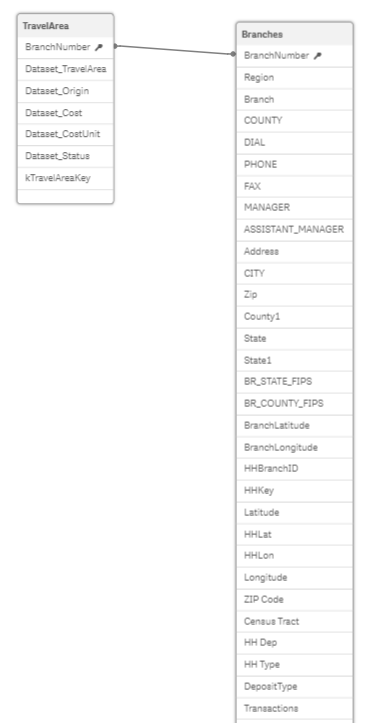
Ok, that's odd, could you share the indata?
Please note the order for 'Latitude and Longitude Point', the last screenshot has the wrong order for the fields.
Should be HHkey,HHLat,HHLon.
I would also drop the 'B.' in front the travelarea table fields.
Thanks,
Patric
- Mark as New
- Bookmark
- Subscribe
- Mute
- Subscribe to RSS Feed
- Permalink
- Report Inappropriate Content
HI patrick, i need to know if the algorithm are to be able to test 4000 points in 12000 polygons
- Mark as New
- Bookmark
- Subscribe
- Mute
- Subscribe to RSS Feed
- Permalink
- Report Inappropriate Content
Should work, I recommend using QGA Plus or an own QGA Server.
Takes also a look at the following doc on how to split the operation into multiple calls, will even out the load and reduce the risk of time outs.
https://community.qlik.com/t5/Qlik-GeoAnalytics-Documents/Splitting-up-GeoAnalytics-connector-operat...
Thanks,
Patric
- Mark as New
- Bookmark
- Subscribe
- Mute
- Subscribe to RSS Feed
- Permalink
- Report Inappropriate Content
Thanks so much!
- Mark as New
- Bookmark
- Subscribe
- Mute
- Subscribe to RSS Feed
- Permalink
- Report Inappropriate Content
Hi Patric,
I have a similar problem and I checked that with a very simple example.
# KML with three countries: Sweden, Poland and Germany
# one point in each country stored in Excel
I filled the form in the following way:

And I get nothing. Have I done sth wrong?
I know there is no key field but it does not have to be, right?


My files inside:

Many thanks
- « Previous Replies
-
- 1
- 2
- Next Replies »