Unlock a world of possibilities! Login now and discover the exclusive benefits awaiting you.
- Qlik Community
- :
- All Forums
- :
- GeoAnalytics
- :
- How to use Multi layer for qlikview in qlikmap?
- Subscribe to RSS Feed
- Mark Topic as New
- Mark Topic as Read
- Float this Topic for Current User
- Bookmark
- Subscribe
- Mute
- Printer Friendly Page
- Mark as New
- Bookmark
- Subscribe
- Mute
- Subscribe to RSS Feed
- Permalink
- Report Inappropriate Content
How to use Multi layer for qlikview in qlikmap?
Hi ,
please tell me how to use multi layer and what is the use of multi layer map in qlikview?
What is the use of shape files?
Thanks in advance!
- Tags:
- qlikmaps
- Mark as New
- Bookmark
- Subscribe
- Mute
- Subscribe to RSS Feed
- Permalink
- Report Inappropriate Content
Hello Harini,
There is a video here that shows this from this video index:
It shows a multi-layer example using 1) Area Layer that then drills-down into a 2) a bubble layer.
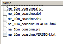
Shapefiles are another source of geo-spatial data, you can read more about what a shapefile is here: What is a shapefile?—Help | ArcGIS for Desktop - it is a common format for storing GIS data: https://www.gislounge.com/shapefile-viewers/
Example shape file withe coresponding .dbf data:
Let me know if this helps.
When applicable please mark the appropriate replies as CORRECT. This will help community members and Qlik Employees know which discussions have already been addressed and have a possible known solution. Please mark threads as HELPFUL if the provided solution is helpful to the problem, but does not necessarily solve the indicated problem. You can mark multiple threads as HELPFUL if you feel additional info is useful to others.
Regards,
Michael Tarallo (@mtarallo) | Twitter
Qlik
Mike Tarallo
Qlik