Announcements
Live today at 11 AM ET. Get your questions about Qlik Connect answered, or just listen in. SIGN UP NOW
Anonymous
Not applicable

Since we launched Qlik GeoAnalytics about a year ago, there has been great interest among both Qlik Sense and QlikView users in adding mapping and geo-analysis capabilities to their Qlik environment.  Now we are making it even easier.  Starting with Qlik Sense April 2018, we updated the mapping capabilities within Qlik Sense to be based on Qlik GeoAnalytics technology.

This new map chart object makes it easy to add maps to your app.  Location related names such as countries, counties, provinces, regions, cities, airports, and zip codes now utilize a dynamic location name lookup service to automatically define and visualize geo data.

This new capability is available to all Qlik Sense users, whether they are using Desktop, Enterprise or Cloud.  Additional Qlik GeoAnalytics features such as multiple layers, layer control, zoom levels, labels, and multiple point symbols are also included.  And if you have maps in your existing apps, they will be seamlessly migrated to the new map object.

Points and area layers are available in this initial release.  Additional layers and more capabilities are planned for future releases. Note that all geo-analysis calculations, such as drive-times, travel areas, binning, clustering or intersections, still require a different license.

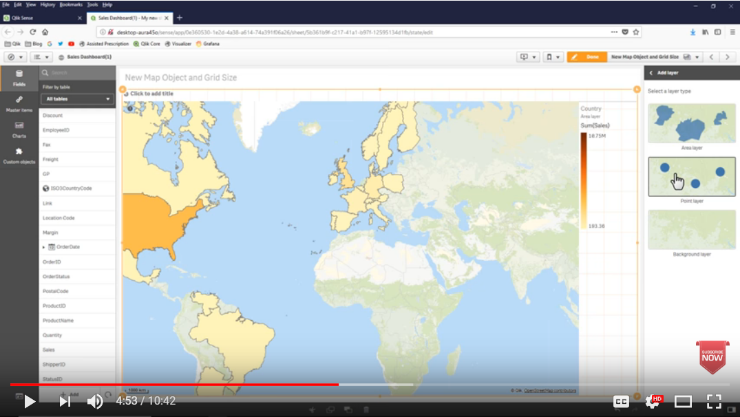
If you haven’t seen it yet, some of these new mapping capabilities can be found in the video - What’s New in Qlik Sense April 2018.  Click on the image below to watch the video.

2018-05-09 12_06_00-Clipboard.png

12 Comments
jerifortune
Creator III
Creator III

Great things are coming. Thanks for the update.

0 Likes
2,642 Views
zain16nib
Contributor III
Contributor III

Great updates Are we can add the country flags or city famous place snap or add snaps on point layer as per expression.

Regards,

Zain

0 Likes
2,642 Views
Patric_Nordstrom
Employee
Employee

Hi,

No, in this first release you can't use images as icons in the point layer as you can in Qlik GeoAnalytics.

But hopefully we can add that in the future.

Thanks,

Patric

0 Likes
2,642 Views
zain16nib
Contributor III
Contributor III

okay fine and thanks Patric Nordstrom.

Regards,

Zain.

0 Likes
2,642 Views
p_verkooijen
Partner - Specialist

Hi bps‌,

You mention "Note that all geo-analysis calculations, such as drive-times, travel areas, binning, clustering or intersections, still require a different license."

In the "Qlik Pricing and Packaging to Win – Feb. 19, 2018 Price List Changes PARTNER FAQ" it states that GeoAnalytics base will be bundled with Qlik Sense.

New packaging for Qlik Sense Enterprise will bundle the capabilities of the following products into the user price for Qlik Sense Enterprise:

─ Qlik GeoAnalytics® base

─ Qlik Web Connectors®

─ Qlik DataMarket® Essentials

─ Test & Dev Servers included (Subscription only)

The Qlik Geo base functionality is more than the default map object that has been changed in this release. Don't we get all Qlik Geo base functionality? Or did you mean you have to install GeoAnalytics to make use of this of these calculations?

https://www.qlik.com/us/-/media/files/product/qlik-geoanalytics/comparison-of-qlik-geoanalytics-offe...

https://www.qlik.com/us/-/media/files/legal/license%20agreements/additional%20terms/qlik-geoanalytic...

2,642 Views
Patric_Nordstrom
Employee
Employee

Hi Paul,

Yes, but QGA Base is bundled with QSE only if the customer is on the new "User" license model (professional/analyzer). QGA Base is still a separate install, the customer use the QSE key to install QGA Base.

The new map chart is something different, it's available for all Qlik Sense users.

Thanks,

Patric

2,642 Views
p_verkooijen
Partner - Specialist

Hi Patric,

Thank you for clarifying, that was the answer I was hoping for


0 Likes
2,355 Views
Anonymous
Not applicable

Hi!

Why was a new Geo Object implemented in Qlik Sense when every new customer can use QGA anyway? Just for Qlik Cloud?

Token-Licenses are not sold any longer (to new customers). So over time mostly every OnPremise Qlik Sense customer will get QGA anyway. Can you give us some infos when to use the "Qlik Sense Map Object" and when to use "QGA" at a new customer?

Are there any features that work better in the "Qlik Sense Map Object", beside the extra installation we need to do for QGA?

Thx,

Roland

0 Likes
2,355 Views
Patric_Nordstrom
Employee
Employee

Hi Roland,

It has been the intent all along since the acquisition of Idevio to integrate the GeoAnalytics visualization deeper into Qlik Sense. Beeing part of Qlik we can leverage internal APIs and make a better integration.

  • The new Sense map chart has a different architecture, the layers are contained with the map and not in separate layer objects. So the new map chart can hide legends and take up less screen estate.
  • The new architecture also makes a better fit with NPrinting and Storytelling, map charts can be included in reports and stories.
  • Each layer in the map chart has an option for a custom sort order, so show "top 10 cities" is easier to do.

QGA has still many more features than the new map chart but we will add more layers and visualization features with every release.

The QGA connector with all the geo analytic operations are not included in the Sense map chart, it's an add-on that you need to install QGA Base or Enterprise to get access to. However, the result from a QGA operation can be used in the new Sense map chart.

The on-premise option, the QGA Enterprise is not included and is offered as an add-on.

Thanks,

Patric

2,355 Views
Anonymous
Not applicable

Hi Patric!

Thanks for your answer. Unfortunately it confuses me even more 🙂

I'm not deep into Qlik Geo Analytics, as we always prefered NPGeoMap over the Idevio solution. Probably that's the reason why I'm unsure about the Geo Analytics terminology.

From what I have seen so far, Qlik Geo Analytics is installed as Extensions on an Qlik Sense Enterprise server. See Screenshot.

Are Qlik Sense Enterprise Customers (Prof/Analyzer license) allowed to use all these Extension objects? Or do they come with an extra license called "QGA Enterprise"?

If included, in which cases the customer should still use the Qlik Sense Default Map object? Or

Thx,

Roland

GeoAnalytics.png

0 Likes
2,355 Views