Unlock a world of possibilities! Login now and discover the exclusive benefits awaiting you.
- Qlik Community
- :
- Forums
- :
- Analytics
- :
- App Development
- :
- Creating a map using UK postcodes (from SQL Server...
Options
- Subscribe to RSS Feed
- Mark Topic as New
- Mark Topic as Read
- Float this Topic for Current User
- Bookmark
- Subscribe
- Mute
- Printer Friendly Page
Turn on suggestions
Auto-suggest helps you quickly narrow down your search results by suggesting possible matches as you type.
Showing results for
Anonymous
Not applicable
2018-04-19
06:57 AM
- Mark as New
- Bookmark
- Subscribe
- Mute
- Subscribe to RSS Feed
- Permalink
- Report Inappropriate Content
Creating a map using UK postcodes (from SQL Server)
Hi,
I'm very new to Qlik, and I've attempted to look up this information but had no luck. I'm attempting to create a map using UK postcodes - the data is coming in from SQL Server. Is Qlik able to directly detect postcodes for mapping purposes, or do I need to pay for an extension?
Thanks for any help.
1,374 Views
1 Reply
Specialist II
2018-10-15
11:24 AM
- Mark as New
- Bookmark
- Subscribe
- Mute
- Subscribe to RSS Feed
- Permalink
- Report Inappropriate Content
Hi Daniel
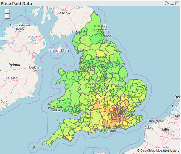
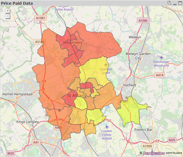
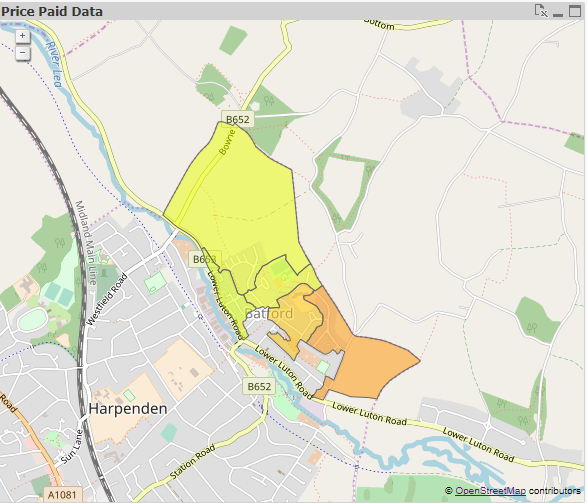
I know it's an old thread but I've done some work on making free UK maps available in QlikView; they are also link to postocodes so hopefully that helps you
I've recently posted a document (QlikView UK Maps) that explains how to obtain and use them
There are different level of details and this is how they would look like

Community Browser