Unlock a world of possibilities! Login now and discover the exclusive benefits awaiting you.
- Qlik Community
- :
- Forums
- :
- Forums by Product
- :
- Products (A-Z)
- :
- Qlik Sense
- :
- Documents
- :
- World Mapping File For Qlik Sense Maps (KML Shape ...
- Move Document
- Delete Document
- Subscribe to RSS Feed
- Mark as New
- Mark as Read
- Bookmark
- Subscribe
- Printer Friendly Page
- Report Inappropriate Content
World Mapping File For Qlik Sense Maps (KML Shape and Point)
- Move Document
- Delete Document and Replies
- Mark as New
- Bookmark
- Subscribe
- Mute
- Subscribe to RSS Feed
- Permalink
- Report Inappropriate Content
World Mapping File For Qlik Sense Maps (KML Shape and Point)
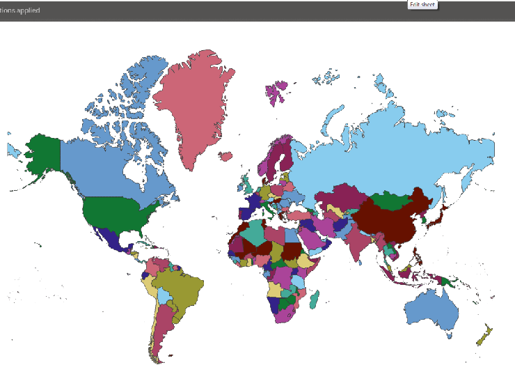
When building mapping visualizations in Qlik Sense, you will need either Lat & Long data to plot points on a map, or shape data to plot areas. For the latter, Qlik Sense will recognize KML files as a data format and load those natively. But shapes are merely a series of lat & long points that when plotted will connect up into a shape, such as a state or a sales region. When multiple shapes are plotted they can connect to form a country, or even a map of the world.
When plotting either points on a map or a series of shapes, you will need either the relevant Lat and Long data or shape data in your data model. It must also be associated the relevant field in your data model to allow you to plot the relationships. For example, to plot a series of bubbles on a world map to indicate population, you will need lat & long data for each country and you will need it linked to your population data on say country code.
UPDATE (8/7/2017): The new mapping object in Qlik Sense allows you to render maps without actually having the shape or point data in your data model. This is because the map object leverages a geospatial engine that recognizes country, state and town names dynamically. For more information refer to our help: https://help.qlik.com/en-US/sense/June2018/Subsystems/Hub/Content/Visualizations/Map/Map.htm
But where can you get such a data set? Well, there are many free location based data sets on the web, but often they are a bit fragmented and incomplete. To save you all a bit of time I have joined together a few files into a single world based location set, which contains the following for each country:
- Latitude & Longitude
- Country Shape data
- 2 char ISO code
- 3 char ISO code
- Short Name
- Full ISO Name
These are contained in the attached QVD file which I hope you find useful. When I get a chance I will also upload a Qlik Sense app with a few examples using the data. If you need some info on how to use the mapping object check out this great video from Mike TaralloQlik Sense - Creating a Map Visualization
- Move Comment
- Delete Comment
- Mark as Read
- Mark as New
- Bookmark
- Permalink
- Report Inappropriate Content
Thank you Lee. Do you think it would be possible to split Bosnia and Herzegovina into B&H and Republika Srpska? The political situation in the country is a bit odd and they have two federative states acting as autonomous/sovereign "countries" - Republika Srpska - Wikipedia
Thank you.
- Move Comment
- Delete Comment
- Mark as Read
- Mark as New
- Bookmark
- Permalink
- Report Inappropriate Content
Great help!
- Move Comment
- Delete Comment
- Mark as Read
- Mark as New
- Bookmark
- Permalink
- Report Inappropriate Content
Hi ,
What map file format does Qlik (View and Sense) support??
- Move Comment
- Delete Comment
- Mark as Read
- Mark as New
- Bookmark
- Permalink
- Report Inappropriate Content
I believe both QlikView and Qlik Sense can load KML files, but only Qlik Sense has the ability to display the shape and point data on a native map object.
Qlik Sense will also recognise country and city data in your data model and add the relevant Geographic Data (shapes and points) if you load your data through the Data Manager.
In the imminent April release new mapping capabilities are planned for the standard Qlik Sense product.
- Move Comment
- Delete Comment
- Mark as Read
- Mark as New
- Bookmark
- Permalink
- Report Inappropriate Content
- Move Comment
- Delete Comment
- Mark as Read
- Mark as New
- Bookmark
- Permalink
- Report Inappropriate Content
where can i find drill down till town level for India?
- « Previous
-
- 1
- 2
- Next »