Unlock a world of possibilities! Login now and discover the exclusive benefits awaiting you.
- Qlik Community
- :
- All Forums
- :
- QlikView App Dev
- :
- Re: Google Map offset
- Subscribe to RSS Feed
- Mark Topic as New
- Mark Topic as Read
- Float this Topic for Current User
- Bookmark
- Subscribe
- Mute
- Printer Friendly Page
- Mark as New
- Bookmark
- Subscribe
- Mute
- Subscribe to RSS Feed
- Permalink
- Report Inappropriate Content
Google Map offset
Hi All,
I have an offset on all the points drawed on the Google Map, but when i zoom in, the points are better placed but not in their place, anyone know why ?
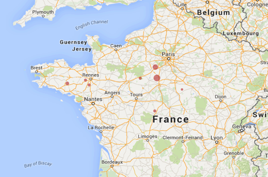
Before : (wrong)
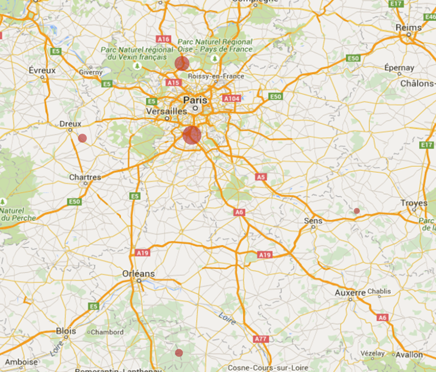
Then, after zoom : (little bit better)
I followed this tutorial :
Step-by-Step Google Map API v3 integration
Thank you,
Loup
- Tags:
- google map
- offset
- « Previous Replies
-
- 1
- 2
- Next Replies »
Accepted Solutions
- Mark as New
- Bookmark
- Subscribe
- Mute
- Subscribe to RSS Feed
- Permalink
- Report Inappropriate Content
map_size_x1= '900';
map_size_y1= '850';
Try changing these to and see if that helps:
| map_size_x1= | '640'; |
map_size_y1= '400';
- Mark as New
- Bookmark
- Subscribe
- Mute
- Subscribe to RSS Feed
- Permalink
- Report Inappropriate Content
No one has had the same issue ?
- Mark as New
- Bookmark
- Subscribe
- Mute
- Subscribe to RSS Feed
- Permalink
- Report Inappropriate Content
Do you have a legend or borders on your chart? Try clearing out everything from the chart area and see if that helps. Can you post a screenshot of the whole chart, including the borders?
Best,
Sunny
- Mark as New
- Bookmark
- Subscribe
- Mute
- Subscribe to RSS Feed
- Permalink
- Report Inappropriate Content
I don't have any Legend on the chart...
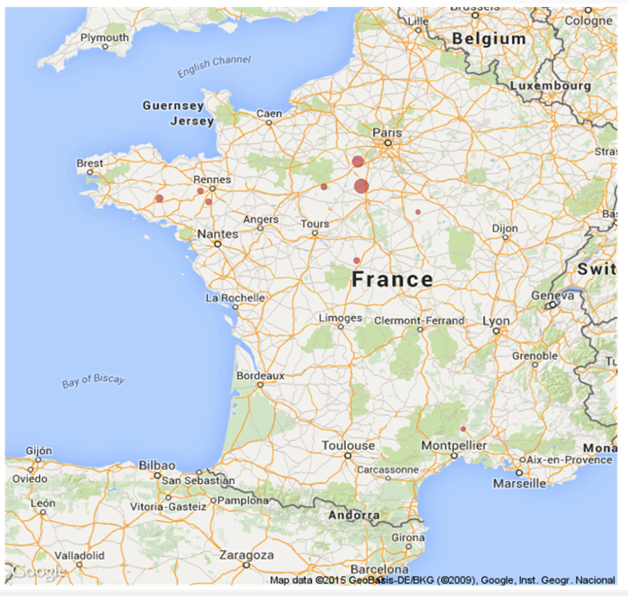
Whole chart :
The script :
max_zoom_level = 17; //maximum value 17
var_pi180= '=pi()/180';
var_lat_offset1= '0';
var_mc21= '=256*pow(2,$(var_zoom1))';
var_mc11= '=256*pow(2,($(var_zoom1)-1))';
var_mid_lat1= '=min([Latitude Assure])+(1+var_lat_offset)*((max([Latitude Assure])-min([Latitude Assure]))/2)';
var_mid_long1= '=min([Longitude Assure])+(max([Longitude Assure])-min([Longitude Assure]))/2';
var_zoom1= '=max(aggr(if(max( round(256*pow(2,(_zoom_level1 -1)))+( [Longitude Assure] *((256*pow(2,_zoom_level1 ))/360)) )-min( round(256*pow(2,(_zoom_level1 -1)))+( [Longitude Assure] *((256*pow(2,_zoom_level1 ))/360)) ) <map_size_x1 AND max((256*pow(2,(_zoom_level1-1)))+((0.5*log((1+(sin(([Latitude Assure])*pi()/180)))/(1-(sin(([Latitude Assure])*pi()/180)))))*((-256*pow(2,_zoom_level1))/(2*pi()))))-min((256*pow(2,(_zoom_level1-1)))+((0.5*log((1+(sin(([Latitude Assure])*pi()/180)))/(1-(sin(([Latitude Assure])*pi()/180)))))*((-256*pow(2,_zoom_level1))/(2*pi()))))<map_size_y1,_zoom_level1,1),_zoom_level1))';
//var_zoom= '5';
var_maptype1= '=if(isnull(only(maptype)),fieldvalue( '&chr(39)&'maptype'&chr(39)&', 1 ),maptype)';
map_size_x1= '900';
map_size_y1= '850';
SET HidePrefix='_' ;
// Field required for calcualting best zoom level
_zoom_level1:
Load RecNo( ) as _zoom_level1 autogenerate(max_zoom_level);
@
set hideprefix = 'maptype';
Thank you
- Mark as New
- Bookmark
- Subscribe
- Mute
- Subscribe to RSS Feed
- Permalink
- Report Inappropriate Content
map_size_x1= '900';
map_size_y1= '850';
Try changing these to and see if that helps:
| map_size_x1= | '640'; |
map_size_y1= '400';
- Mark as New
- Bookmark
- Subscribe
- Mute
- Subscribe to RSS Feed
- Permalink
- Report Inappropriate Content
It is good !
So I have to change the size in order to keep this ratio ?
Thank you !
EDIT: Seems that I have to keep theses little dimensions...
- Mark as New
- Bookmark
- Subscribe
- Mute
- Subscribe to RSS Feed
- Permalink
- Report Inappropriate Content
No problem 
Just in the script, I think. Front end object can stay and looks the same.
Best,
Sunny
- Mark as New
- Bookmark
- Subscribe
- Mute
- Subscribe to RSS Feed
- Permalink
- Report Inappropriate Content
EDIT: Seems that I have to keep theses little dimensions...
Not sure what dimensions you are talking about, can you please elaborate?
- Mark as New
- Bookmark
- Subscribe
- Mute
- Subscribe to RSS Feed
- Permalink
- Report Inappropriate Content
Sorry, I was speaking about the size and not dimension (=in french).
If I keep the same front end object, it look horrible (in fact the map is extented), but when I change both size (script and front end), the offset appears, so I can't have a bigger map 
- Mark as New
- Bookmark
- Subscribe
- Mute
- Subscribe to RSS Feed
- Permalink
- Report Inappropriate Content
Would you be able to share the application? I can take a look at it, if you want.
Best,
Sunny
- « Previous Replies
-
- 1
- 2
- Next Replies »