Unlock a world of possibilities! Login now and discover the exclusive benefits awaiting you.
- Qlik Community
- :
- Forums
- :
- Analytics
- :
- App Development
- :
- Mapping Issue - Urgent
- Subscribe to RSS Feed
- Mark Topic as New
- Mark Topic as Read
- Float this Topic for Current User
- Bookmark
- Subscribe
- Mute
- Printer Friendly Page
- Mark as New
- Bookmark
- Subscribe
- Mute
- Subscribe to RSS Feed
- Permalink
- Report Inappropriate Content
Mapping Issue - Urgent
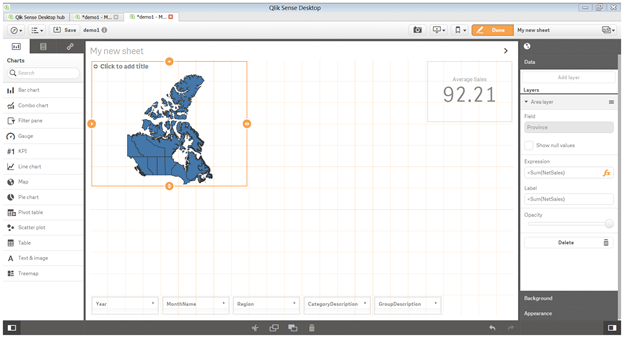
In Qlik Sense 1.1, I have loaded polygon data into the model. When I go to add a layer to the map object, it cannot find ANY fields in the data model whatsoever.
I successfully loaded a KML into a different dashboard last week. When I go to drag in a field directly I get an error message saying that the field cannot be applied to the visualization.
The object seems to be disconnected from everything. This is extremely frustrating. Am I overlooking something? Thanks.
EDIT:
So I used a different KML. It decided to allow me to add layers. Now when I add an expression, it does not pick up the expression values. There is no colour gradient at all. Also the expression label does not work (stays blank in the chart always)

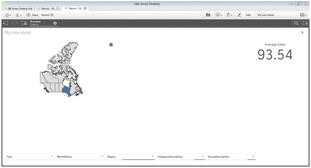
This is not a data modelling issue. See below, when I click a province, all other objects (e.g. KPIs) update perfectly to reflect that province's data. For some reason the object itself refuses to show an expression or label or colour according to the expression. It even showed an old label I had typed at one point and did not update the object when I updated the label. This should have taken 10 minutes to complete and has in the past.
If anyone knows of updates made to the polygon maps in v 1.1 that may have affected this please let me know.
- Tags:
- bug
- kml
- map
- qlik sense
- Mark as New
- Bookmark
- Subscribe
- Mute
- Subscribe to RSS Feed
- Permalink
- Report Inappropriate Content
The first KML will still render graphically but not let me attach anything.
I managed to get things to work by dragging the expression I wanted onto the chart of the second kml. Seems to me it was not allowing an expression to be entered directly in the right hand panel. It would show the text in the box but when I save and re-enter the app it would show a blank expression field.
With this in mind, I'm still curious as to why I'm experiencing this buggy behaviour. It cost me valuable development time.
- Mark as New
- Bookmark
- Subscribe
- Mute
- Subscribe to RSS Feed
- Permalink
- Report Inappropriate Content
Hi,
Can you attach the app here so I can look at it and I may answer your questions?
Quan
- Mark as New
- Bookmark
- Subscribe
- Mute
- Subscribe to RSS Feed
- Permalink
- Report Inappropriate Content
Sorry I can't share the QVF.
- Mark as New
- Bookmark
- Subscribe
- Mute
- Subscribe to RSS Feed
- Permalink
- Report Inappropriate Content
Hi,
The area layer needs:
- one field for name or identifier (e.g. Country, City) which is used for displaying area names in tooltip;
- one field for geo-data (i.e. Country.Area) which is used for rendering the shapes of areas;
- zero or one measure (e.g. Population, GDP) which can be used for coloring areas. This measure is formed from fields which connect to the first field (mentioned above) of the area layer.
In your case I guess, the dimension you use for the map is not connected to other fields in other tables (you can look at at the data model viewer to check this). If this is the case, it does not make sense to use a measure for the area layer (except if you want to have ,for example, a random measure). Can you attach the screen shot of the data model viewer here and so I can check if the dimension you used for the area layer has any connection to other fields?
Quan