Unlock a world of possibilities! Login now and discover the exclusive benefits awaiting you.
- Qlik Community
- :
- Forums
- :
- Analytics
- :
- New to Qlik Analytics
- :
- MAP INTEGRATION
- Subscribe to RSS Feed
- Mark Topic as New
- Mark Topic as Read
- Float this Topic for Current User
- Bookmark
- Subscribe
- Mute
- Printer Friendly Page
- Mark as New
- Bookmark
- Subscribe
- Mute
- Subscribe to RSS Feed
- Permalink
- Report Inappropriate Content
MAP INTEGRATION
Hi guys
I am very new to qlik sense and need some help on a map that i want to insert on my dashboard, very simple customers by state and i dont need to put in GPS coordinates as i only group them by state and sales person.
i just want the map and be able to select the state to get the data
something like this:

- Mark as New
- Bookmark
- Subscribe
- Mute
- Subscribe to RSS Feed
- Permalink
- Report Inappropriate Content
If you have a file with a column 'state' (the state name) ; add the file containing the colum with the data editor (the graphic assistant not the script); and then don't load directly the file, but instead click on PREPARE DATA then load
Once this done, Qlik Sense will automatically create a geoField with the column state that you can use to create maps.
Hope this helps
- Mark as New
- Bookmark
- Subscribe
- Mute
- Subscribe to RSS Feed
- Permalink
- Report Inappropriate Content
You will need to download a .kml file that has been created displaying the same states. (Or alternatively create one using software like QGIS)
Load this in you script and link to the state names in your data.
- Mark as New
- Bookmark
- Subscribe
- Mute
- Subscribe to RSS Feed
- Permalink
- Report Inappropriate Content
You need to have a KML (or other supported format) file with your states (countries) you are planning to display.
You can just Google it, there are tons of sites that provides this data.
Load it in your script (here is the example for the world map):
World:
LOAD
world.Name as ISO_Country,
world.Area
FROM [lib://ExternalData/Geo\world.kml]
(kml, Table is [World.shp/Features]);
Make sure you are linking your data with this Geo data (my data above is linked via " ISO_Country" field.
Add mapping object and select appropriate field to be used as Dimension (State Name, Country Name, etc).
Add an expression (Count of Sales Persons, for example).
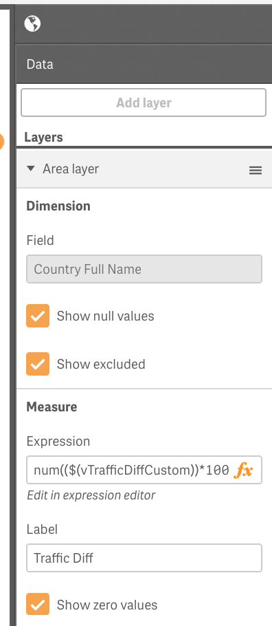
As a result you should see something like:
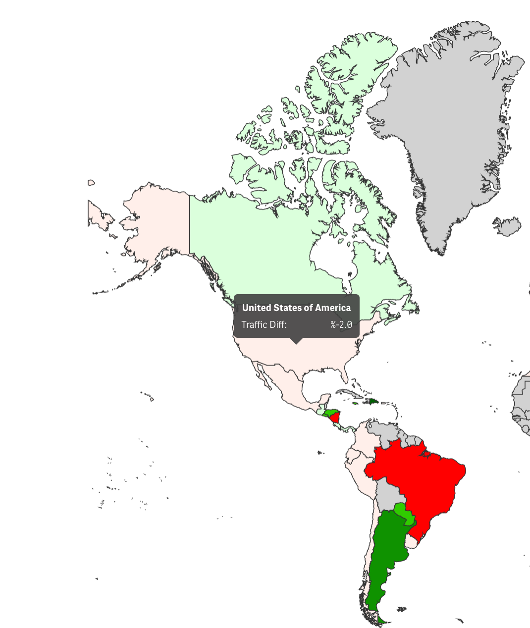
You can do a default area coloring, using a default colors or color your states/countries based on number of sales persons, for example (like in my example above).
Regards,
Vlad
P.S. When applicable, please mark this answer Correct or Helpful.