Unlock a world of possibilities! Login now and discover the exclusive benefits awaiting you.
- Qlik Community
- :
- Forums
- :
- Analytics & AI
- :
- Products & Topics
- :
- App Development
- :
- City / County and State Confusion in Map Visualiza...
Options
- Subscribe to RSS Feed
- Mark Topic as New
- Mark Topic as Read
- Float this Topic for Current User
- Bookmark
- Subscribe
- Mute
- Printer Friendly Page
Turn on suggestions
Auto-suggest helps you quickly narrow down your search results by suggesting possible matches as you type.
Showing results for
Partner - Creator III
2019-08-29
03:29 PM
- Mark as New
- Bookmark
- Subscribe
- Mute
- Subscribe to RSS Feed
- Permalink
- Report Inappropriate Content
City / County and State Confusion in Map Visualization
Hello,
Using Qlik Sense Desktop I've been exploring some datasets with City and State names for US and Brazil.
In the script I created a "City, State" field which is used in the Map, with the Country code.
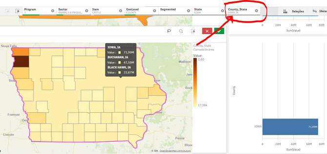
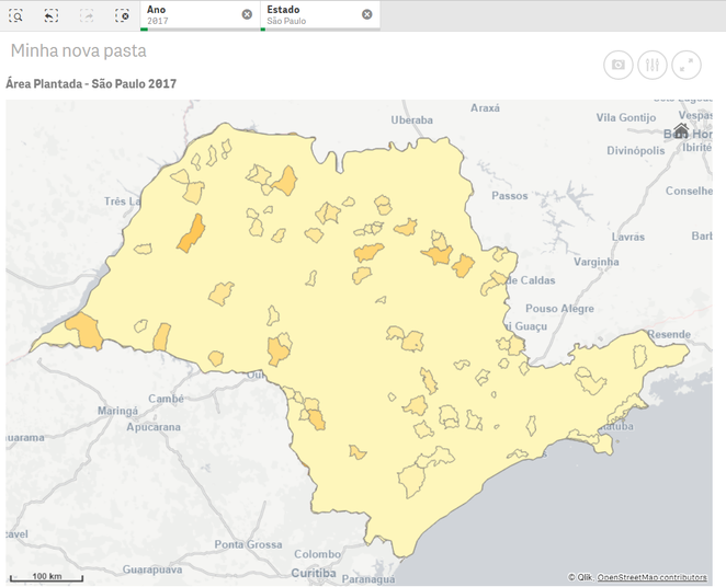
In most states I can see every city or county, except for those in which the city/county name is the same as of the state's.
Example: São Paulo, SP (the city and state have the same name) or Iowa, IA .
The map gets messy and the only solution I found was to exclude these cases from the map.
Does anybody know how to solve this issue?
Two simple examples below, just to make it clear:
- Tags:
- city state
- map
641 Views
0 Replies

