Unlock a world of possibilities! Login now and discover the exclusive benefits awaiting you.
- Qlik Community
- :
- Forums
- :
- Analytics
- :
- New to Qlik Analytics
- :
- qlik sense map
- Subscribe to RSS Feed
- Mark Topic as New
- Mark Topic as Read
- Float this Topic for Current User
- Bookmark
- Subscribe
- Mute
- Printer Friendly Page
- Mark as New
- Bookmark
- Subscribe
- Mute
- Subscribe to RSS Feed
- Permalink
- Report Inappropriate Content
qlik sense map
Hello
I got a table that has names of cities and the related longitude and latitude data
I used the makeGeoPoint function and called that column community_location
this script is put in a qvf called 1.qvf
and now the dashboard binary loads from 1.qvf
however I cannot select the dimension on the map
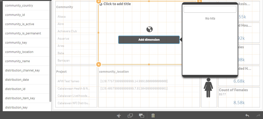
whereas it is working on 1.qvf
and i'm working on Qlik sense desktop v3.1.4
please advise
- Mark as New
- Bookmark
- Subscribe
- Mute
- Subscribe to RSS Feed
- Permalink
- Report Inappropriate Content
Hello Ali,
sometimes Qlik Sense does not recognize a field with geo information. In this case you have to put "Tag field community_location with $geopoint;" in your script to tag the field.
Regards Tobias
- Mark as New
- Bookmark
- Subscribe
- Mute
- Subscribe to RSS Feed
- Permalink
- Report Inappropriate Content
how can I add tag?
please advise as I'm new to qlik sense (but QlikView expert  )
)
- Mark as New
- Bookmark
- Subscribe
- Mute
- Subscribe to RSS Feed
- Permalink
- Report Inappropriate Content
You have to add the script to your load script as you can see below. Hope that helps you to solve the issue.

- Mark as New
- Bookmark
- Subscribe
- Mute
- Subscribe to RSS Feed
- Permalink
- Report Inappropriate Content
In the newest version 3.2 of Qlik Sense it seems that the issue has been solved.
Regards Tobias