Unlock a world of possibilities! Login now and discover the exclusive benefits awaiting you.

- Qlik Community
- :
- All Forums
- :
- QlikView
- :
- Google Map - Zoom without Losing Dimensions
- Subscribe to RSS Feed
- Mark Topic as New
- Mark Topic as Read
- Float this Topic for Current User
- Bookmark
- Subscribe
- Mute
- Printer Friendly Page

- Mark as New
- Bookmark
- Subscribe
- Mute
- Subscribe to RSS Feed
- Permalink
- Report Inappropriate Content
Google Map - Zoom without Losing Dimensions
Hello-
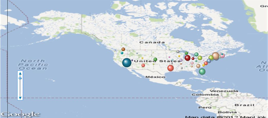
I'm using a map to plot US States. In my dimension, I'm excluding HI, AK, PR. When I leave var_zoom variable at the default (2) I can see all my data points, plus more map than I need.
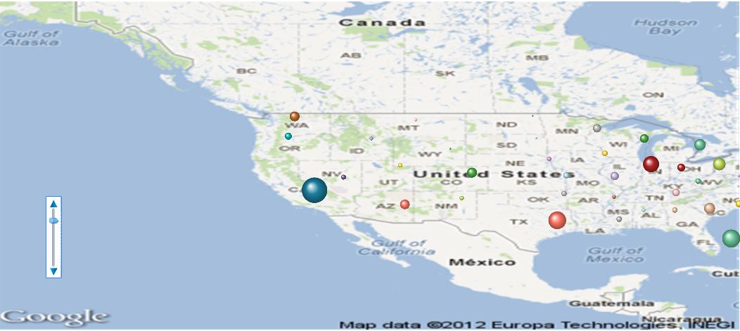
So then I zoom to level 3 and some of my data points dissappear:
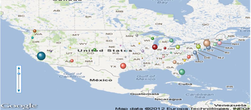
The only way I can get my map to show the way I want it to show is first highlight the US and then select zoom level to 3. How can I get the image below without having to do the steps outlined in the previous sentence? Perhaps this is due to my not including states in the dimension that were initially in the load script??? Thanks!
Accepted Solutions
- Mark as New
- Bookmark
- Subscribe
- Mute
- Subscribe to RSS Feed
- Permalink
- Report Inappropriate Content
If you display latitud/longitud in two list boxes and then higlight only in the US, does any values turn gray?
- Mark as New
- Bookmark
- Subscribe
- Mute
- Subscribe to RSS Feed
- Permalink
- Report Inappropriate Content
Are you setting max and min for your Axis scale?
- Mark as New
- Bookmark
- Subscribe
- Mute
- Subscribe to RSS Feed
- Permalink
- Report Inappropriate Content
Hello-
Here is what I set for the min/max for the axis:
X Axis
Min:
(256*pow(2,($(var_zoom)-1)))+( var_mid_long *((256*pow(2,$(var_zoom)))/360)) -round(map_size_x/2)
Max:
( (256*pow(2,($(var_zoom)-1)))+( var_mid_long *((256*pow(2,$(var_zoom)))/360)) + round(map_size_x/2)-15)
Y Axis
Min:
=((256*pow(2,($(var_zoom)-1)))+((0.5*log((1+(sin(var_mid_lat*pi()/180)))/(1-(sin(var_mid_lat*pi()/180)))))*((-256*pow(2,$(var_zoom)))/(2*pi())))+round(map_size_y/2))
Max:
=((256*pow(2,($(var_zoom)-1)))+((0.5*log((1+(sin(var_mid_lat*pi()/180)))/(1-(sin(var_mid_lat*pi()/180)))))*((-256*pow(2,$(var_zoom)))/(2*pi())))-round(map_size_y/2)+15)
- Mark as New
- Bookmark
- Subscribe
- Mute
- Subscribe to RSS Feed
- Permalink
- Report Inappropriate Content
In my charts I dont have the +- 15 in the maxs, is the only difference i see.
- Mark as New
- Bookmark
- Subscribe
- Mute
- Subscribe to RSS Feed
- Permalink
- Report Inappropriate Content
This centered my bubble a little more on the state, but that's all. Thank you for responding!
- Mark as New
- Bookmark
- Subscribe
- Mute
- Subscribe to RSS Feed
- Permalink
- Report Inappropriate Content
If you display latitud/longitud in two list boxes and then higlight only in the US, does any values turn gray?
- Mark as New
- Bookmark
- Subscribe
- Mute
- Subscribe to RSS Feed
- Permalink
- Report Inappropriate Content
Thank you!! I had HI and AK in my original load script, but then decided not to use them in my dimension. Once I removed the lat and long for these two from the load script my map is perfect.