Unlock a world of possibilities! Login now and discover the exclusive benefits awaiting you.
Announcements
Now accepting applications for the Qlik Luminary and Partner Ambassador Programs: Apply by July 6!
- Qlik Community
- :
- All Forums
- :
- QlikView
- :
- Plot Lines on a Map?
Options
- Subscribe to RSS Feed
- Mark Topic as New
- Mark Topic as Read
- Float this Topic for Current User
- Bookmark
- Subscribe
- Mute
- Printer Friendly Page
Turn on suggestions
Auto-suggest helps you quickly narrow down your search results by suggesting possible matches as you type.
Showing results for
Not applicable
2014-10-14
11:18 PM
- Mark as New
- Bookmark
- Subscribe
- Mute
- Subscribe to RSS Feed
- Permalink
- Report Inappropriate Content
Plot Lines on a Map?
Hi
I have been able to successfully implement Lat/Lon coordinates based on my data. I would now like to plot lines in between the points based on the great circle.
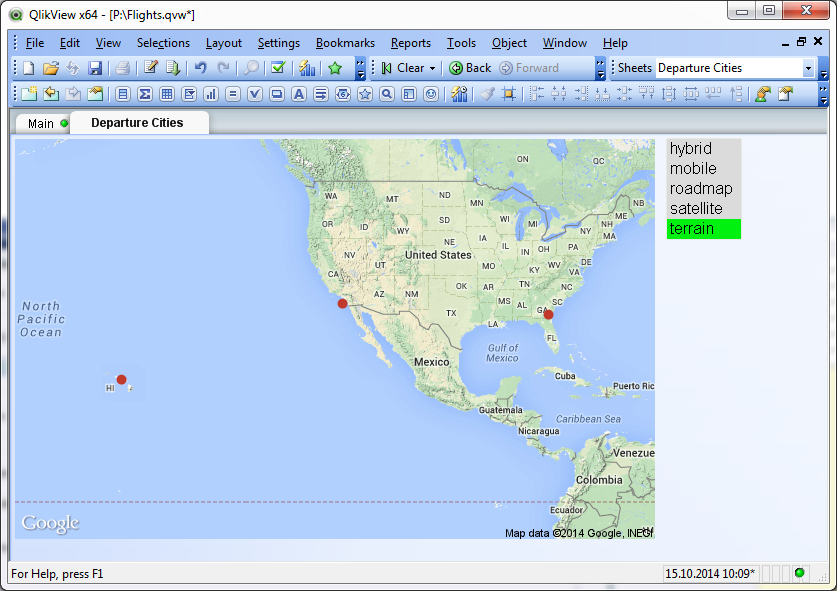
So I would like to connect the three points above with a line showing the flight path of an aircraft, therefore it should use the great circle to use the shortest line between the two points.
Would I need to create an extension for that? I successfully created these lines on a webpage, but how do I do it within Qlikview?
Thanks for your help.
618 Views
0 Replies