Unlock a world of possibilities! Login now and discover the exclusive benefits awaiting you.
- Qlik Community
- :
- Blogs
- :
- Technical
- :
- Design
- :
- Getting to Know Qlik GeoAnalytics
- Subscribe to RSS Feed
- Mark as New
- Mark as Read
- Bookmark
- Subscribe
- Printer Friendly Page
- Report Inappropriate Content
Hello Qlik Community! 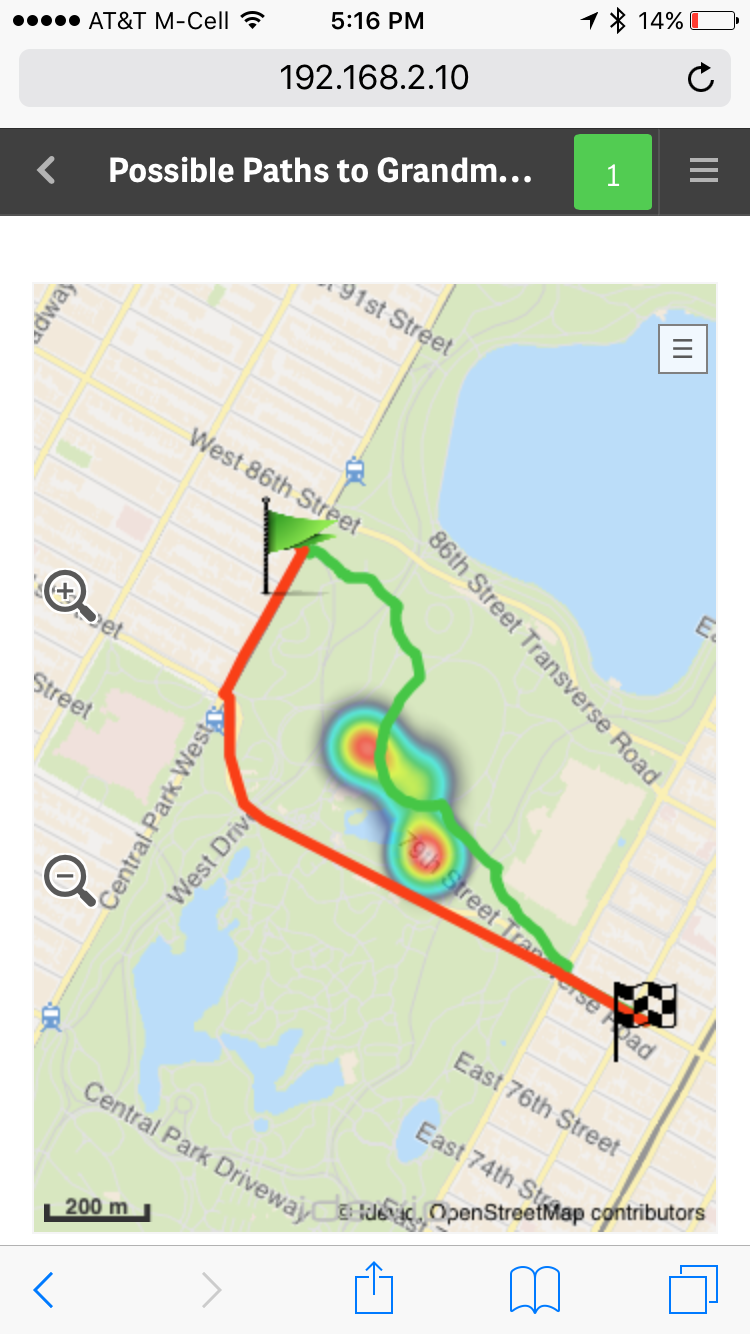 In my last blog entry Introducing Qlik GeoAnalytics - I um...well....introduced our latest product offering... Qlik GeoAnalyitcs.
  I also included a promo video showcasing its various capabilities. (In case you have not seen it, I suggest you start with that first.)
I've been working with Qlik GeoAnalytics for a few weeks now and I am really enjoying it. I'm gathering tremendous knowledge (thanks to the fantastic Idevio team who is now part of the Qlik family) and compiling it so I can share it with you so you can get started quickly. You can see some of the efforts in this new video index which provides a few primers to help you get started with Qlik GeoAnalytics for both Qlik Sense and QlikView. If you have Qlik GeoAnalytics related questions you can also start a discussion in our new section on the Qlik Sense forums: Qlik GeoAnalytics Community.
Over the next few weeks I'll be presenting other topics in a series of blogs and community posts that will help you learn more about Qlik GeoAnalytics, presenting its various capabilities. To that point, I recently discovered the Qlik GeoAnalytics Connector which can grab data from a variety of external geo-data services to return route information, distance, time and spatial relationships and associate them with your 'decision making data'. Look at this fun example using Qlik GeoAnalytics Line, Bubble (flags), and Heatmap layers to represent long and short travel routes, along with a fictional "area of concern" depicted by the heatmap. With Qlik Sense small devices mode it even fits and reacts perfectly on my iPhone too, I did not have to create a separate mobile-version of the app....."Oh, no - I don't want to take that shortcut through Central Park, there are way too many street performers along that route!!" ...but more on that later. What I love the most about Qlik GeoAnalytics, it's more than just plotting simple dots on a map, it moves Qlik beyond visualization and supports a broad range of advanced geoanalytic use cases. I hope you will see the value and benefits it has to offer and that you have as much fun with it as I.
To kick of the knowledge share, in this below video I show you how to create a very simple Area map, which can also be known as a boundary or choropleth map, that you can drill-down into.
If you cannot see the video, or you would like the sample data, you can find both here: Qlik GeoAnalytics - Creating a Drill-down Area Map
Let me know what you think and I looking forward to joining the conversation on the Qlik GeoAnalytics Community.
Regards,
Michael Tarallo (@mtarallo) | Twitter
Senior Marketing Manager
Qlik
You must be a registered user to add a comment. If you've already registered, sign in. Otherwise, register and sign in.