Unlock a world of possibilities! Login now and discover the exclusive benefits awaiting you.
- Qlik Community
- :
- Forums
- :
- Analytics
- :
- New to Qlik Analytics
- :
- Re: How to disambiguate cities across states in ma...
- Subscribe to RSS Feed
- Mark Topic as New
- Mark Topic as Read
- Float this Topic for Current User
- Bookmark
- Subscribe
- Mute
- Printer Friendly Page
- Mark as New
- Bookmark
- Subscribe
- Mute
- Subscribe to RSS Feed
- Permalink
- Report Inappropriate Content
How to disambiguate cities across states in maps?
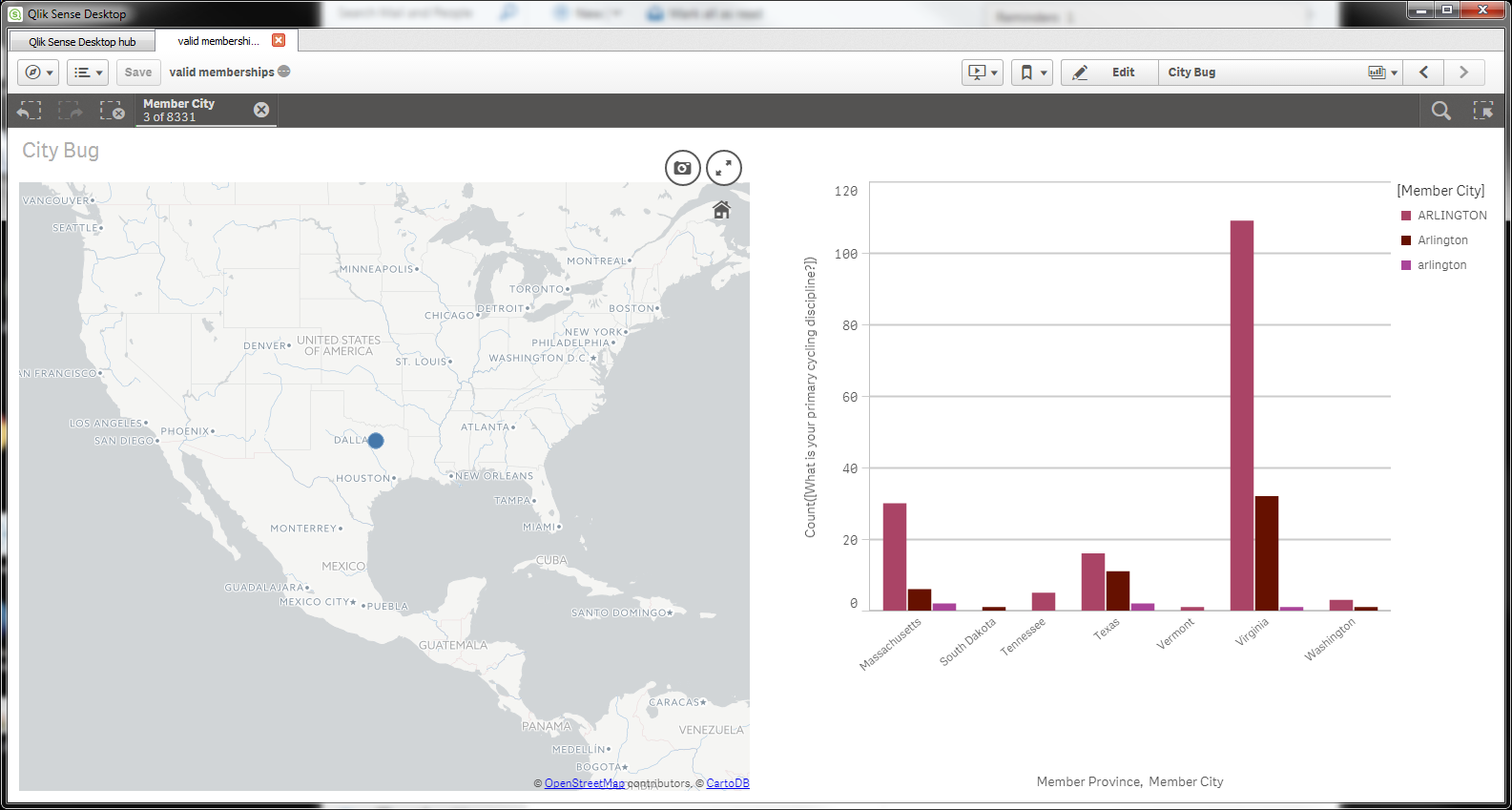
I created a simple map visualization, or so I think. I used the field type help to ensure my data loaded with Geo data. But there's only city and country, no state (or province). Sure enough, as this screenshot shows, the city of Arlington is ambiguous.There's one in Massachusetts, South Dakota, Tennessee, Texas, Vermont, Virginia, and Washington. Yet the map plots all my data in Texas. What am I missing?
- Tags:
- geo map
Accepted Solutions
- Mark as New
- Bookmark
- Subscribe
- Mute
- Subscribe to RSS Feed
- Permalink
- Report Inappropriate Content
I think the embedded qvds for mapping cities work only with 1 city per country ....
have a look at the basic qvds
C:\Users\YOURUSERNAME\AppData\Local\Programs\Qlik\Sense\DataPrepService\src\geo
- Mark as New
- Bookmark
- Subscribe
- Mute
- Subscribe to RSS Feed
- Permalink
- Report Inappropriate Content
Robin's answer confirms that the way I was trying to do it. I'll call it answered. I also got some information through my sales rep that might help others. It seems that without Qlik GeoAnalytics®, best practices would suggest to manually load lat/long data for the particular cities in mind.
And he suggested these resources:
- Qlik Help: Loading map data
- Qlik Help: Creating geographic maps based on your data
- Video Tutorial: Creating a Point Map
- Video Tutorial: Understanding Geographic Data Profiling
I got exactly what I needed (and what I expected) with Tableau using ZIP Codes. And States are built-in geo locations in Tableau. If I learn more about this as it relates to Qlik I'll reply again here.