Unlock a world of possibilities! Login now and discover the exclusive benefits awaiting you.
- Qlik Community
- :
- All Forums
- :
- QlikView App Dev
- :
- Create a GeoQlik layer from another layer
- Subscribe to RSS Feed
- Mark Topic as New
- Mark Topic as Read
- Float this Topic for Current User
- Bookmark
- Subscribe
- Mute
- Printer Friendly Page
- Mark as New
- Bookmark
- Subscribe
- Mute
- Subscribe to RSS Feed
- Permalink
- Report Inappropriate Content
Create a GeoQlik layer from another layer
Hi all,
I want to create a new map layer from an existing layer.
I'll explain, I already have one layer I'm working with relative to Tunisia (regions) which contains 24 "regions".
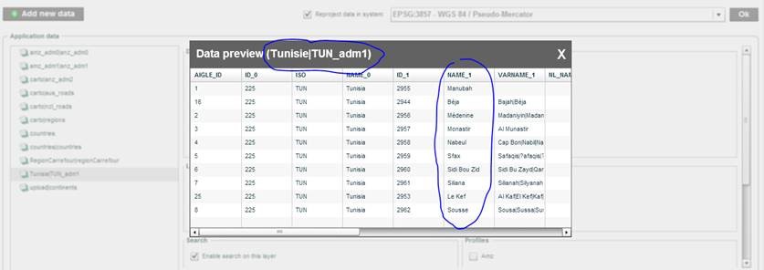
But, in reality, the regions are not 24, but only 6 regions (Tunis, nord, sud, sfax, centre et Cap Bon)
what I dit:
I created a shapeFile from the shapefile I used in the first layer and changed the regions names (with qgis)
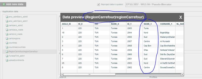
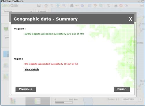
And even so QlikView has succeded to geocode the objet I can't see my new regions.
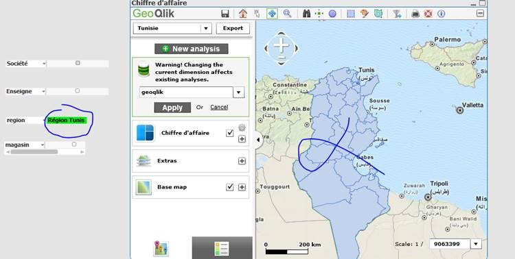
Previously, in the first layer I was working with ( with the 24 regions), when I select for example Tunis, Marsa and Ben Arous, the 3 will be appearing in my geoqlik map. What I did is replacing Marsa and Ben Arous with Tunis and thought that with my new layer created, if I select Tunis as a region to filter with, the 3 should appear in the map. But that didn't go well:
what should I do? thanks !
- Mark as New
- Bookmark
- Subscribe
- Mute
- Subscribe to RSS Feed
- Permalink
- Report Inappropriate Content
Hi Omar,
I suggest you contact GeoQlik's support team: support@geoqlik.com .
I'm sure they'll be willing and able to assist you!
Kind regards,
Ariel
GeoQlik Product Team
- Mark as New
- Bookmark
- Subscribe
- Mute
- Subscribe to RSS Feed
- Permalink
- Report Inappropriate Content
Hi Ariel and thanks for the answer
Well I already did and succeded in the task 