Unlock a world of possibilities! Login now and discover the exclusive benefits awaiting you.
- Qlik Community
- :
- All Forums
- :
- QlikView App Dev
- :
- Re: Google, MapQuest and MapBox APIs funny behavio...
- Subscribe to RSS Feed
- Mark Topic as New
- Mark Topic as Read
- Float this Topic for Current User
- Bookmark
- Subscribe
- Mute
- Printer Friendly Page
- Mark as New
- Bookmark
- Subscribe
- Mute
- Subscribe to RSS Feed
- Permalink
- Report Inappropriate Content
Google, MapQuest and MapBox APIs funny behaviour
I have three maps in my application using three different APIs namely Google, MapQuest and MapBox. I am loading local data and the app works well with 38 geolocations displaying the national map and local cities. I have loaded a geolocations file with about 407 records and i get world maps for all three APIs (see below). What could be going wrong?
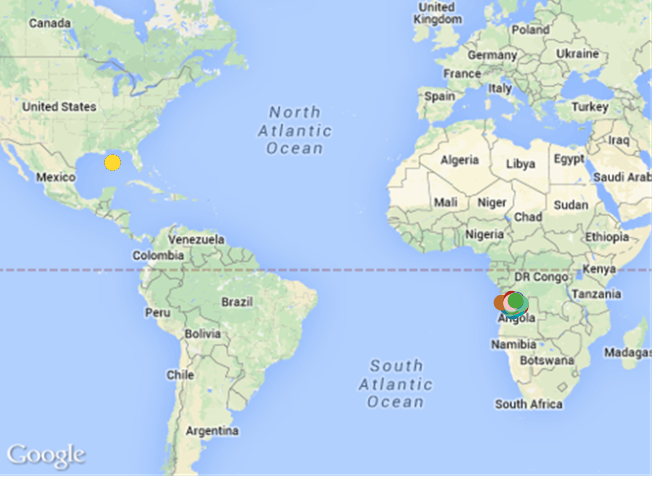
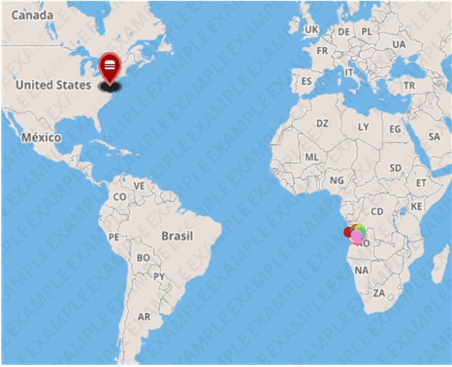
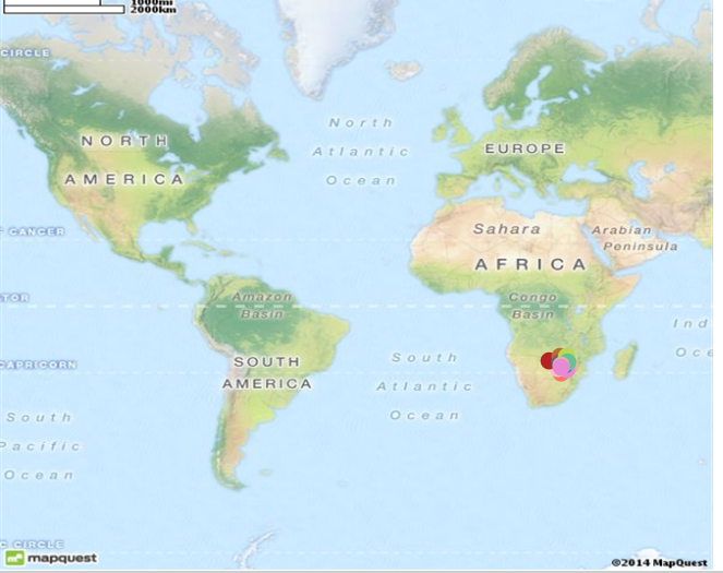
regards Chris
Accepted Solutions
- Mark as New
- Bookmark
- Subscribe
- Mute
- Subscribe to RSS Feed
- Permalink
- Report Inappropriate Content
Hi Jonathan
thank you very much for your response and my apologies for getting back to you. What i have realized is that when the world map is shown and you click on the relevant country, it displays the country as per what i was expecting. I have just added a list box with country as dimension and click on this to display the country of choice.
Once again thanks.
Regards.
- Mark as New
- Bookmark
- Subscribe
- Mute
- Subscribe to RSS Feed
- Permalink
- Report Inappropriate Content
Can you attach your qvw file,
Most of the time, I am too lazy to go through the whole Google Map API guide that i would just start from an existing working Map example and load my data to that.It's possible you may have missed a step to prepare the Map(scatter points,dynamic image and all other formulas which are basically copy paste)
- Mark as New
- Bookmark
- Subscribe
- Mute
- Subscribe to RSS Feed
- Permalink
- Report Inappropriate Content
Hi Jonathan
thank you very much for your response and my apologies for getting back to you. What i have realized is that when the world map is shown and you click on the relevant country, it displays the country as per what i was expecting. I have just added a list box with country as dimension and click on this to display the country of choice.
Once again thanks.
Regards.