Unlock a world of possibilities! Login now and discover the exclusive benefits awaiting you.
Woohoo! Qlik Community has won “Best in Class Community” in the 2024
Khoros Kudos awards!
Announcements
Nov. 20th, Qlik Insider - Lakehouses: Driving the Future of Data & AI - PICK A SESSION
- Qlik Community
- :
- All Forums
- :
- QlikView App Dev
- :
- Google Maps - Chart and picture misaligned. People...
Options
- Subscribe to RSS Feed
- Mark Topic as New
- Mark Topic as Read
- Float this Topic for Current User
- Bookmark
- Subscribe
- Mute
- Printer Friendly Page
Turn on suggestions
Auto-suggest helps you quickly narrow down your search results by suggesting possible matches as you type.
Showing results for
Not applicable
2010-08-29
10:23 AM
- Mark as New
- Bookmark
- Subscribe
- Mute
- Subscribe to RSS Feed
- Permalink
- Report Inappropriate Content
Google Maps - Chart and picture misaligned. People living in the sea?
Hi,
I've followed the tutorial given below, which gets google maps up and running using a chart, over a text box
http://community.qlik.com/media/p/61758.aspx
This works - but when i plot the locations of the postcode data I have, i end up with people living in the sea?! The latitude and longitude data that I have was downloaded from here http://www.freemaptools.com/download-uk-postcode-lat-lng.htm
And i assume it is correct, i've don ethis two or three times just to make sure i'm not making a mistake, but get the same problem. Has anyone else come accross this, is there a better way of doing it?
Thanks - Matt
1,242 Views
6 Replies
Partner Ambassador/MVP
2010-08-29
04:36 PM
- Mark as New
- Bookmark
- Subscribe
- Mute
- Subscribe to RSS Feed
- Permalink
- Report Inappropriate Content
I played a bit with the application that's supplied as one of the Samples within the QlikView installation, and it worked fine... The key is to take care of the static Axis settings, in combination with the variables that calculate zoom factor etc... Based on your picture, it looks like your Chart is plotting the dots on a slightly wider scale than the map is built for... Perhaps you changed one of the Chart settings that caused the misalignment?
562 Views
Not applicable
2010-08-29
05:36 PM
Author
- Mark as New
- Bookmark
- Subscribe
- Mute
- Subscribe to RSS Feed
- Permalink
- Report Inappropriate Content
i thought that too. but ive followed the instructions again and again and get the same result. Unless one of the settings in the example is wrong .The only thing that isnt standard is the long and lat coordinates which i have downloaded from elsewhere.. Do you get a perfect map of the UK using postcode districts? Thank for your help Oleg
562 Views
Partner Ambassador/MVP
2010-08-29
06:13 PM
- Mark as New
- Bookmark
- Subscribe
- Mute
- Subscribe to RSS Feed
- Permalink
- Report Inappropriate Content
I haven't used it for a while, can't tell at this point... Try using the QlikView Sample application instead. You can also post your QVW example here and let the experts take a look at it.
562 Views
Not applicable
2010-08-30
05:11 PM
Author
- Mark as New
- Bookmark
- Subscribe
- Mute
- Subscribe to RSS Feed
- Permalink
- Report Inappropriate Content
Hi
I created an app with the coordinate you get. It seems to work ie the coordinates fit the map.
JJ
562 Views
Not applicable
2011-08-15
03:55 PM
Author
- Mark as New
- Bookmark
- Subscribe
- Mute
- Subscribe to RSS Feed
- Permalink
- Report Inappropriate Content
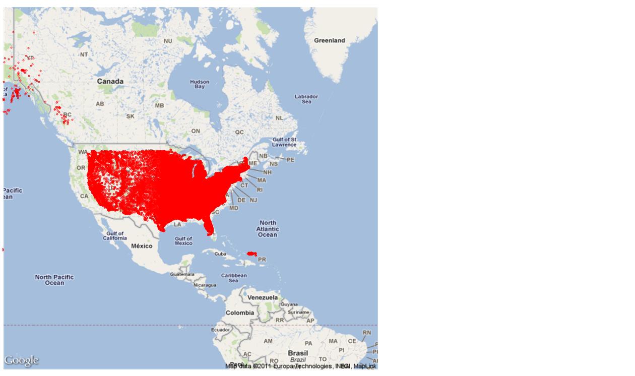
Did you ever find a solution? I am having the same issue, and I have no idea how to fix it.
The red data points should completely cover the US, but as you can see the data is plotting to a slightly smaller size that the Google map.
562 Views
Not applicable
2017-02-01
06:36 AM
Author
- Mark as New
- Bookmark
- Subscribe
- Mute
- Subscribe to RSS Feed
- Permalink
- Report Inappropriate Content
Hi Marc,
Did you find a solution to this?
562 Views