Unlock a world of possibilities! Login now and discover the exclusive benefits awaiting you.
- Qlik Community
- :
- All Forums
- :
- QlikView App Dev
- :
- Map
- Subscribe to RSS Feed
- Mark Topic as New
- Mark Topic as Read
- Float this Topic for Current User
- Bookmark
- Subscribe
- Mute
- Printer Friendly Page
- Mark as New
- Bookmark
- Subscribe
- Mute
- Subscribe to RSS Feed
- Permalink
- Report Inappropriate Content
Map
Hi everyone,
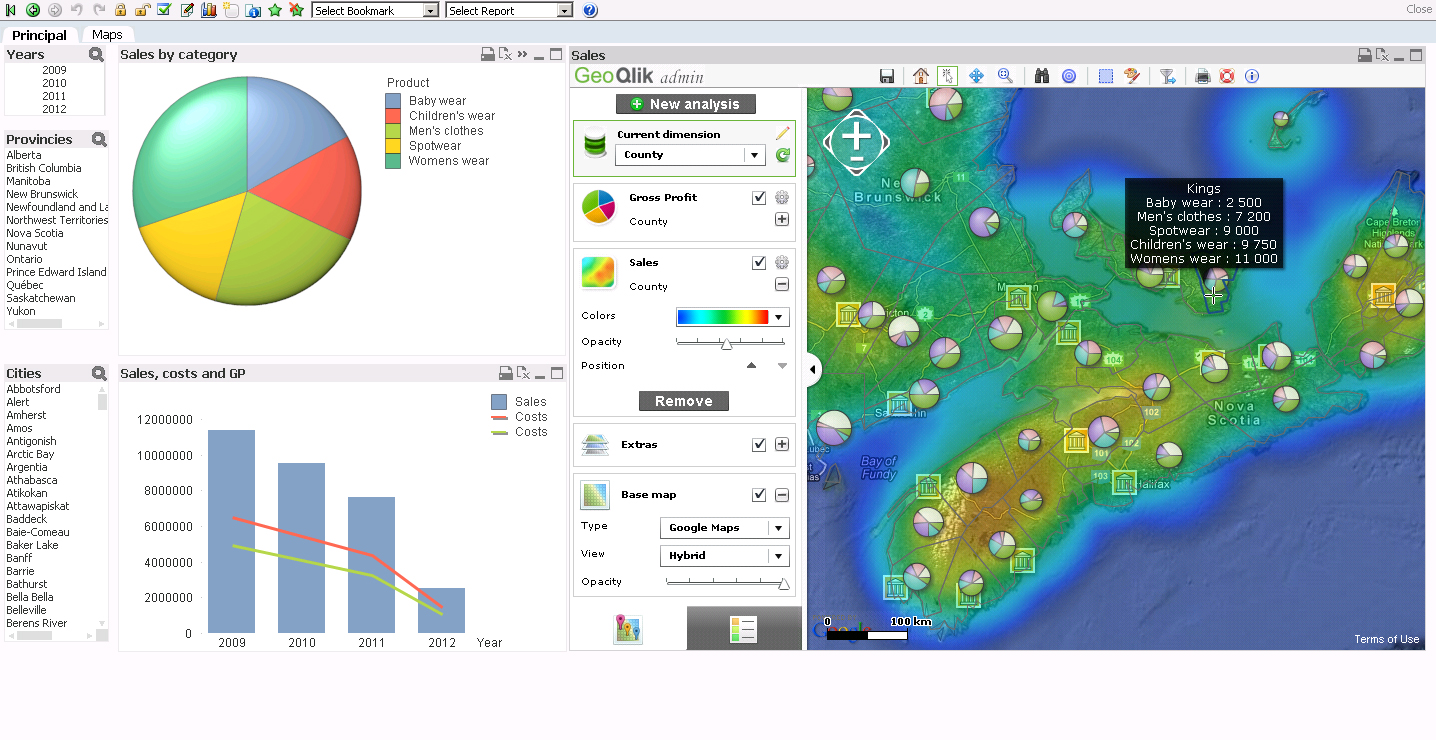
I'm just wondering if this kind of map (heat map) is possible using extension?
because i want to use google's map so i can zoom in and zoom out to a certain location.
thanks!
- Mark as New
- Bookmark
- Subscribe
- Mute
- Subscribe to RSS Feed
- Permalink
- Report Inappropriate Content
If this is possible can you post a sample here??
thank you so much!
- Mark as New
- Bookmark
- Subscribe
- Mute
- Subscribe to RSS Feed
- Permalink
- Report Inappropriate Content
You can already adds maps to a QlikView document without an extension by using GeoQlik (www.geoqlik.com) which embeds the QlikView plugin to add maps objects displaying QlikView data. See attached image.
- Mark as New
- Bookmark
- Subscribe
- Mute
- Subscribe to RSS Feed
- Permalink
- Report Inappropriate Content
Is this a freeware??
- Mark as New
- Bookmark
- Subscribe
- Mute
- Subscribe to RSS Feed
- Permalink
- Report Inappropriate Content
No you have to buy a license in order to use it. You can contact them to watch a demo and get more information about the product features and prices.
- Mark as New
- Bookmark
- Subscribe
- Mute
- Subscribe to RSS Feed
- Permalink
- Report Inappropriate Content
Hi,
GIS/Maps Analytics in QlikView is a very interesting topic and "Heat Maps" are one of the ways to display QlikVIew KPI indicators and to represent a density on a Geografic map (ex: population, deliveries, etc.)
QlikView customers and channel parners are interested in displaying their QlikView KPI indicators on Geographic maps but also sometimes on a Building Plan (ex: logistic warehouse, supermarket, hospital, etc).
Business Geografic has developed a mapping extension for QlikView (V9, V10, V11) namely "GeoQlik" and we have been a Technology Partner of QlikTech since 2006 starting with QlikView 8!
I hereby suggest you to have a look at our new mapping extension for QlikView 11 "SR1": GeoQlik v11.6:
http://www.geoqlik.com/en/geoqlik-for-qlikview/geoqlik-v11.html
Please find hereafter a few "Heat Maps" screenshots of GeoQlik V11.6 using WMS/TMS services to display QlikView KPIs:

Thanks and regards,
David
@ Business Geografic