Unlock a world of possibilities! Login now and discover the exclusive benefits awaiting you.
- Qlik Community
- :
- All Forums
- :
- QlikView App Dev
- :
- Query on using Gmap in application
- Subscribe to RSS Feed
- Mark Topic as New
- Mark Topic as Read
- Float this Topic for Current User
- Bookmark
- Subscribe
- Mute
- Printer Friendly Page
- Mark as New
- Bookmark
- Subscribe
- Mute
- Subscribe to RSS Feed
- Permalink
- Report Inappropriate Content
Query on using Gmap in application
Dear all,
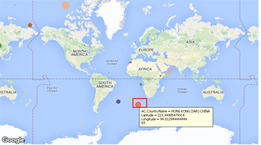
I am facing below problem in my application :
The bubbles in the chart are not reflecting as per the actual longitude and latitude provided from the database.
Example :
If I select Hong Cong City then the actual longitude and latitude are different and while reflecting on the chart those are different,Also the location of the bubble is showing below the Africa region as the county is China.
Below are screenshot :
Kindly Help.
Regards,
Mahamed.
- Mark as New
- Bookmark
- Subscribe
- Mute
- Subscribe to RSS Feed
- Permalink
- Report Inappropriate Content
Do you translate the Latitude and Longitude into x,y coordinates of the chart? If not you will have to use a formula to do that which is rather involved but easy to copy and paste from sample Google Map applications like the one described here: Step-by-Step Google Map API v3 integration
- Mark as New
- Bookmark
- Subscribe
- Mute
- Subscribe to RSS Feed
- Permalink
- Report Inappropriate Content
Hey Petter,
Thank you for your response. Yes I followed the standard steps for this Gmap application.
- Mark as New
- Bookmark
- Subscribe
- Mute
- Subscribe to RSS Feed
- Permalink
- Report Inappropriate Content
Hi Faizan,
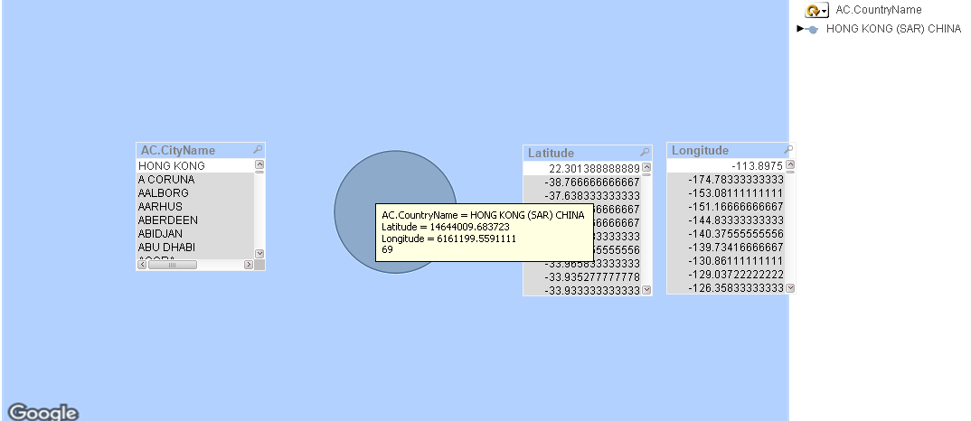
It seems the latitude and longitude you are displaying in the tool tip (on hover) are the computed X and Y values, and not the actual Latitude and Longitude values as seen in the list-box.
Also, please check the longitude values in your DB, the lat, long values for HongKong are (22.30138, 113.8975) where as in your list-box it is seen as (22.30138, -113.8975).
HTH,
Kedar