Unlock a world of possibilities! Login now and discover the exclusive benefits awaiting you.

- Qlik Community
- :
- All Forums
- :
- QlikView
- :
- Re: Zoom in / Zoom out problem
- Subscribe to RSS Feed
- Mark Topic as New
- Mark Topic as Read
- Float this Topic for Current User
- Bookmark
- Subscribe
- Mute
- Printer Friendly Page

 ravindraa
- Mark as New
- Bookmark
- Subscribe
- Mute
- Subscribe to RSS Feed
- Permalink
- Report Inappropriate Content
Zoom in / Zoom out problem
Hi All,
I have struck one place please give me suggestion on this to come out from that.
I have created Map chart in qlikview but i am not finding Zoom/Zoom out option , if i select any one place it is zooming but i am not finding Zoom in/ Zoomout scale on Mapchart .
Please give me suggestion how to put zoom in / zoom out scale option on Map chart.
pleas find the attached document.
Thanks in advance..............
- « Previous Replies
-
- 1
- 2
- Next Replies »
ravindraa
- Mark as New
- Bookmark
- Subscribe
- Mute
- Subscribe to RSS Feed
- Permalink
- Report Inappropriate Content
Hi Mahamed Khan,
Thanks for replay, i have downloaded GeoQliktrail.qar file then i am trying to creat map but i am trying to give dimension but is not showing the values .
Please give me suggetion how to create map using Geo qlik ,
Thanks in advance.

- Mark as New
- Bookmark
- Subscribe
- Mute
- Subscribe to RSS Feed
- Permalink
- Report Inappropriate Content
Dear Niranjan,
you will find a quick start guide on the link below:
http://demo.geoqlik.com/geoqlik/index.aspx
do not hesitate to contact us (contact@geoqlik.com) should you have any questions or requests for support,
Kind regards,
Cyril
ravindraa
- Mark as New
- Bookmark
- Subscribe
- Mute
- Subscribe to RSS Feed
- Permalink
- Report Inappropriate Content
Hi Cyril,
Thank you very much for replay ,
I need to create Chart map in qlikview one of my requirement, For this I have created standerad Qlivkew map there I am not seeing some futures which is available in GeoQlik Map. But I am unable to create chart in GeoQlik please help me how to do the chart.
First Step I am taking Dimension
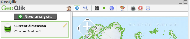
Then I am going to take Expression for that I select New analysis tab here it is asking Dimension coordinates here(Like Longitude and Latitude) .
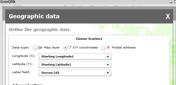
And expression
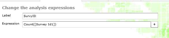
I done all the things but it is not showing the values(it is showing empty map ) according to latitude and longitude wise.
Please give me suggestion where I did mistake.
Thanks in advance
Thanks& Regards
Niranjan
- Mark as New
- Bookmark
- Subscribe
- Mute
- Subscribe to RSS Feed
- Permalink
- Report Inappropriate Content
Dear Niranjan,
I have just retested on my Trial version and it works fine:

My best guess would be to check the Coordinate system:

Help for GeoQlik is mostly provided by contacting GeoQlik Partners worldwide or by contacting us.
Please contact us so that Support can give you further help (contact@geoqlik.com).
Kind regards,
Cyril
ravindraa
- Mark as New
- Bookmark
- Subscribe
- Mute
- Subscribe to RSS Feed
- Permalink
- Report Inappropriate Content
Hi Experts,
Kindly look it into , kindly suggest to come out from This.
Thanks
ravindraa
- Mark as New
- Bookmark
- Subscribe
- Mute
- Subscribe to RSS Feed
- Permalink
- Report Inappropriate Content
Hi Ctril,
Thanks for replay already i have sent a mail.
what i did mistake in my chart.
Thanks
Niranjan
- « Previous Replies
-
- 1
- 2
- Next Replies »