Unlock a world of possibilities! Login now and discover the exclusive benefits awaiting you.
- Qlik Community
- :
- All Forums
- :
- GeoAnalytics
- :
- Re: Create drill down relation on custom layers
- Subscribe to RSS Feed
- Mark Topic as New
- Mark Topic as Read
- Float this Topic for Current User
- Bookmark
- Subscribe
- Mute
- Printer Friendly Page
- Mark as New
- Bookmark
- Subscribe
- Mute
- Subscribe to RSS Feed
- Permalink
- Report Inappropriate Content
Create drill down relation on custom layers
Hi people,
I'm learning to use GeoAnalytics with Qlik Sense, and have encountered a problem.
When using the country-state-city-zip code thing as we see most from the tutorial videos, things are much neater and smooth. However my company is working on much smaller scale of the world, which means country-state-city-zip code thing is not really applicable, not to mention the GIS people here had been building their own layers for many years and we don't want to drop that.
That is the context, here comes the quesion: I have two layers made from KML files, one showing city parts (larger area), another one showing city districts (smaller areas).
Each city parts contain several city districts, however this is not known by Qlik Sense since there are not drill down/ association (or whatever it is called) between the two KML file. However the city districts do totally fall in the corresponding city part, GIS-ly.
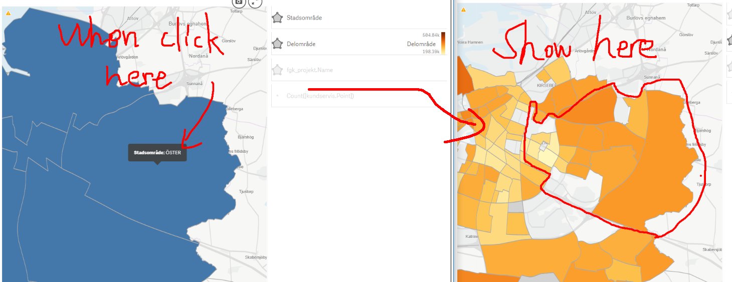
Is it possible to create a drill down relation between city parts and the city districts? For instance when I click the city part and then confirm selection, the city districts that fall in the selected city part would pop-up.
I attached an imaging showing desired result.
Any ideas would be appreciated, thanks in advance!
Poppel
Accepted Solutions
- Mark as New
- Bookmark
- Subscribe
- Mute
- Subscribe to RSS Feed
- Permalink
- Report Inappropriate Content
Hi,
This is exactly what the operation IntersectsMost is intended for in the GeoAnalytics Connector. It finds the relation between overlapping areas in two datasets (tables), see https://help.qlik.com/en-US/geoanalytics/Subsystems/GeoConnector/Content/connector/connector-geoanal.... Note that the GeoAnalytics Connector is an addon to Qlik that is licensed and installed separately.