Unlock a world of possibilities! Login now and discover the exclusive benefits awaiting you.
- Qlik Community
- :
- All Forums
- :
- Visualization and Usability
- :
- area map for sales
- Subscribe to RSS Feed
- Mark Topic as New
- Mark Topic as Read
- Float this Topic for Current User
- Bookmark
- Subscribe
- Mute
- Printer Friendly Page
- Mark as New
- Bookmark
- Subscribe
- Mute
- Subscribe to RSS Feed
- Permalink
- Report Inappropriate Content
area map for sales
Hi everybody, I need an help: I'm working on a qliksense document. I need to create a italian zipcode map to monitor sales for italian zipcode. I can't find the right way to do this. I have an qvd file with geometry for each zipcode but i can't know how to do an area map.
I attach qvd file for italian zipcode.
I hope Someone can help me,
Thank You Anna
- « Previous Replies
-
- 1
- 2
- Next Replies »
- Mark as New
- Bookmark
- Subscribe
- Mute
- Subscribe to RSS Feed
- Permalink
- Report Inappropriate Content
- Mark as New
- Bookmark
- Subscribe
- Mute
- Subscribe to RSS Feed
- Permalink
- Report Inappropriate Content
Hi Anna,
Here's how to do it:
go to: http://www.gadm.org
Select Italy and select the admin level that you want to download. I tried with admin level3, the smallest and most detailed. However there are over 8000 polygons in this files and it runs slowly in QlikSense. You'd need to select and show only some of th epolygons. I find 3000 to be a good limit. Perhaps based on the sales.
Choose the "KMZ" format and download it.
This is a zipped version of KML. Change the file extension from kmz to kml and then unzip it. Now you have a kml file. This can be loaded directly into your Sense app using the data loader.
Next, create a new worksheet in the application and drag a map layer to it. Then drag in an area layer. In the area layer parameters, change the following:
Dimension: Area.Name
Measure: Area
Location: select "measure" in the drop down menu
Layer options: increase the number of polygons from 1000 to 9000
- Mark as New
- Bookmark
- Subscribe
- Mute
- Subscribe to RSS Feed
- Permalink
- Report Inappropriate Content
Here are some screenshots that illustrate the steps outlined above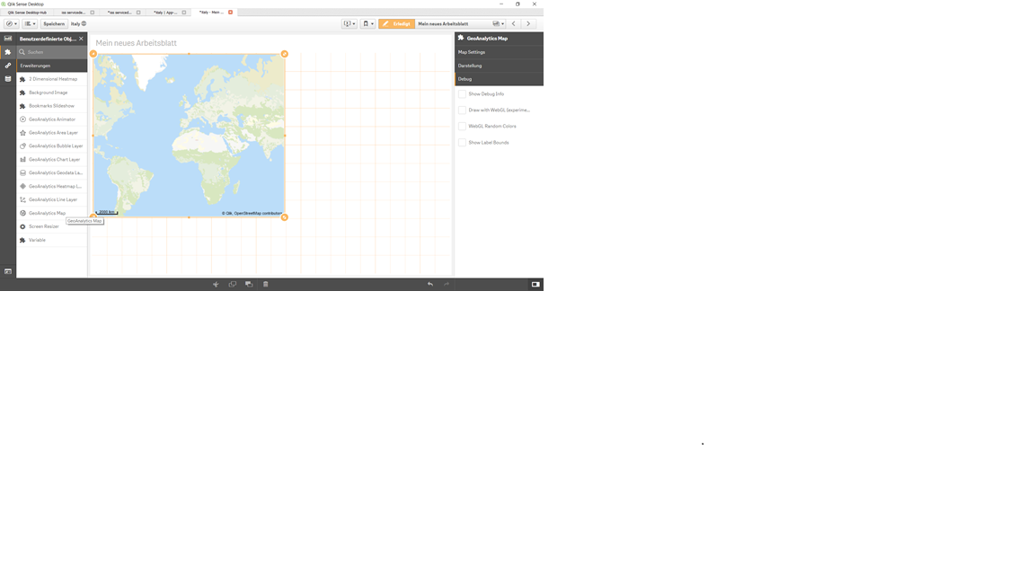
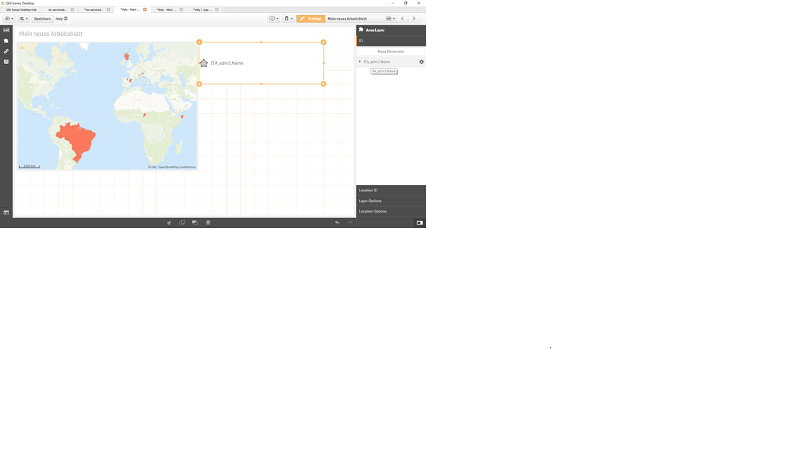
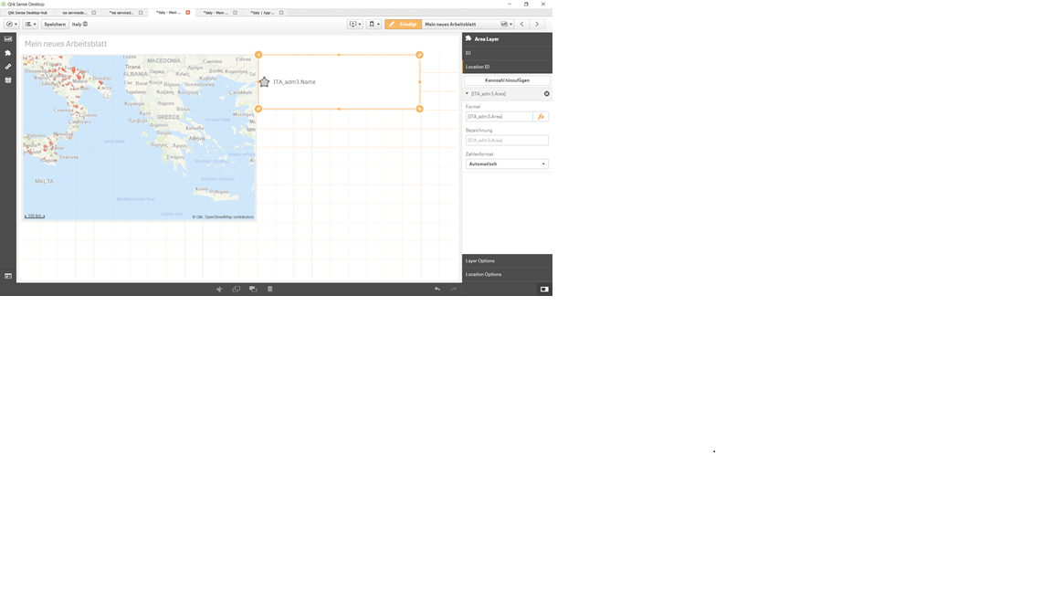
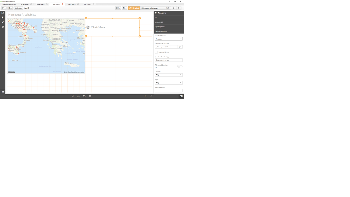
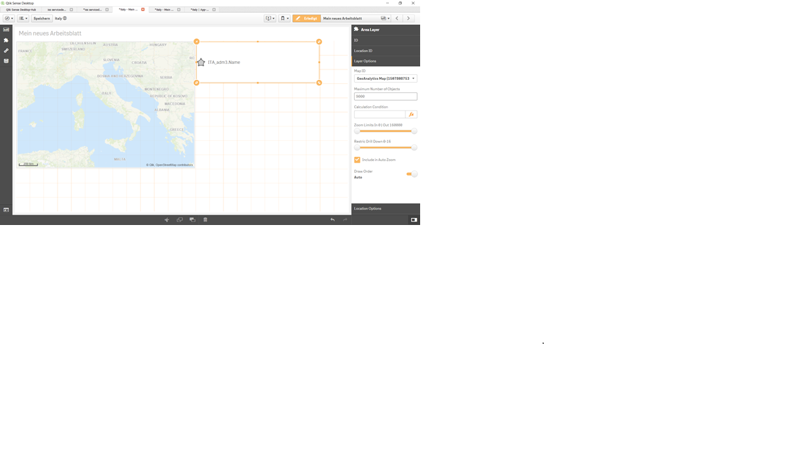
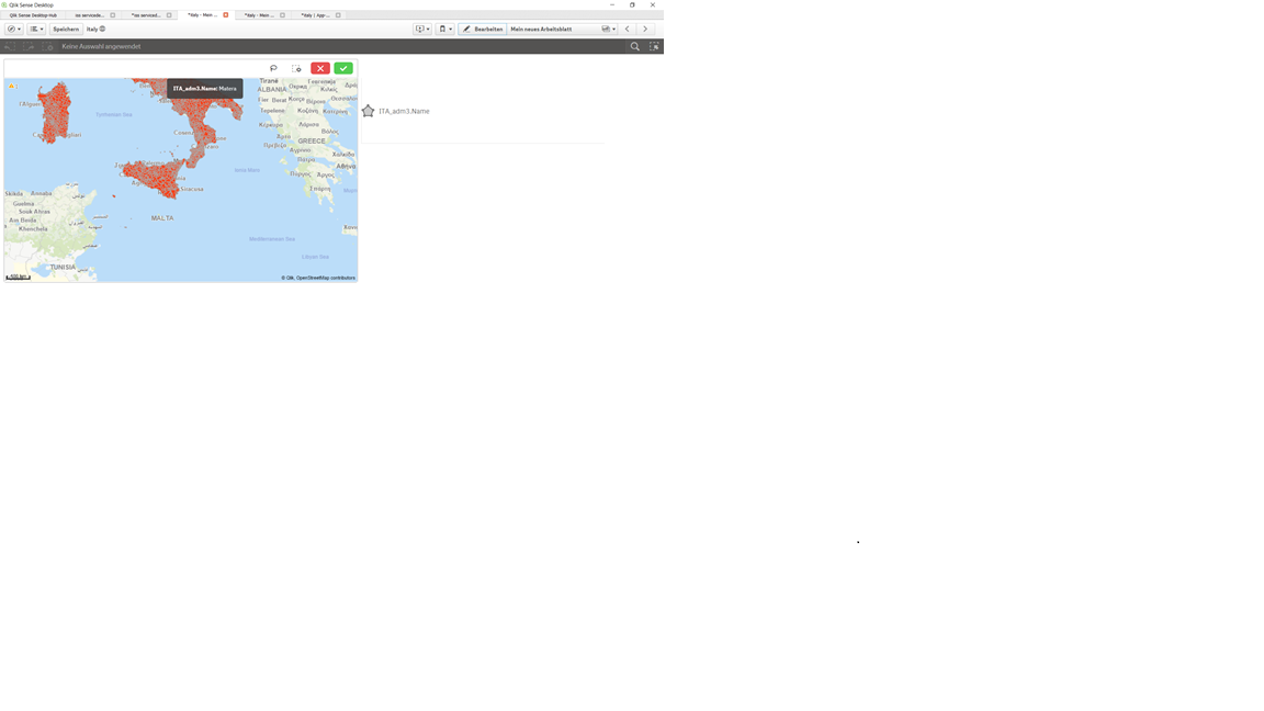
I hope that helps!
Best regards,
Pamela
- Mark as New
- Bookmark
- Subscribe
- Mute
- Subscribe to RSS Feed
- Permalink
- Report Inappropriate Content
Hi Anna,
Did that work for you? Let me know if I can help further.
Best regards,
Pamela
- « Previous Replies
-
- 1
- 2
- Next Replies »