Unlock a world of possibilities! Login now and discover the exclusive benefits awaiting you.
Announcements
Qlik Connect 2025: 3 days of full immersion in data, analytics, and AI. May 13-15 | Orlando, FL:
Learn More
- Qlik Community
- :
- All Forums
- :
- GeoAnalytics
- :
- Re: Google Maps with API
Options
- Subscribe to RSS Feed
- Mark Topic as New
- Mark Topic as Read
- Float this Topic for Current User
- Bookmark
- Subscribe
- Mute
- Printer Friendly Page
Turn on suggestions
Auto-suggest helps you quickly narrow down your search results by suggesting possible matches as you type.
Showing results for
Creator III
2018-06-24
12:08 PM
- Mark as New
- Bookmark
- Subscribe
- Mute
- Subscribe to RSS Feed
- Permalink
- Report Inappropriate Content
Google Maps with API
Hi Experts,
Hope you are doing well !!
Here attached QVW, i have implemented the google maps with Long and Latitude information but i would like to see this maps with effective manner.
I saw few videos Tlgsoft, and Learn yourself. But am unable to improve this in professional manner.
Here i want give the hyper links to the maps. It's logistic maps, capturing the vehicle violations( i.e., HA, HB,OVSD...).
When i click on the HA the map should show the only HA points. vice versa for all violations.
Please suggest me if any extensions i need to add further implementations.
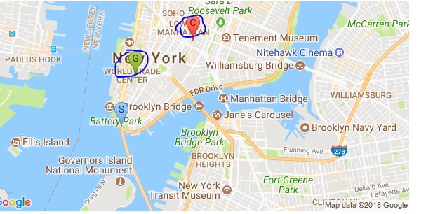
I want to see the the map like below instead of showing the Dots.
- Tags:
- tlgsoft
626 Views
1 Reply
Employee
2019-03-21
09:59 AM
- Mark as New
- Bookmark
- Subscribe
- Mute
- Subscribe to RSS Feed
- Permalink
- Report Inappropriate Content
I recommend to use Qlik GeoAnalytics for QlikView, it has everything you need for your logistic app.
Thanks,
Patric
Thanks,
Patric
424 Views