Unlock a world of possibilities! Login now and discover the exclusive benefits awaiting you.
- Qlik Community
- :
- All Forums
- :
- QlikView App Dev
- :
- Re: Can I copy shapes from ppt into a qlikview doc...
- Subscribe to RSS Feed
- Mark Topic as New
- Mark Topic as Read
- Float this Topic for Current User
- Bookmark
- Subscribe
- Mute
- Printer Friendly Page
- Mark as New
- Bookmark
- Subscribe
- Mute
- Subscribe to RSS Feed
- Permalink
- Report Inappropriate Content
Can I copy shapes from ppt into a qlikview document?
Hello everyone,
I have the following shapes in a .ppt document (every country in the world as an individual shape):
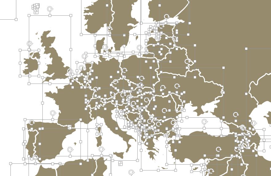
I would like to copy these shapes into my Qlikview document, but I am running into problems. The only method that allows me to do this, is saving every individual shape as a .png document and then creating a text object in Qlikview and then make it an image.
The problem with this method is that I don't get the same spacing as my original shapes and I have to place every single country by hand. As you can imagine this is very time consuming and not easy/accurate at all (because .ppt doesn't use pixel placement). So I was wondering, is there an easier/better way to achieve this?
Just to be clear, it is a requirement that all the countries become their own object, so I can individually manipulate each country in Qlikview.
(I also want to put them in a single container so I can manipulate them all at the same time. Any things to consider when doing this?)
Thanks in advance,
Casper
- « Previous Replies
-
- 1
- 2
- Next Replies »
- Mark as New
- Bookmark
- Subscribe
- Mute
- Subscribe to RSS Feed
- Permalink
- Report Inappropriate Content
Heh, we trully need a better drawing solutions in QV because all basic instruments as helpfull as a Jinny summonin from a shoe.
All I have invented for now is to make a blank frame for each (omg!) country, and under this blank frame you can place a textbox which will be colored. The textbox is a square, but countries are not, so you'll have to use round corners somewhere. Wow, I even can't possibly imagine how immense this work is. Maybe there are some alternatives? I mean marking countries with round textboxes (circles) can be the way?
I'll attach a colorful fish. It's an instance of a blank frame.
- Mark as New
- Bookmark
- Subscribe
- Mute
- Subscribe to RSS Feed
- Permalink
- Report Inappropriate Content
Really nice fish! And I think you are correct that the best way is by using a lot of frames. It's truly a shame there hasn't already been someone (crazy) that did this before me (or did and didn't share it).
I think i'll make a small scale example and see if it works as desired (continents instead of all the countries) and move forward from there. I already made sure I have a frame for every country in the world, so scaling up should be relatively easy.
Thanks for thinking along with me.
- « Previous Replies
-
- 1
- 2
- Next Replies »