Unlock a world of possibilities! Login now and discover the exclusive benefits awaiting you.
- Qlik Community
- :
- All Forums
- :
- QlikView App Dev
- :
- Google Maps API
- Subscribe to RSS Feed
- Mark Topic as New
- Mark Topic as Read
- Float this Topic for Current User
- Bookmark
- Subscribe
- Mute
- Printer Friendly Page
- Mark as New
- Bookmark
- Subscribe
- Mute
- Subscribe to RSS Feed
- Permalink
- Report Inappropriate Content
Google Maps API
Hello,
I was looking some QV Dashboards and I found that I can insert a map with some information inside. How can I add this kind of object and associate the places with the information?
If anyone has a demo or some code, please let me know.
That will be great.
Thank you very much.
- Mark as New
- Bookmark
- Subscribe
- Mute
- Subscribe to RSS Feed
- Permalink
- Report Inappropriate Content
Hi Juan,
Could you solve your problem? I'm trying to create a map with Colombia coordinates, I'm using "Steps to Implement Google Map in Qlikview" in QlikView PE, but it didn't work. I didn't get any symbol on the map. Could you help me?
- Mark as New
- Bookmark
- Subscribe
- Mute
- Subscribe to RSS Feed
- Permalink
- Report Inappropriate Content
Hi andreqlik,
I solved my problem and here I attach a qvw for you to check it out.
Hope it helps!
Best regards.
- Mark as New
- Bookmark
- Subscribe
- Mute
- Subscribe to RSS Feed
- Permalink
- Report Inappropriate Content
Hi Juan,
Thanks for the file but I have Personal Edition and I can't open files. Could you share your code or tell me what exactly changed for the map work?
Best Regards.
- Mark as New
- Bookmark
- Subscribe
- Mute
- Subscribe to RSS Feed
- Permalink
- Report Inappropriate Content
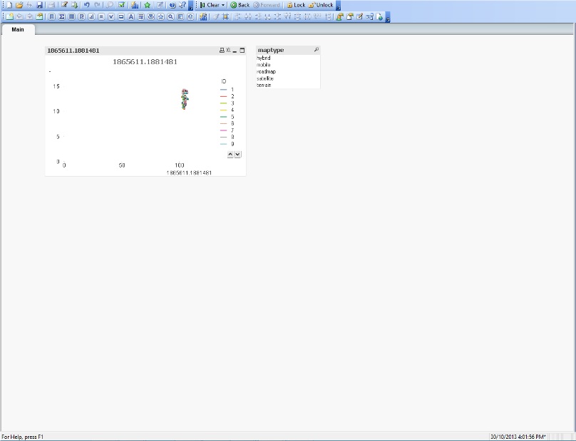
I am also having this problem. I am followed the steps and this is what i get. Can anyone help me?
What did i do wrong?
I cant seem to display google map.
I had used the scripts above.
- Mark as New
- Bookmark
- Subscribe
- Mute
- Subscribe to RSS Feed
- Permalink
- Report Inappropriate Content
In the Colors tab, look for the Frame Background. Now check Dynamic Image and in the expression paste this:
='http://maps.google.com/staticmap?center='
&
num(var_mid_lat, '##############', '.', ',' )
&
','
&
num(var_mid_long, '##############', '.', ',' )
&
'&zoom=$(var_zoom)'
&
'&maptype='&var_maptype
&
'&size='&map_size_x&'x'&map_size_y
&
'&key='&gmap_key & '&.jpg'
- Mark as New
- Bookmark
- Subscribe
- Mute
- Subscribe to RSS Feed
- Permalink
- Report Inappropriate Content
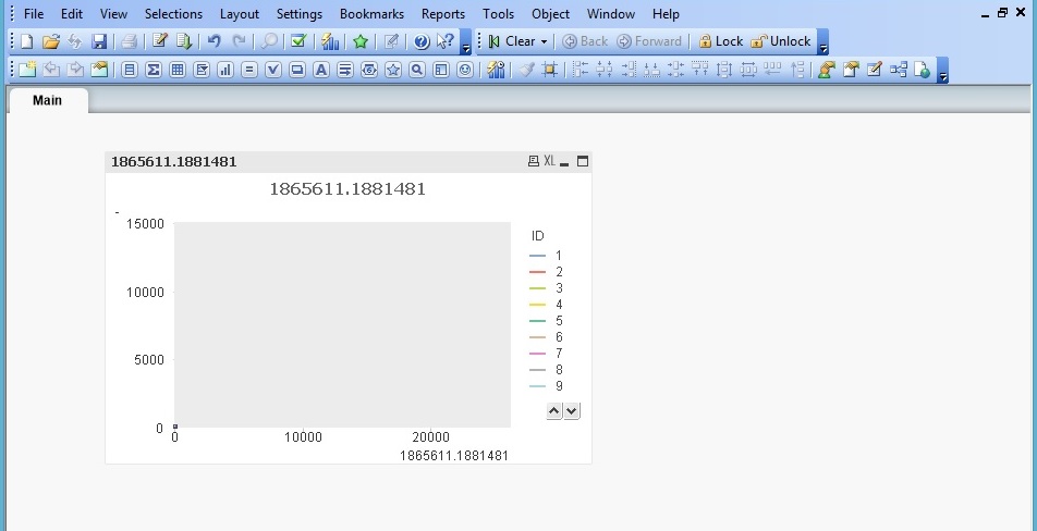
Unfortunately still the same... 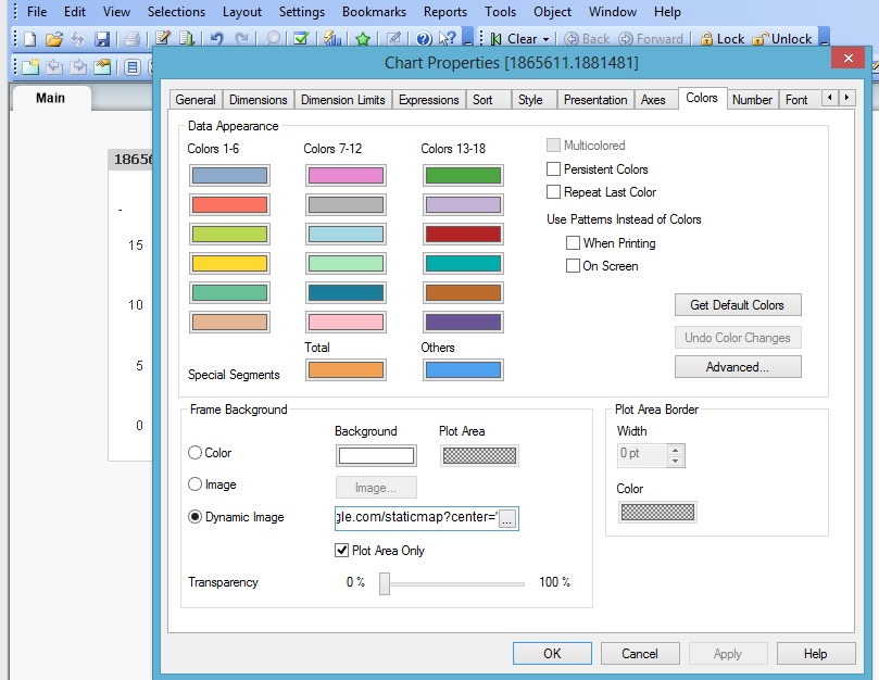
I have attached my Qlikview file. Hope you could enlighten me on how to do it step by step? as i will not be able to open your file since I am using the personal edition.
thanks much
- Mark as New
- Bookmark
- Subscribe
- Mute
- Subscribe to RSS Feed
- Permalink
- Report Inappropriate Content
In the Axes Tab, you have to modify the Static Min and Max.
X-Axis:
Static Min:
(256 * pow(2,($(var_zoom)-1))) + ( var_mid_long * ((256 * pow(2,$(var_zoom))) / 360)) - Round(map_size_x/2)
Static Max:
((256 * pow(2,($(var_zoom)-1))) + ( var_mid_long * ((256 * pow(2,$(var_zoom)))/360)) + Round(map_size_x/2)-15)
Y-Axis:
Static Min:
((256 * pow(2,($(var_zoom)-1))) + ((0.5 * log((1 + (sin(var_mid_lat * pi() / 180))) / (1 - (sin(var_mid_lat * pi() / 180))))) * ((-256 * pow(2,$(var_zoom))) / (2*pi()))) + Round(map_size_y/2))
Static Max:
=((256 * pow(2,($(var_zoom)-1))) + ((0.5 * log((1 + (sin(var_mid_lat*pi()/180))) / (1 - (sin(var_mid_lat * pi() / 180))))) * ((-256 * pow(2,$(var_zoom))) / (2 * pi()))) - round(map_size_y/2)+15)
Also te gmap_key that you where using won't plot anything. I reatached, please reload and let me know.
- Mark as New
- Bookmark
- Subscribe
- Mute
- Subscribe to RSS Feed
- Permalink
- Report Inappropriate Content
Thanks... This is what it looks like now... what do you mean by gmap_key wont plot anything? Could you tell me where to find the gmap_key?
I cant open your qvw file, sorry, as i am working off the personal edition.... could i trouble you to explain over in text? Or can you let me know the new script?
I have amended according to what you have said.
thanks!
- Mark as New
- Bookmark
- Subscribe
- Mute
- Subscribe to RSS Feed
- Permalink
- Report Inappropriate Content
Attached is the qvs of the script and a xml with the object of the map.
The object you have to import it from the file menu Import/Import Document Layout. And the script from the Script Editor.. File/Open External Script File... and that will be it... let me know if that works for you.
And send me the xls of the coordinates please.
- Mark as New
- Bookmark
- Subscribe
- Mute
- Subscribe to RSS Feed
- Permalink
- Report Inappropriate Content
I am stuck with the same problem. I cant seem to get the map background. I am trying to show a map of South Africa but it just comes up blank. Please help, busy going insane!