Unlock a world of possibilities! Login now and discover the exclusive benefits awaiting you.
- Qlik Community
- :
- All Forums
- :
- QlikView App Dev
- :
- Simple Heat Map (google) Example
- Subscribe to RSS Feed
- Mark Topic as New
- Mark Topic as Read
- Float this Topic for Current User
- Bookmark
- Subscribe
- Mute
- Printer Friendly Page
- Mark as New
- Bookmark
- Subscribe
- Mute
- Subscribe to RSS Feed
- Permalink
- Report Inappropriate Content
Simple Heat Map (google) Example
Hi,
I need to put together a simple Heat Map. I have a data file with Longtitude and Latitude against a UK Post Code. Does anyone have a basic demo app that I can use and develop?
Really appreciate your help.
Fiorano
- Mark as New
- Bookmark
- Subscribe
- Mute
- Subscribe to RSS Feed
- Permalink
- Report Inappropriate Content
Check this one out http://community.qlik.com/message/292998
I just updated Alexander's example to use Google's heatmap layer.
- Mark as New
- Bookmark
- Subscribe
- Mute
- Subscribe to RSS Feed
- Permalink
- Report Inappropriate Content
HI
Thanks for reading my post.
Im totally new to Qlikview and feel this may be a bit in depth for me. Im not too sure where to get started with the sample you have provided.
Are you able to help with some further explanation?
Really appreciate your help,
Fiorano
- Mark as New
- Bookmark
- Subscribe
- Mute
- Subscribe to RSS Feed
- Permalink
- Report Inappropriate Content
What are you trying to achieve?
If you download the sample and install the extension it should be easy to change the qvw to load your information.
- Mark as New
- Bookmark
- Subscribe
- Mute
- Subscribe to RSS Feed
- Permalink
- Report Inappropriate Content
Im using QV11 and cant work out where to install the extension.... I have a large dataset of people with longtitude and latitude and need to show a density map...
Many thanks for your help
- Mark as New
- Bookmark
- Subscribe
- Mute
- Subscribe to RSS Feed
- Permalink
- Report Inappropriate Content
Extension will get installed by double clicking on it.
Edit the QVW Script, load the file with the information.
- Mark as New
- Bookmark
- Subscribe
- Mute
- Subscribe to RSS Feed
- Permalink
- Report Inappropriate Content
Hi,
Is this screen shot correct ?
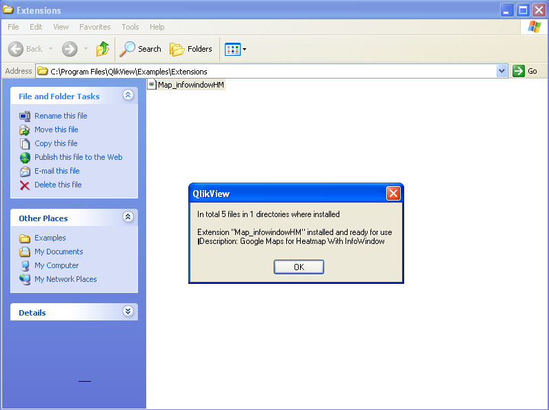
Many thanks
- Mark as New
- Bookmark
- Subscribe
- Mute
- Subscribe to RSS Feed
- Permalink
- Report Inappropriate Content
If you are willing to share your dataset, only the lat/lng/zip codes, I could throw something together for you.
The google maps extensions is way over due for an update anyways so I could incorporate both heat maps, pushpins and clusters for you. Could have that done by next week.
- Mark as New
- Bookmark
- Subscribe
- Mute
- Subscribe to RSS Feed
- Permalink
- Report Inappropriate Content
Hi Alexander,
Really appreciate your time on this. Sorry for the late reply - but Ive been out of the office since your last reply.
I've attached a sample csv file which contains a descriptor, uk post code, lat and long.
Many many thanks for your help. Heat Maps and clusters would be awesome for my application!!!!
Fiorano