Unlock a world of possibilities! Login now and discover the exclusive benefits awaiting you.
- Qlik Community
- :
- All Forums
- :
- QlikView Integrations
- :
- Max Number of Regions in SVG Map Extension
- Subscribe to RSS Feed
- Mark Topic as New
- Mark Topic as Read
- Float this Topic for Current User
- Bookmark
- Subscribe
- Mute
- Printer Friendly Page
- Mark as New
- Bookmark
- Subscribe
- Mute
- Subscribe to RSS Feed
- Permalink
- Report Inappropriate Content
Max Number of Regions in SVG Map Extension
Hi,
I have just implemented a trial of using the SVG Map extension with a client, to show which departments have been spending the most, plotted on top of a map of the building. So far so good and it seems to be working well.
What the client wants to do after this trial is to move on to breaking the areas down to smaller chunks (offices), and adding in some additional sites. This is going to mean many many more IDs that they require to map to.
Is there a limit in the extension as to how many regions can be used, from both an absolute perspective and from a performance point of view?
Thanks in advance,
Steve
Accepted Solutions
- Mark as New
- Bookmark
- Subscribe
- Mute
- Subscribe to RSS Feed
- Permalink
- Report Inappropriate Content
Well there's no limit within the context of the extension itself, but given that we're talking about the web it can affect performance. Are you talking about thousands more? tens of thousands?
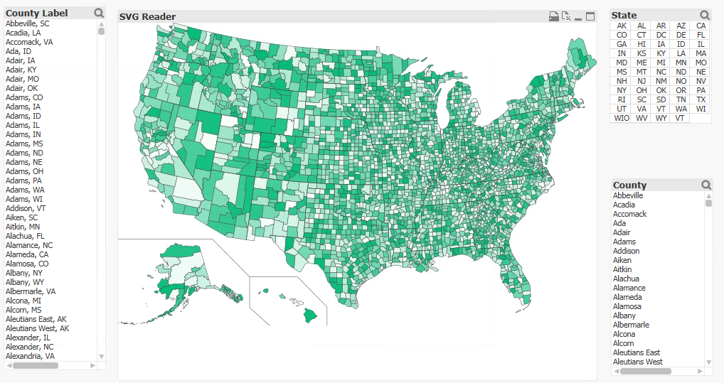
The US Counties map that comes with the extension plots overtop of over 3000 regions and is relatively speedy, but I guess there's also a question of the most useful viz. Maybe it would be useful to separate out the more granular maps into smaller SVGs?
- Mark as New
- Bookmark
- Subscribe
- Mute
- Subscribe to RSS Feed
- Permalink
- Report Inappropriate Content
Hi Brian,
It's not going to go to more than 3,000, so the fact that the US Counties map works is good enough evidence that we can start getting the office SVG built.
Have been thinking around the zoom for different levels. Perhaps something that shows a department level one if multiple sites are possible in the selection, but an office level if only one site is selected. I presume that as you can put a function in the SVG field you could pick different files at different times in that way? Obviously, the ID field would also have to switch based on selections.
Will give the US Counties a try on their hardware to check that it is performant, but it sounds like we are good to go.
Thank you.
Steve
- Mark as New
- Bookmark
- Subscribe
- Mute
- Subscribe to RSS Feed
- Permalink
- Report Inappropriate Content
Hi Brian,
Just to update you on how that went. I loaded the SVG for US Counties, and loaded in the County List using the same SVG as an XML data source. Attached to each node I also pulled in a random number. And presto:

It needed a bit of a tweak, in that with a straight rand() random number it rendered all in black - but I then figured I had created 3,000 unique (probably) numbers and gave it a fair bit to think about. I multiplied the rand by 1,000 and floored the output and it worked perfectly.
It was quite sluggish on the Dekstop, particularly with saving the app, but it works fine in the browser. The zoom onto particular areas works well also.
It would definitely appear that we have a workable solution.
Thank you for providing the Extension, and for your assistance here.
Steve