Unlock a world of possibilities! Login now and discover the exclusive benefits awaiting you.
- Qlik Community
- :
- Forums
- :
- Analytics & AI
- :
- Products & Topics
- :
- Visualization and Usability
- :
- Re: How To Plot Area Layer using Map ?
- Subscribe to RSS Feed
- Mark Topic as New
- Mark Topic as Read
- Float this Topic for Current User
- Bookmark
- Subscribe
- Mute
- Printer Friendly Page
- Mark as New
- Bookmark
- Subscribe
- Mute
- Subscribe to RSS Feed
- Permalink
- Report Inappropriate Content
How To Plot Area Layer using Map ?
Hai,
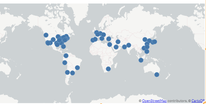
In Qlik sense, map shows only the point Layer i want in a area Layer.
Whether i have to add any extension file.
can anyone Help Me.
i have attached the output file below .
- Mark as New
- Bookmark
- Subscribe
- Mute
- Subscribe to RSS Feed
- Permalink
- Report Inappropriate Content
can you post the app
- Mark as New
- Bookmark
- Subscribe
- Mute
- Subscribe to RSS Feed
- Permalink
- Report Inappropriate Content
sorry i cannot share
- Mark as New
- Bookmark
- Subscribe
- Mute
- Subscribe to RSS Feed
- Permalink
- Report Inappropriate Content
can any one suggest any other solution for this problem
- Mark as New
- Bookmark
- Subscribe
- Mute
- Subscribe to RSS Feed
- Permalink
- Report Inappropriate Content
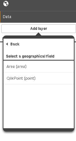
while selecting dimension you can choose layer
- Mark as New
- Bookmark
- Subscribe
- Mute
- Subscribe to RSS Feed
- Permalink
- Report Inappropriate Content
Thanks for the response..
i can see it for the country dimension,but for city dimension i am getting only point options.....
Attached the screenshot for reference....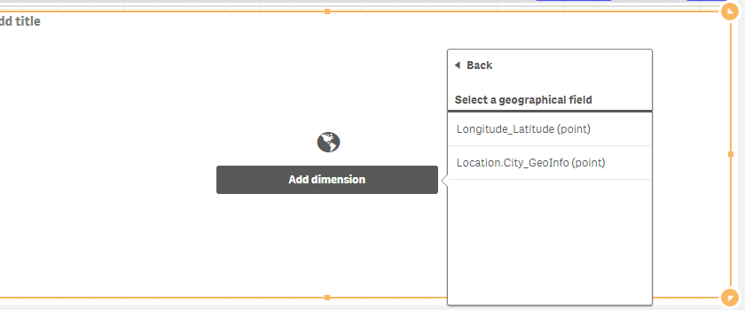
- Mark as New
- Bookmark
- Subscribe
- Mute
- Subscribe to RSS Feed
- Permalink
- Report Inappropriate Content
Hi Jothy,
by default if you have information about a point (so Latitude and Longitude) you won't be able to plot an area.
To do that you need to load in the script a KML or something with the same info.
Take a look at this blog post: World Mapping File For Qlik Sense Maps (KML Shape and Point)
I found it very usefull in the past, as it gives a QVD with both point and area info (at a country level), that will let you plot an area layer in the map.
If you need something more detailed, you could make your own KML (take a look here Create a KML polygon shape file manually and use it in Qlik Sense) or take a look at Qlik's GeoAnalytics
I hope this helps you
Riccardo