Unlock a world of possibilities! Login now and discover the exclusive benefits awaiting you.
- Qlik Community
- :
- Forums
- :
- Forums by Product
- :
- Products (A-Z)
- :
- Qlik Sense
- :
- Documents
- :
- KML files for Germany, Austria, Switzerland (Count...
- Move Document
- Delete Document
- Subscribe to RSS Feed
- Mark as New
- Mark as Read
- Bookmark
- Subscribe
- Printer Friendly Page
- Report Inappropriate Content
KML files for Germany, Austria, Switzerland (County, District Level)
- Move Document
- Delete Document and Replies
- Mark as New
- Bookmark
- Subscribe
- Mute
- Subscribe to RSS Feed
- Permalink
- Report Inappropriate Content
KML files for Germany, Austria, Switzerland (County, District Level)
Oct 13, 2014 6:41:39 AM
Oct 13, 2014 6:41:39 AM
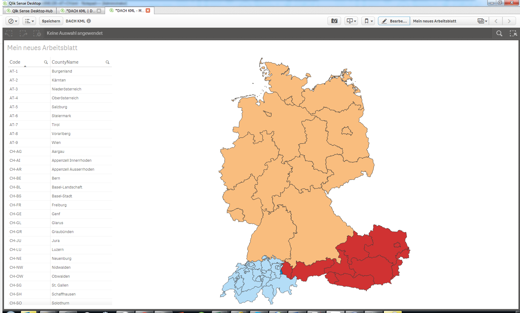
The following KML files have been successfully tested to work with Qlik Sense 1.0 mapping object. The polygones are not too complex but yet fine enough.
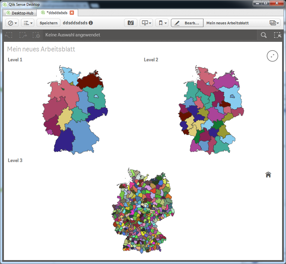
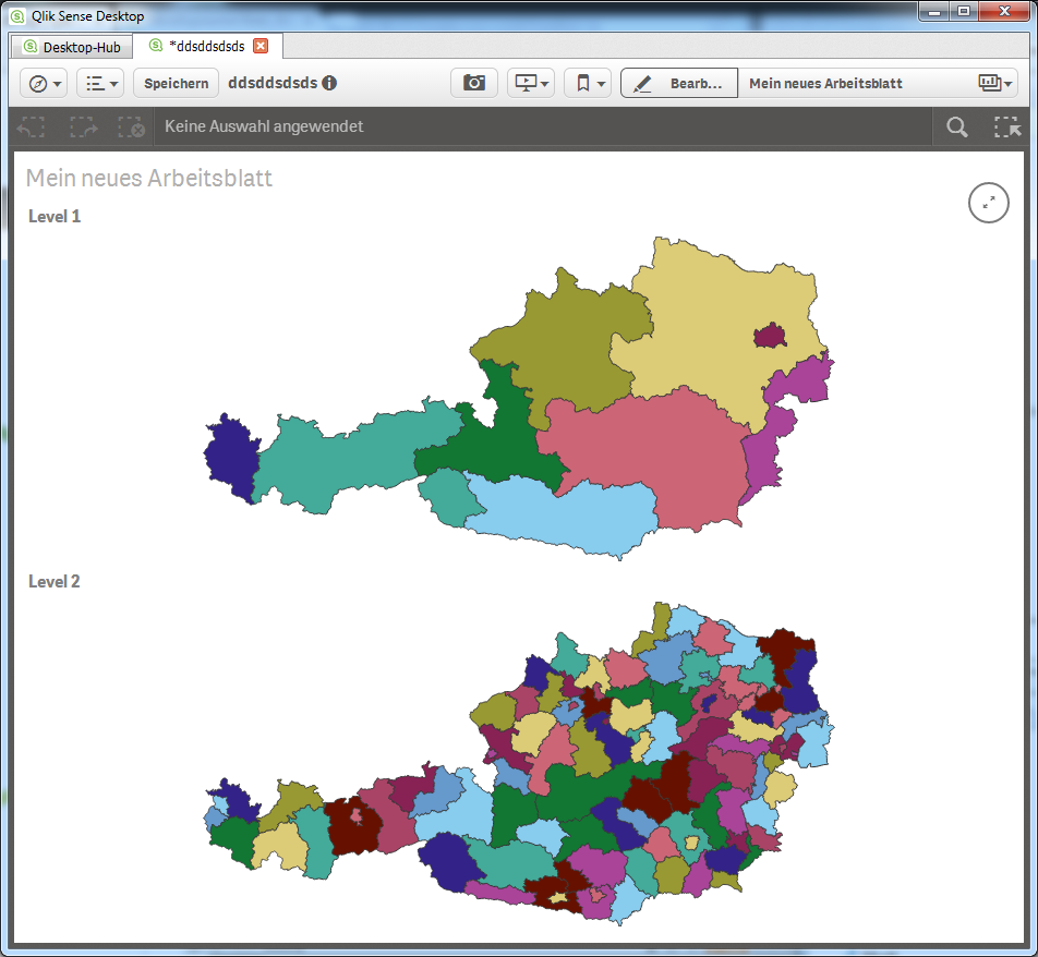
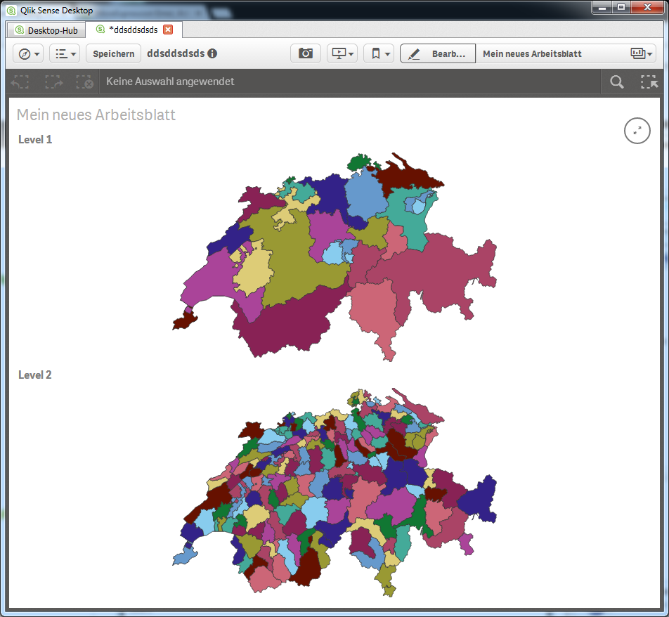
Level 1 = Bundesland / Kanton
Level 2-3 = Bezirk (District)
There is now a new combined KML in this ZIP, which has all 3 Countries (DE, CH, AT) on Kanton/Bundesland Level (Level1), and Liechtenstein. There is a translation table for the used codes into German labels as well.
These are the Germany files:
- Germany divisions.Level 1.kml
- Germany divisions.Level 2.kml
- Germany divisions.Level 3.kml
These are the Austria files:
- Austria divisions.Level 1.kml
- Austria divisions.Level 2.kml
These are the Swiss files:
- Switzerland divisions.Level 1.kml
- Switzerland divisions.Level 2.kml
- Move Comment
- Delete Comment
- Mark as Read
- Mark as New
- Bookmark
- Permalink
- Report Inappropriate Content
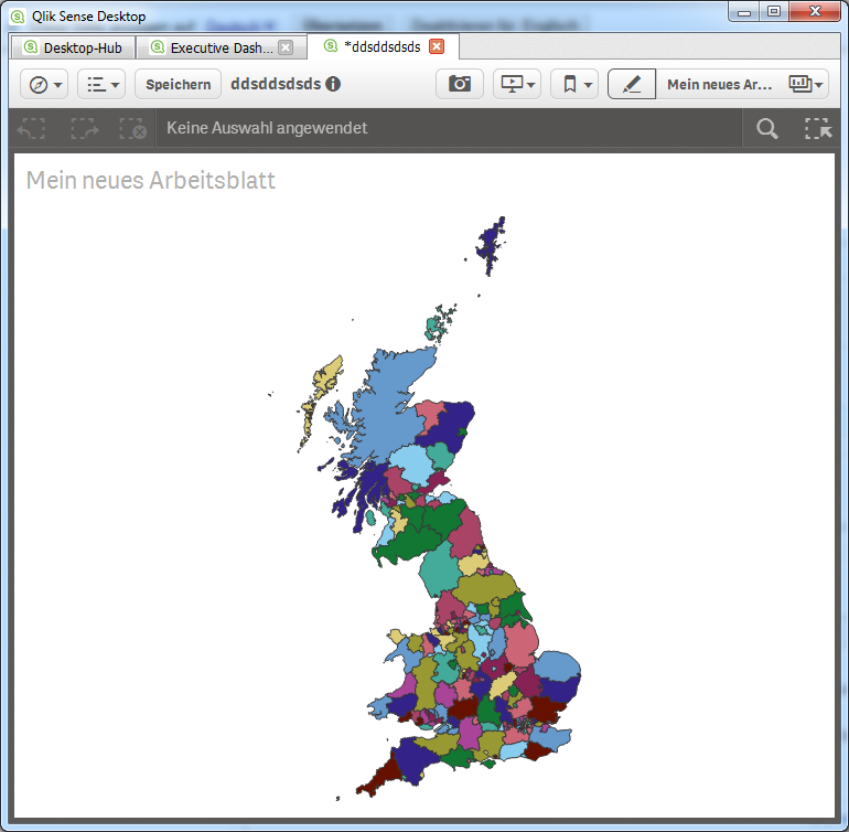
Cool, any chance you have a full UK one too? Thanks 🙂
- Move Comment
- Delete Comment
- Mark as Read
- Mark as New
- Bookmark
- Permalink
- Report Inappropriate Content
There's always a chance 😉
I looked up http://www.gadm.org/download for .kmz files, which I converted to .kml using Google Earth, and I looked up http://geocommons.com , where I pulled down this map: http://geocommons.com/overlays/116292.kml - this works fine, it is UK (with Scottland  ) but without Northern Ireland.
- Move Comment
- Delete Comment
- Mark as Read
- Mark as New
- Bookmark
- Permalink
- Report Inappropriate Content
The problem with county boundaries in the UK is that they change every few years 
- Move Comment
- Delete Comment
- Mark as Read
- Mark as New
- Bookmark
- Permalink
- Report Inappropriate Content
Great stuff Christof. I shall look to include into a demo app I'm building internally here. Previous attempts in Qlikview always left us without Scotland and Wales, when drilling to a county level 
- Move Comment
- Delete Comment
- Mark as Read
- Mark as New
- Bookmark
- Permalink
- Report Inappropriate Content
As long as it looks roughly OK, with minimal annual maintenance then at least I've got something! 
- Move Comment
- Delete Comment
- Mark as Read
- Mark as New
- Bookmark
- Permalink
- Report Inappropriate Content
Great map! Do you have created the kml files on your own? Or do you have used an open source file?
- Move Comment
- Delete Comment
- Mark as Read
- Mark as New
- Bookmark
- Permalink
- Report Inappropriate Content
@csw
Do you have the KML or KMZ file from Europe?
- Move Comment
- Delete Comment
- Mark as Read
- Mark as New
- Bookmark
- Permalink
- Report Inappropriate Content
Sorry, I do not.
- Move Comment
- Delete Comment
- Mark as Read
- Mark as New
- Bookmark
- Permalink
- Report Inappropriate Content
yes I do. Its here Europe_ISO2.kml (cleaned overseas provinces and cut eastern Russia)
- Move Comment
- Delete Comment
- Mark as Read
- Mark as New
- Bookmark
- Permalink
- Report Inappropriate Content
Is it somehow possible to use these KML-files with IdevioMap5 & Area Layer in QlikView?