Unlock a world of possibilities! Login now and discover the exclusive benefits awaiting you.
- Qlik Community
- :
- All Forums
- :
- QlikView App Dev
- :
- How do I remove unwanted lines from a map?
- Subscribe to RSS Feed
- Mark Topic as New
- Mark Topic as Read
- Float this Topic for Current User
- Bookmark
- Subscribe
- Mute
- Printer Friendly Page
- Mark as New
- Bookmark
- Subscribe
- Mute
- Subscribe to RSS Feed
- Permalink
- Report Inappropriate Content
How do I remove unwanted lines from a map?
Hello
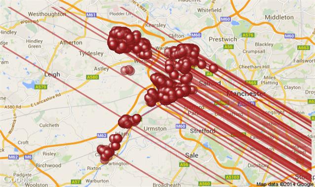
I'm compiling an app and have used maps before Qlikview. For some reason, this map has lines across it. How do I remove them?
Any help will be gratefully received.
Mike Hack
City West Housing Trust
- Tags:
- new_to_qlikview
Accepted Solutions
- Mark as New
- Bookmark
- Subscribe
- Mute
- Subscribe to RSS Feed
- Permalink
- Report Inappropriate Content
Hi Adam
Thanks for your reply.
I’ve resolved the issue. We’d put in two sets of addresses to the Used Dimensions box on the Dimensions sheet. By removing one set, the lines disappeared, leaving us with the location bubbles for the remaining set, which is as we wanted.
- Mark as New
- Bookmark
- Subscribe
- Mute
- Subscribe to RSS Feed
- Permalink
- Report Inappropriate Content
Hi Mike,
Have you checked the chart options on the Presentation tab, specifically the top left drop down Representation? This has three options, Only Lines, Only Symbols and Both Lines and Symbols. This might be causing your extra lines, especially where there are multiple values for each of your primary dimension.
- Mark as New
- Bookmark
- Subscribe
- Mute
- Subscribe to RSS Feed
- Permalink
- Report Inappropriate Content
Hi Adam
Thanks for your reply.
I’ve resolved the issue. We’d put in two sets of addresses to the Used Dimensions box on the Dimensions sheet. By removing one set, the lines disappeared, leaving us with the location bubbles for the remaining set, which is as we wanted.
- Mark as New
- Bookmark
- Subscribe
- Mute
- Subscribe to RSS Feed
- Permalink
- Report Inappropriate Content
Excellent, glad you got to the bottom of the issue. Please make sure to mark the thread as answered to keep things tidy.