Unlock a world of possibilities! Login now and discover the exclusive benefits awaiting you.
- Qlik Community
- :
- All Forums
- :
- GeoAnalytics
- :
- Re: Local path to image in GeoAnalytics Bubble Lay...
- Subscribe to RSS Feed
- Mark Topic as New
- Mark Topic as Read
- Float this Topic for Current User
- Bookmark
- Subscribe
- Mute
- Printer Friendly Page
- Mark as New
- Bookmark
- Subscribe
- Mute
- Subscribe to RSS Feed
- Permalink
- Report Inappropriate Content
Local path to image in GeoAnalytics Bubble Layer custom symbol using Local GeoAnalytics Server Enterprise
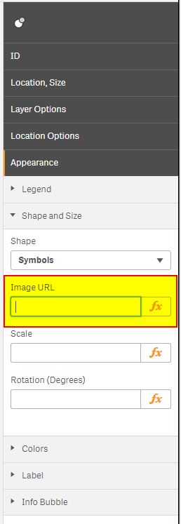
Is it possible to use local path to image symbol when using Local Qlik GeoAnalytics Server Enterprise?
If Yes, then can You give an example where place the image and exactly path which got to be used in Bubble Layer Shape and Size options?
I know that online path works fine, but server machine with Qlik Sense and Qlik GeoAnalytics Server is OFFLINE.
I've tried many options using local path string and with no results. Images (png) was placed on the same machine where installed Local GeoAnalytics Server enironment.

- Mark as New
- Bookmark
- Subscribe
- Mute
- Subscribe to RSS Feed
- Permalink
- Report Inappropriate Content
Yes, if the url is visible from the local QGA server.
To check, log on to the QGA server and try url on a web browser.
It has to be a direct link to the image.
And if it is on the same machine, the server must be unlocked to show local files:
Qlik GeoAnalytics Server settings
Thanks,
Patric
- Mark as New
- Bookmark
- Subscribe
- Mute
- Subscribe to RSS Feed
- Permalink
- Report Inappropriate Content
Good news, Patric.
Now working fine with Your tips.
Thanks ![]()
Qlik GeoAnalytics Server (WebMap Module) block access to local files, until one of setting in XML config file will be changed.
C:\ProgramData\Qlik GeoAnalytics Server\server3\modules\webmap5\config\WebMap5Module.xml
<?xml version="1.0" encoding="UTF-8"?>
<WebMap5Module allowGetResourceLocal="true" />
- Mark as New
- Bookmark
- Subscribe
- Mute
- Subscribe to RSS Feed
- Permalink
- Report Inappropriate Content
Michal-
Where did you end up putting the image files locally on the QGA server and what was the url you referenced in the bubble layer?
- Mark as New
- Bookmark
- Subscribe
- Mute
- Subscribe to RSS Feed
- Permalink
- Report Inappropriate Content
Are there any plans to bring this functionality in the Qlik Sense standard map ?
For the moment, only geometrical figures are possible there...
- Mark as New
- Bookmark
- Subscribe
- Mute
- Subscribe to RSS Feed
- Permalink
- Report Inappropriate Content
Yes, image symbols in the point layer is coming (most likely) during spring 2020.
Thanks,
Patric
- Mark as New
- Bookmark
- Subscribe
- Mute
- Subscribe to RSS Feed
- Permalink
- Report Inappropriate Content
Is it possible to use qliksens contentlibraries path to image symbol when using Local Qlik GeoAnalytics Server Enterprise?
when I use content libraries of qliksense like this image : http://qliksense/content/5.png
the symbol not get the image .
and in the developer tool I see that the service 'http://...webmap5/GetResource' return back to the model the a qliksense log in page instead of the image symbol
- Mark as New
- Bookmark
- Subscribe
- Mute
- Subscribe to RSS Feed
- Permalink
- Report Inappropriate Content
It is possible when using the new native mapchart but requires the user to have access and to be logged in.
- Mark as New
- Bookmark
- Subscribe
- Mute
- Subscribe to RSS Feed
- Permalink
- Report Inappropriate Content
Thank you very much for your help
Very convenient to use Geo Analytics extension is dynamic and has HTML control option
How can you still access the content libraries from the Geo Analytics map?
And something else about what you mean:
"But requires the user to access and be logged in"?
We manage users using groups in AD that allow access
For each group through security role
Why are Qlik Sense users on the local Geo Analytics server not configured in Gao Analytics?
And how can they be configured by Qlick Sense user management or connect the local Gao Analytics to Active Directory?
Waiting for an answer
And again thank you very much
- Mark as New
- Bookmark
- Subscribe
- Mute
- Subscribe to RSS Feed
- Permalink
- Report Inappropriate Content
How can you still access the content libraries from the Geo Analytics map?
Not from the GeoAnalytics map view extension, the image is retrieved first by the GeoAnalytics and then sent to the client browser.
The native map chart on the other hand can fetch any image (in the background layer), as the retrieval is done from the directly from the browser.
Why are Qlik Sense users on the local Geo Analytics server not configured in Gao Analytics?
There is no need to have users replicated in the map server, the map server only serves geographic content.
And how can they be configured by Qlick Sense user management or connect the local Gao Analytics to Active Directory?
No, that is not possible.
Thanks,
Patric
