Unlock a world of possibilities! Login now and discover the exclusive benefits awaiting you.
- Qlik Community
- :
- Forums
- :
- Analytics & AI
- :
- Products & Topics
- :
- Integration, Extension & APIs
- :
- Re: Maps
- Subscribe to RSS Feed
- Mark Topic as New
- Mark Topic as Read
- Float this Topic for Current User
- Bookmark
- Subscribe
- Mute
- Printer Friendly Page
- Mark as New
- Bookmark
- Subscribe
- Mute
- Subscribe to RSS Feed
- Permalink
- Report Inappropriate Content
Maps
Hi Expert,
I wanted to draw map for malaysia..can i get the excel sheets with kml files and area fields for states and cities in it
thanks
- « Previous Replies
-
- 1
- 2
- Next Replies »
Accepted Solutions
- Mark as New
- Bookmark
- Subscribe
- Mute
- Subscribe to RSS Feed
- Permalink
- Report Inappropriate Content
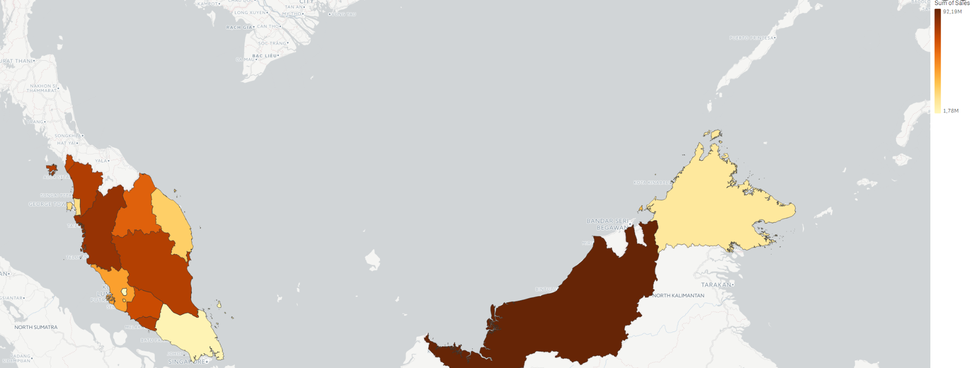
The kmz files you can unzip with 7 Zip to a kml file.
I have tried it by myself and created a short testapp :

- Mark as New
- Bookmark
- Subscribe
- Mute
- Subscribe to RSS Feed
- Permalink
- Report Inappropriate Content
Hello Rupesh,
I don´t know where to find a kml file from malaysia, but here you can find files with geocoordinates:
Or the direct link to the malaysia file:
http://download.geonames.org/export/zip/MY.zip
To read this you can use something like that:
LOAD
@1 AS country,
@2 AS "post code",
@3 AS city,
@4 AS "federeal state",
@5 AS "federeal state shortcut",
@8 AS district,
'[' & @11 & ','& @10 &']' as geocoordinates
FROM [lib://Path to read from/MY.txt]
(txt, utf8, no labels, delimiter is '\t', msq);
TAG FIELDS geocoordinates WITH $geopoint;
- Mark as New
- Bookmark
- Subscribe
- Mute
- Subscribe to RSS Feed
- Permalink
- Report Inappropriate Content
yeah..thanks coordinates... i am having...looking state/city ares/kmls
thanks
- Mark as New
- Bookmark
- Subscribe
- Mute
- Subscribe to RSS Feed
- Permalink
- Report Inappropriate Content
Great,
I am glad that I could help you, if that answers your question please mark my answer as correct.
- Mark as New
- Bookmark
- Subscribe
- Mute
- Subscribe to RSS Feed
- Permalink
- Report Inappropriate Content
Sure..I have coordinates information and looking for area\kml info. in same format like csv and all
thanks
- Mark as New
- Bookmark
- Subscribe
- Mute
- Subscribe to RSS Feed
- Permalink
- Report Inappropriate Content
If you have latitude & longitude information then you can use geomakepoint() to plot on map
- Mark as New
- Bookmark
- Subscribe
- Mute
- Subscribe to RSS Feed
- Permalink
- Report Inappropriate Content
I have tried it but it doesn´t work correct with this files.
- Mark as New
- Bookmark
- Subscribe
- Mute
- Subscribe to RSS Feed
- Permalink
- Report Inappropriate Content
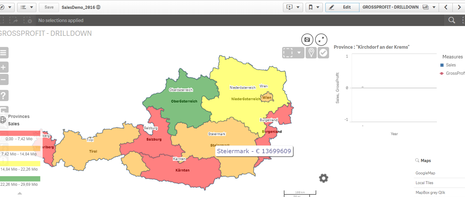
Right...i wanted to know area info like this

- Mark as New
- Bookmark
- Subscribe
- Mute
- Subscribe to RSS Feed
- Permalink
- Report Inappropriate Content
- Mark as New
- Bookmark
- Subscribe
- Mute
- Subscribe to RSS Feed
- Permalink
- Report Inappropriate Content
yes. this map is available in for UK and USA .Need for asian countries
- « Previous Replies
-
- 1
- 2
- Next Replies »